

The sun was setting when Highway 9 dead-ended into Highway 89. The intersection was labeled on the map as “Mount Carmel Junction.” We found the junction to be a quaint town with an awesome motel.

The Thunderbird Lodge was a welcoming site after the previous night’s cheap Bates-like motel in Springdale. Even though the Thunderbird was more than 62 miles from Bryce Canyon National Park, we checked in for two nights recognizing our fatigue and yearning for a comfortable respite. Those two conditions had us sleeping in the next day and not arriving at Bryce Canyon until 1 p.m.

The gorgeous canyon is sprawling and includes some long looping trails on the northern and southern ends.

But with only a half-day to immerse ourselves, we chose to stick to the heart of the canyon and the short, but steep, series of connecting trails near and below the visitor center.
The half-mile trek along Rim Trail from Sunset to Sunrise Point provides amazing photo opportunities.


From Sunrise Point we cut down onto Queen’s Garden Trail which had us winding closely around and through the hoodoos and natural bridges.


The vibrant orange shades changed and gleamed as we passed through the hoodoo forest down into the canyon floor. Strolling along the pine-lined path was shaded and peaceful, a great place to rest before ascending back up and out of the canyon.

At the intersection of Navajo Loop Trail, we chose to take the outer section of the trail through “Wall Street,” so named, I assume, because of the towering slot canyon walls.


In total, the 3-mile loop took us about two and half hours and that included many stops to bask in the geological phenomenon in which we were hiking, and to take photos of course.


We cooled our heals over a late lunch in nearby Bryson City before driving through the park’s northern border to Mossy Cave.

The cave, which we failed to capture, is what I would call a grotto and would have been more exciting, or at least worth the drive, if we had been visiting in the spring rather than a very dry October.
We did learn that the arroyo the trail follows was hand dug over a century ago by a community of Mormons. They’d dug the 15-mile trench to tap into the Sevier River as a water source for their town, Tropic.

With sunset nearing we backtracked past the visitor center to Inspiration Point. We’d been told that at dusk, spectacular colors cast across the hoodoos and canyon.

Upon arriving, clouds rolled over the western skyline and blocked what I imagine would have been stunning views.
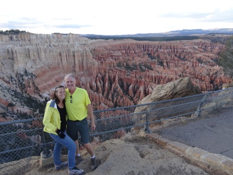
Our disappointment didn’t last long though. As we walked along the platform in awe of the canyon’s magnitude and beauty, the sun dipped below the horizon and the clouds rose slightly, alighting the distant hilltops ablaze with color.


A perfect send off to a perfect day in Bryce National Park.
More Pics…


Beautiful photographs. The scenery and colours look stunning.
LikeLiked by 1 person
Thanks!
LikeLiked by 1 person
Beautiful, beautiful pictures. Thanks
c
LikeLiked by 1 person
Awesome pictures – that’s one of my favorite National Parks!
LikeLiked by 1 person