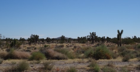
Upon exiting Sequoia National Park we’d entered the Mojave Desert and the portion of this “great looping quest” in which I was most apprehensive… the desert.

I had preconceived notions about desert existence, mostly negative because my perceptions weren’t based on actual experience. So, I’d anticipated a colorless, desolate environment… unfriendly and uninhabitable. After all, the Mojave has a valley named “Death!”
What I discovered was just the opposite, a welcoming beauty, thriving and very much alive. For me, establishing a sense of grounding in the desert required no conscious effort – the desert rose up firmly beneath my feet.

Within Mojave’s arid landscape, where odd and varied creatures flourished, I felt my own belonging.

The desert’s embrace forever changed my perspective, it corrected it and taught me a lesson about the ridiculous power we give to our perceptions.
~~~
A cheap (because it was undergoing a noisy renovation) Las Vegas casino/hotel served as our basecamp while we explored what lies beyond the city’s fringes… the even more wild and wonderful. First up…
Hoover Dam


For a hundred years the Hoover Dam has risen 726 feet from the floor of the Colorado River.

It is an unyielding concrete monster, a sight to behold that attracts some seven million people a year… by car, boat, and helicopter.

Its proximity to Las Vegas—40 minutes southeast—enables this constant flow of people. Unfortunately, the flow of water for which the dam was built is not as reliable and, as in California, the effect of prolonged drought was visible through the river’s receding waterline.

We purchased tickets to tour the dam’s power plant… $15 in 2014, and well worth it.
Inside, 30 foot pipes snake through tunnels and rows of enormous generators churn out 4 billion kilowatt hours of electricity annually for the good folks of Nevada, Arizona, and California. The dam’s structure also serves to control flooding and reserve water for California’s fruitful valleys and its southern cities.
Valley of Fire State Park
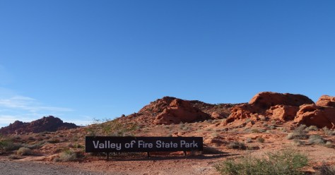
 Nevada’s Valley of Fire State Park is located about 50 miles (an hour’s drive) northeast of Las Vegas. Its sculpted red rocks are stacked and scattered throughout the park’s 40,000 acres.

Only one road cuts through the park, just above its southern border. The road provides access to loads of popular hikes and fun formations, more than enough to keep one occupied for a day.

The rest of the park, the vast majority of its wilderness, is a sprawling preservation area, seemingly inaccessible except by foot.
Our arrival in the late afternoon limited our hiking options, but we had the park to ourselves.

Also, the sun’s low stance illuminated the red rocks and danced through canyons making our walks even more magical.

The half-mile trail to Mouse Tank led us down a canyon marked with hundreds of petroglyphs.

These uninterpretable messages hovered just above us, holding steadfast onto the secrets of an ancient civilization.

Only the sunset, spectacular and fleeting, could force us out of the Valley of Fire and back toward the maddening lights of Las Vegas.
Death Valley National Park
We traveled northwest for 140+ miles to enter Death Valley National Park where my attitude and apprehensions about deserts were permanently altered. Death Valley’s mystique and it’s rolling, constantly changing landscapes captivated me.

We stopped often, awestruck by its colors and geology.
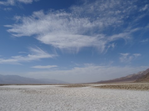
Near the center of Death Valley is Badwater Basin, a massive flat of salt exposed by rain runoff from the surrounding mountains.

The basin sits 282 feet below sea level, the lowest point in North America.

Its limited drainage results in artsy, salty shapes forming through heat induced evaporation. The salt configurations cover the basin creating an eerie, alien terrain.

We traversed over the salt and out into the basin and became mesmerized by the patterns. Before we realized it, we were about a mile in, which is nowhere near the basin’s center.

As intense heat began pulsing around us, we sensed our own vulnerability and soon turned back toward the parking area.

Wending through a painted canyon on Artists’ Drive was like bounding through a rainbow. The one-way nine-mile road is narrow with rocky hillsides rolling up, out, and along both sides.

The palette effect is from minerals (including hematite and chlorite) altered by volcanic eruptions five million years ago. Elements aluminum, iron, magnesium and titanium also add to the mountainous canvas.
Our other hike in Death Valley, was the Natural Bridge Trail, accessible about a mile and half down a dirt road that breaks off from Badwater Road.

It’s an easy one-mile round-trip trail into a narrow, high-walled canyon.

The trail crosses under the bridge formation and continues into a box canyon.

We had the trail to ourselves, or at least it was devoid of other humans. This gal, a Swainson’s Thrush, accompanied us from the rock bridge to the trail’s end.

As we neared the bird, it would take flight, landing 20 or so feet up trail where it waited for us to approach again. Over and over it repeated this routine, escorting us all the way into the rocky boxed area…

and then safely back to the bridge.
We also spied a reddish fox, the Desert Kit Fox, strolling alongside Hwy 190 as we left the park, but missed photographing him.
More Pics

Up next… Zion and Bryce Canyon National Parks


