Although now in southcentral New Mexico, we were still in Apache territory, the Mescalero Apache. (see Gila National Monument for info on the Chiricahua Apache.)
The Mescalero Apache thrive in their native “heartland” on a 463,000 acre reservation that includes their four sacred mountains… Sierra Blanca, Guadalupe, Three Sisters, and Oscura Peak.
Sierra Blanca Mountain, Mescalero Apache Reservation
The reservation, which includes other Apache bands, is governed by tribal code, a constitution, and under the leadership of a Tribal Council. Their economy relies on tourism and is supported by an abundance of outdoor activities—fishing, hunting, camping, golf, snow skiing—and the indoor activity of gambling.
It’s the perfect playground for Texans, yet this was our first visit.
Inn of the Mountain Gods
The Mescalero’s Inn of the Mountain Gods Resort & Casino is their mountain jewel, and it was a haven for this road-weary traveler.
Inn of the Mountain Gods Resort & Casino
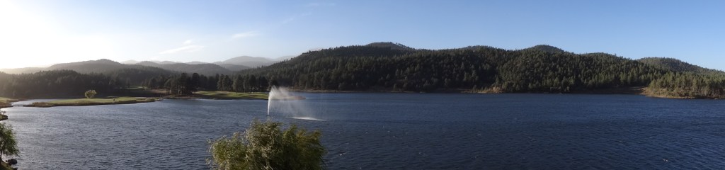
Nestled in a peaceful, forested valley overlooking serene, trout-filled Mescalero Lake, Inn of the Mountain Gods is most appropriately named.
View from inside Inn of the Mountain Gods
Our first morning coincided with the first arctic front of the season. Thirty-five mph winds and frigid temperatures kept our bikes stowed and us mostly inside…
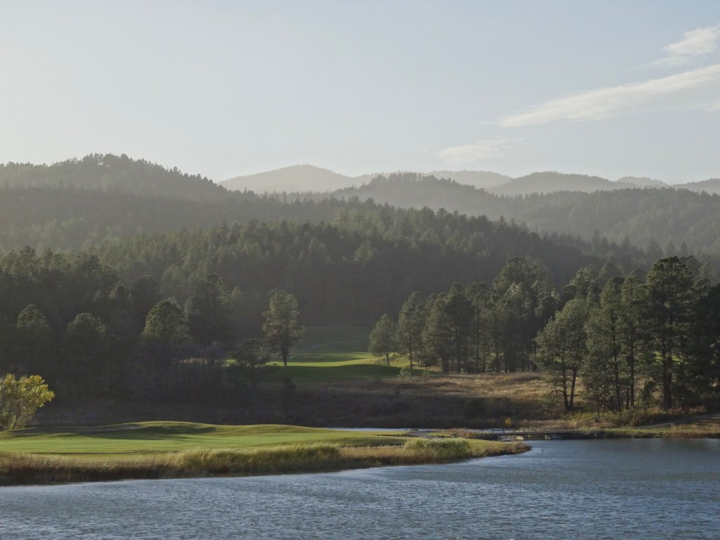
Trey bundled up and ventured out for an icy-windy round of golf at their Championship Golf Course, his last of four golf excursions.
Championship Golf Course, Inn of the Mountain Gods, NM
He said the trees protected him from the wind somewhat, but still made the challenging course even more difficult.
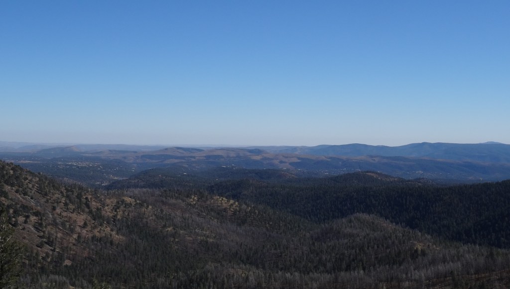
Ski Apache
Ski Apache
From Hwy 48 on the outskirts of Ruidoso, Hwy 532 climbs 12 ½ miles to Ski Apache.
Windy Point on Hwy 532 was very windy!
Nine of those miles switch up, back, and along mountain ledges with gorgeous vistas.
The ski area was weeks away from opening, so we had the mountain top to ourselves.
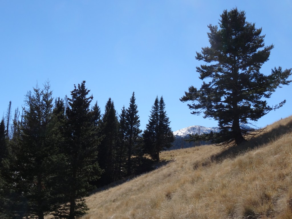
Despite not having water nor proper jackets, we were lured onto a hiking trail just above the parking area.
Hiking path at Ski Apache
We made it about a mile in before heading back, but not before appreciating the natural beauty and solitude.
View from base of Ski Apache, New Mexico
Food
On Wednesday evening, we drove into nearby Ruidoso for dinner without considering that mid-November is a downtime for the ski city. Many restaurants weren’t open or had closed early. After driving around a bit we noticed the Caliente Grill appeared to be open. We were the first of a few diners that evening, which gave us the opportunity to visit with the restaurant’s friendly owners. We chatted about wine and Austin… they were heading there the following week. Overall, the evening, food, service, and company were excellent.
Several dining options are offered at Inn of the Mountain Gods. We particularly enjoyed Wendell’s Steak & Seafood for a reasonable and tasty breakfast and lunch. For dinner, they go more upscale… food was amazing, just pricey.
Casino
Trey spent some of his evenings at the Casino’s blackjack tables. He experienced ups and downs, but overall left with an extra $200 in his pocket.
Sunset across Lake Mescalero, Inn of the Mountain Gods, NM
With a casino, first-rate restaurants, indoor pool, workout room and spa, the Inn of the Mountain Gods was ideal for being stuck indoors.
It wasn’t a difficult decision, or even a disappointment, to delay our departure a day… the winter blast would make it impossible to safely climb Guadalupe Peak, our final stop before home.
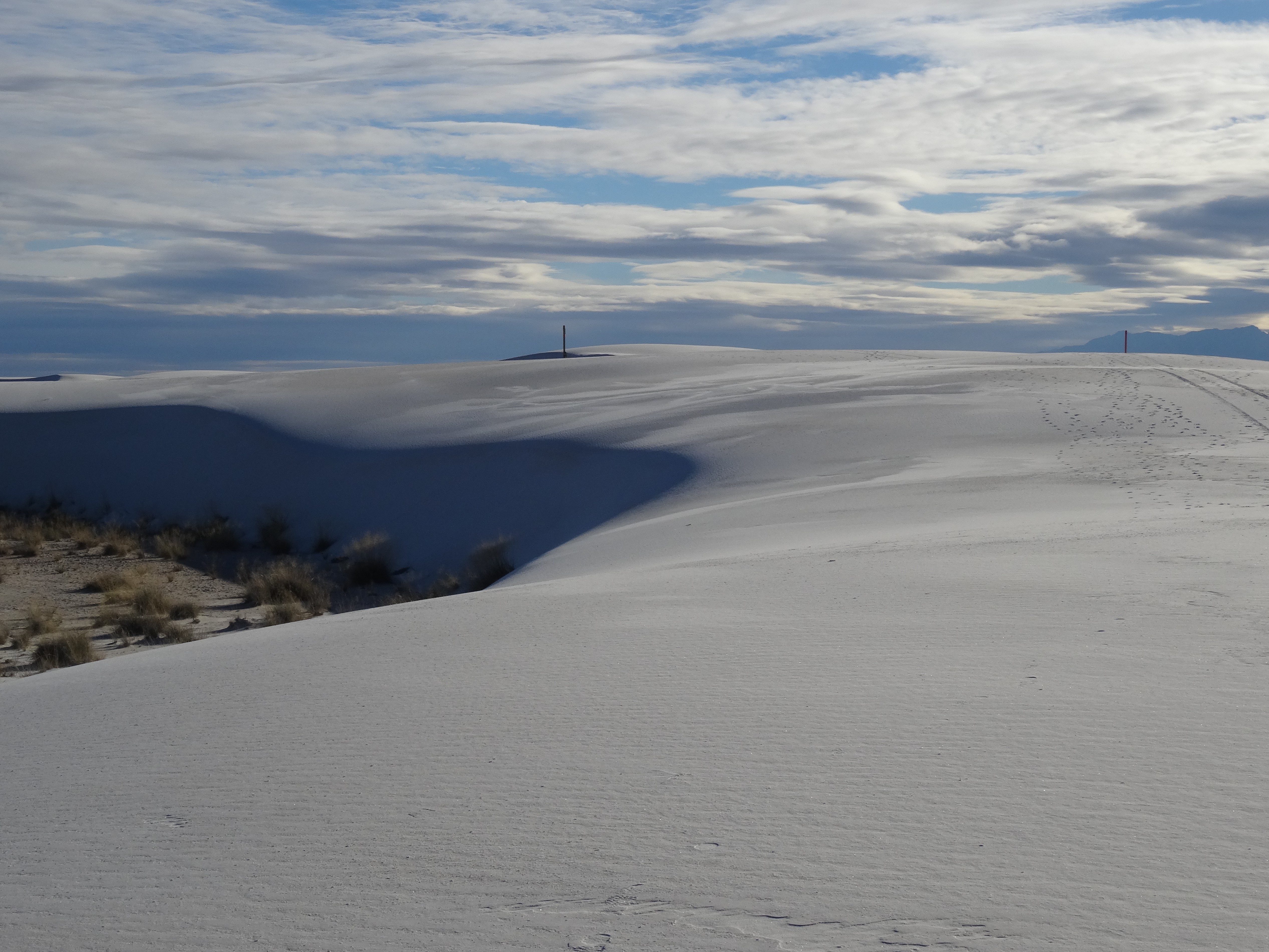
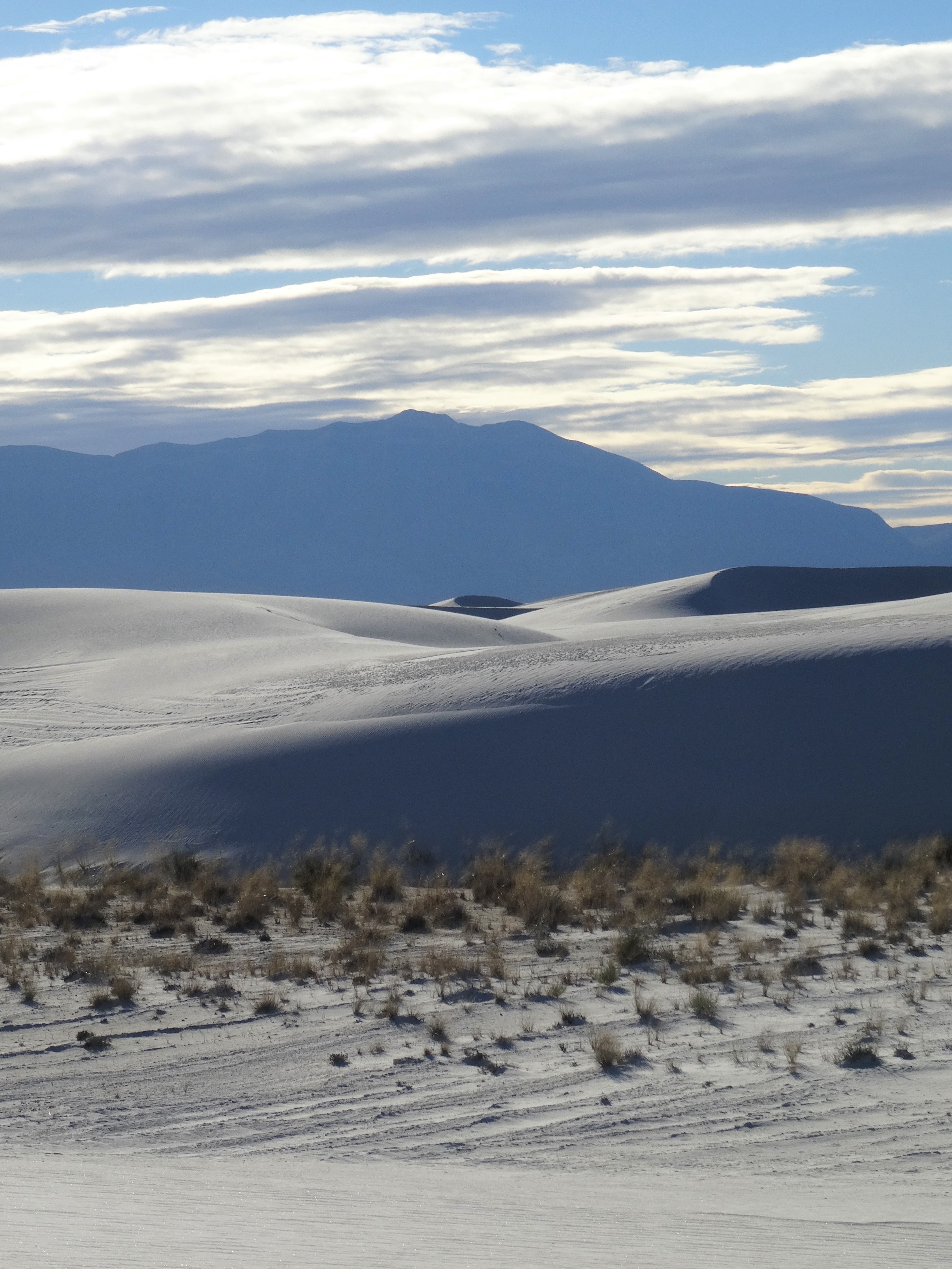
We fell in love with White Sands National Monument (now a national park). Best we could tell, we had the dunes to ourselves.
Drive into White Sands National Monument
Hiking the 2-mile Backcountry Camping Trail was great for gaining a sense of the parks’ magnitude and beauty. It also provided us with the surreal experience of exploring an alien-like environment.
Backcountry Camping Area, White Sands NP, New Mexico
The San Andres Mountains rise up along the park’s western border. Their size and contrast against the white gypsum give the illusion that they’re closer than they are… White Sands encompasses 228 square miles! No, you can’t walk across it.
Trey, White Sands National Monument
Treading across the vast whiteness, amongst the ever flowing and shifting dunes, one can easily lose their bearings. It’s both exuberant and eerie, but always having a trail marker within sight was reassuring.
Trail Markers, White Sands National Monument
November was perfect timing for our visit… cool and gorgeous weather, perfect sky, and no people.
We played like kids and appreciated the experience fully.
Backcountry Camping Area, White Sands NP
Once again, the visitor center was looping an informative film on the park’s history, geology and ecology.
At 10,000 years, White Sands is a relatively young environment. The expanding (even onto surrounding highways) sandy tract was formed by gypsum deposits in the nearby mountains.
White Sands National Monument
Northeasterly winds break off gypsum pieces and grind them into fine bits, dusting the basin continuously.
We’d already decided to return after dark for star gazing but learned that the park’s gates close at 6pm – no entry or exit after that time.
Escape Mobile Alone in the Parking Lot
Alamogordo, New Mexico
We’d chosen Alamogordo as a base due to its proximity to White Sands and only became aware of all it has to offer upon our arrival. First up…
New Mexico Space History Museum
New Mexico Space History Museum
Tularosa Basin has been an epicenter for military research and testing since the U.S. entered World War II. It is home to Holloman Air Force Base and White Sands Missile Range, both innovators in technology and aeronautical aviation.
As a Smithsonian affiliate, the Space History Museum preserves New Mexico’s role in space flight and tells the larger story of the U.S. space program, from the space race with the then Soviet Union to NASA’s ongoing mars program.
Not only are there numerous exhibits from each progressing stage of the U.S. space program, there are several educational videos and interactive displays.
Viparita Virabhadrasana @ New Mexico Space History Museum
You can even test your skill at landing a space shuttle using a simulator. Trey managed to crash, while I ranked “flown where no man has gone before.” I don’t recall if that was a good or bad thing.
Ham the Chimp Memorial Plaque
The Museum and it’s International Hall of Fame where Ham, the first space chimpanzee is honored, kept us fascinated for hours.
Ham’s Space Suit & Capsule, Space History Museum
Then there is the John P. Stapp Air and Space Park that surrounds the museum building. A lunar module capsule, land-speed vehicle, launching track, and rockets of all sorts cover the grounds overlooking the City of Alamogordo.
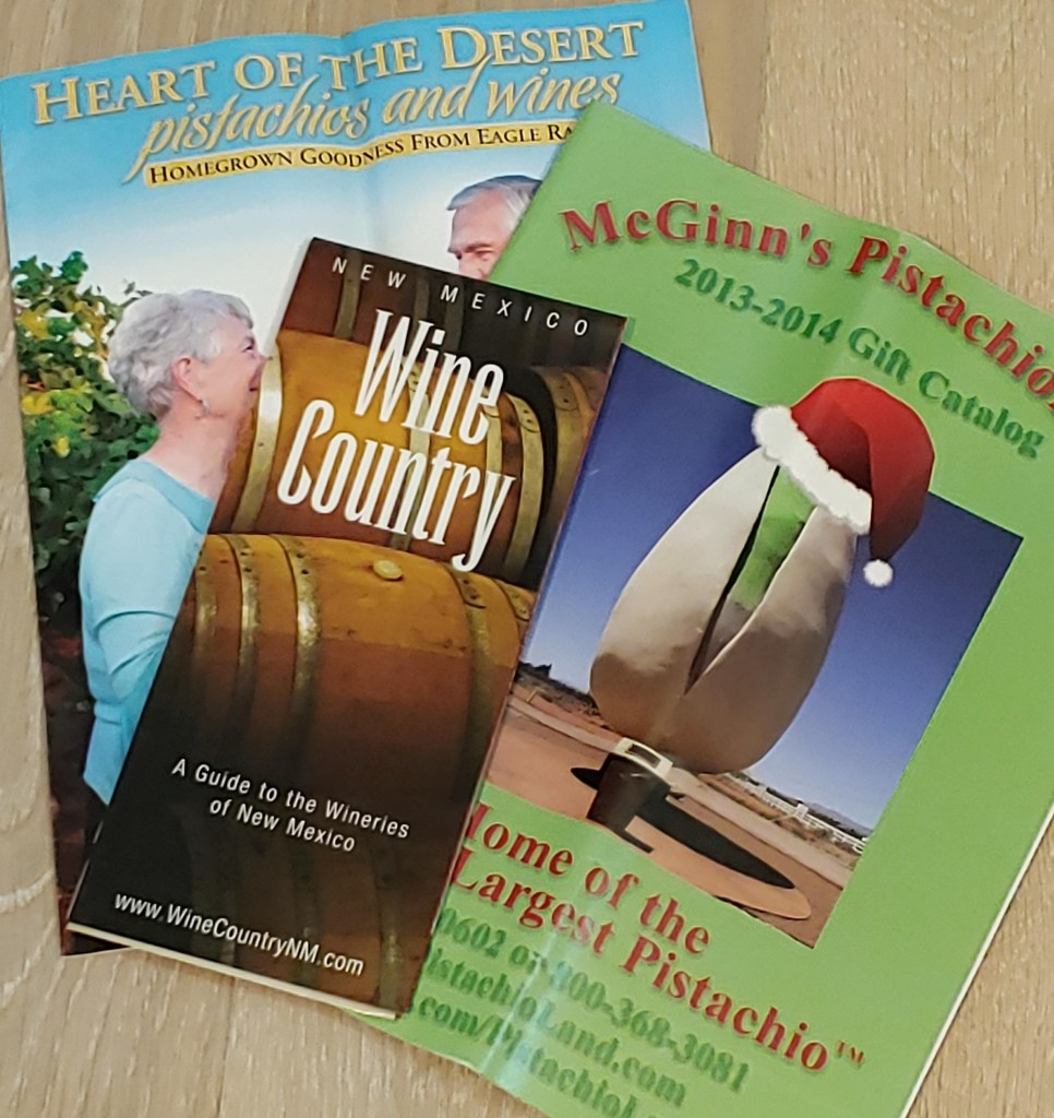
Wine & Pistachios
We didn’t realize we were back in wine country until we passed a billboard on the way to the space museum. The billboard advertised a winery further up the main road, White Sands Boulevard, but several other vineyards surround the area.
Alamogordo Pamphlets
Tularosa Basin’s soil composition, altitude, and temperatures make it ideal for grape production. Spanish settlers and missionaries knew this and were the initiators of New Mexico’s wine tradition.
We sampled wines at Heart of the Desert and Arena Blanca wineries and bought a couple of bottles.
Heart of the Desert wine bottle is now used as a candlestick holder
Arena Blanca is associated with the Pistachio Tree Ranch, or Pistachio Land, a 90-acre orchard and home to the world’s largest pistachio.
World’s Largest Pistachio
Pistachio trees benefit from the same natural conditions that make this basin ideal for grapes. A bag of roasted and shelled pistachios sustained us through the remainder of our trip. Very fresh and yummy!
Food…
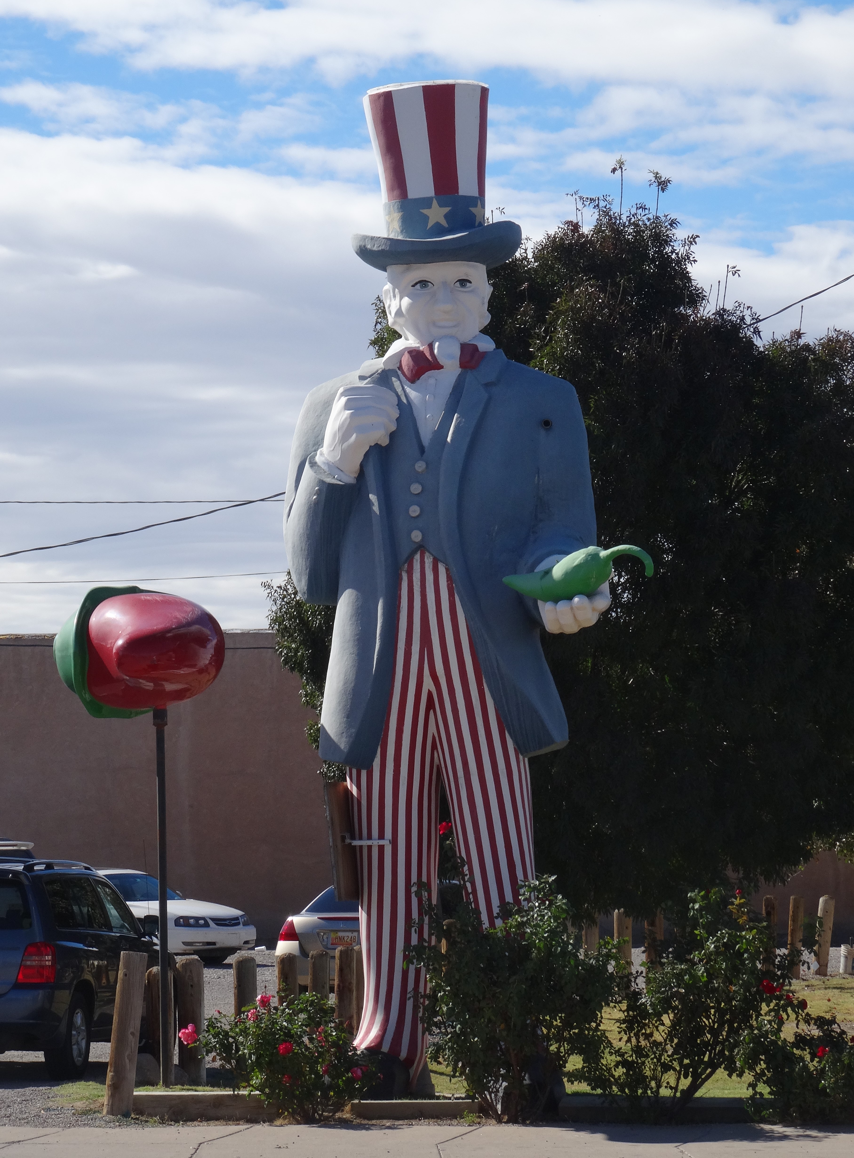
Blake’s Lotaburger, a family owned chain, is a New Mexico tradition much like Texas’ Whataburger. Its fame expanded beyond New Mexico when it was featured in the AMC’s series Breaking Bad. We hadn’t yet watched Breaking Bad but were lured to Blake’s simply by its authentic and nostalgic burger joint vibe. It did not disappoint; the green chilies burger was nothing less than phenomenal!
We thought our last family visit had taken place in Reno with my brother and his family. No, one more Alamogordo surprise awaited.
Trey outside La Posta de Mesilla
Trey’s nephew lives in El Paso, which wasn’t on our path of travel. Happily, Jim contacted us and proposed meeting for lunch in between El Paso and Alamogordo. He suggested La Posta’s in Messila (Old Town Los Cruces).
Photo from La Posta’s Website
Best Mexican food of the entire trip! And if anyone has read through these blog posts, they know we love Mexican food and ate it whenever we could… from Montreal, Quebec to the Redwood Forest.
It was wonderful catching up with Jim and we were so grateful for the opportunity to add one last reunion to this six-month trek.
Next Stop…
Mescalero Apache Reservation, New Mexico (via Cloudcroft and the Lincoln National Forest)
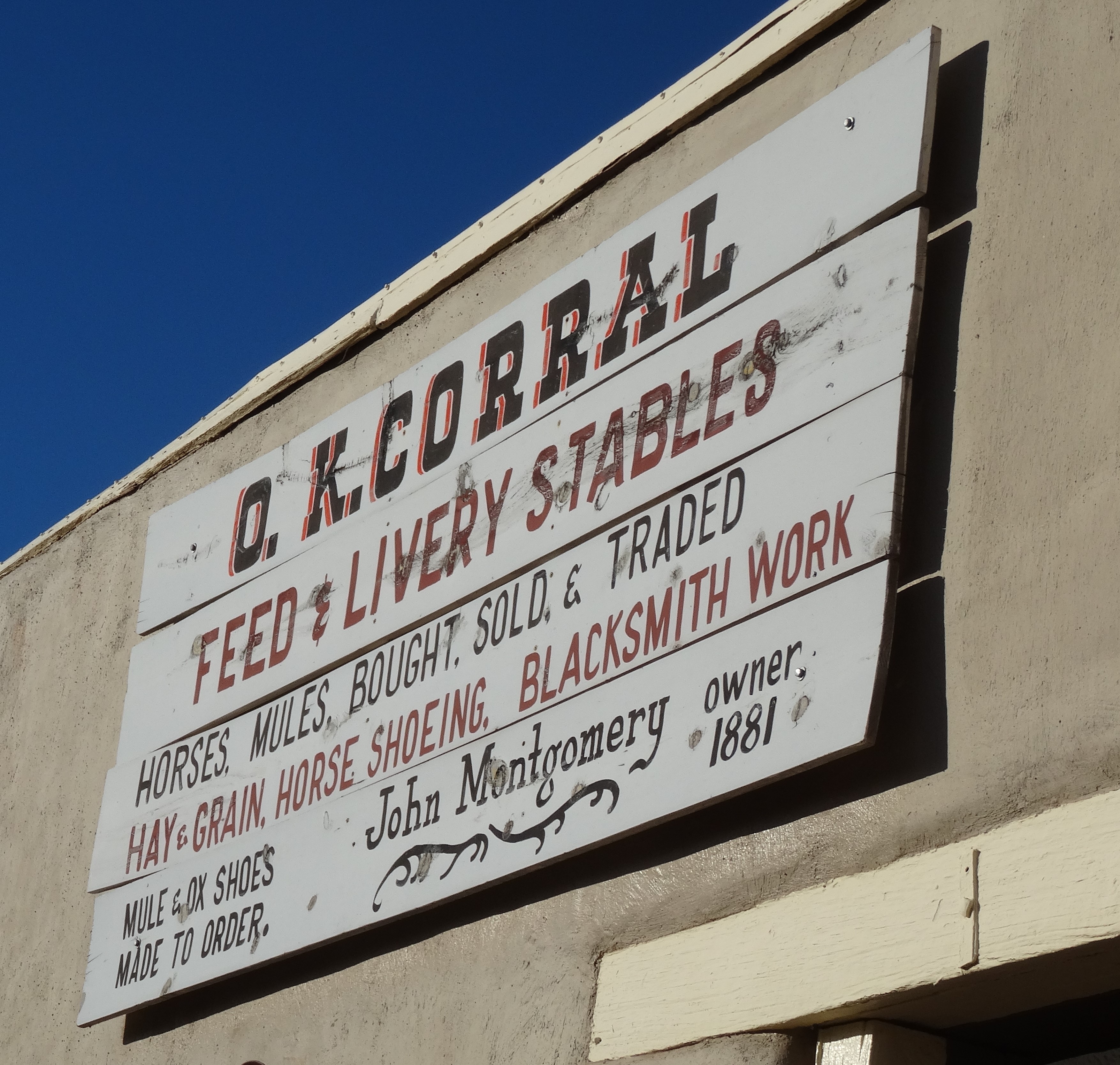
Between I-10 and the Mexican border lies the infamous town of Tombstone, Arizona. It’s an easy drive from Tucson —about 75 miles—and the cutoff (Hwy 80) was on the way to New Mexico.
Tombstone, Arizona
Like Virginia City, Nevada, Tombstone’s classic western scape is preserved and attracts tourists now rather than cowboys, miners, and outlaws.
Since we weren’t interested in souvenirs or saloons, there wasn’t much to do except walk around, bask in the nostalgia, and read historical markers.
In 1877, and after being told he was foolish and would only discover his own tombstone, Edward Schieffelin found silver in the surrounding hills. By the mid-1880’s, his small encampment had grown into the town of Tombstone with a population upwards of 15,000.
Trey’s best outlaw look
Allen St., Tombstone, Arizona
Yet, Tombstone is worth the detour whether you love the lore of the American West or are simply curious. In fact, it enticed us longer than we’d meant to stay.
The detour to Tombstone added 50 miles to the 200-mile drive to southwestern New Mexico, and it was already late afternoon. By the time we were again heading east on I-10, the sun was setting.
Waxing Moon, I-10 heading toward New Mexico
Cookies, it’s what’s for dinner!
After the deluge in Redwoods National Forest, we had no more camping plans. We also knew there’d be no kitchen access for the remaining eleven days of this adventure, so there was no need to tote food, other than a few snacks. Plus, we’d filled our bellies with a hearty breakfast at Cross Roads Restaurant in Tucson and felt satisfied enough to get through to evening. But, the long day and drive had us arriving in Silver City, NM just after restaurants had closed. Luckily Petit Écolier cookies, leftover from making s’mores, sustained us to morning. This wasn’t the first time we had cookies for dinner.
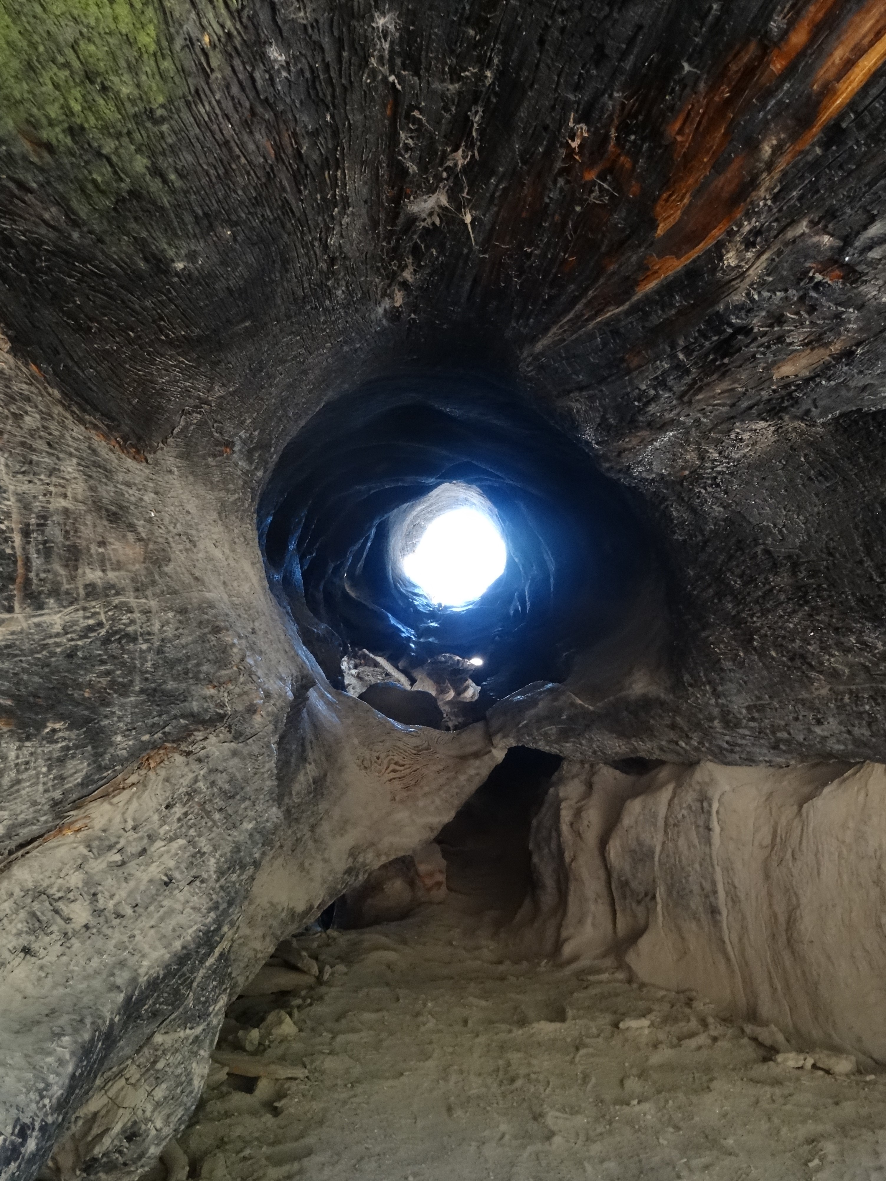
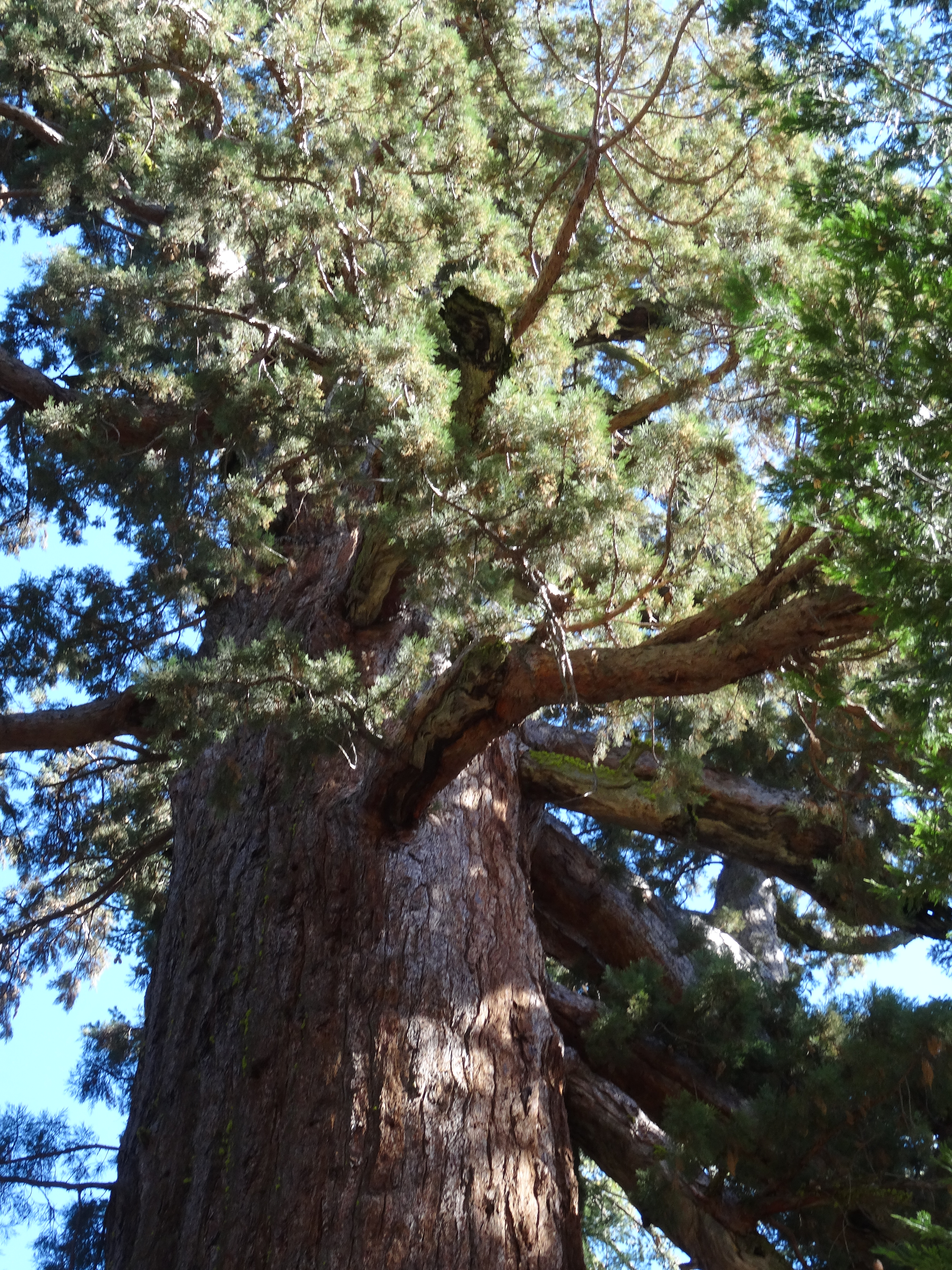
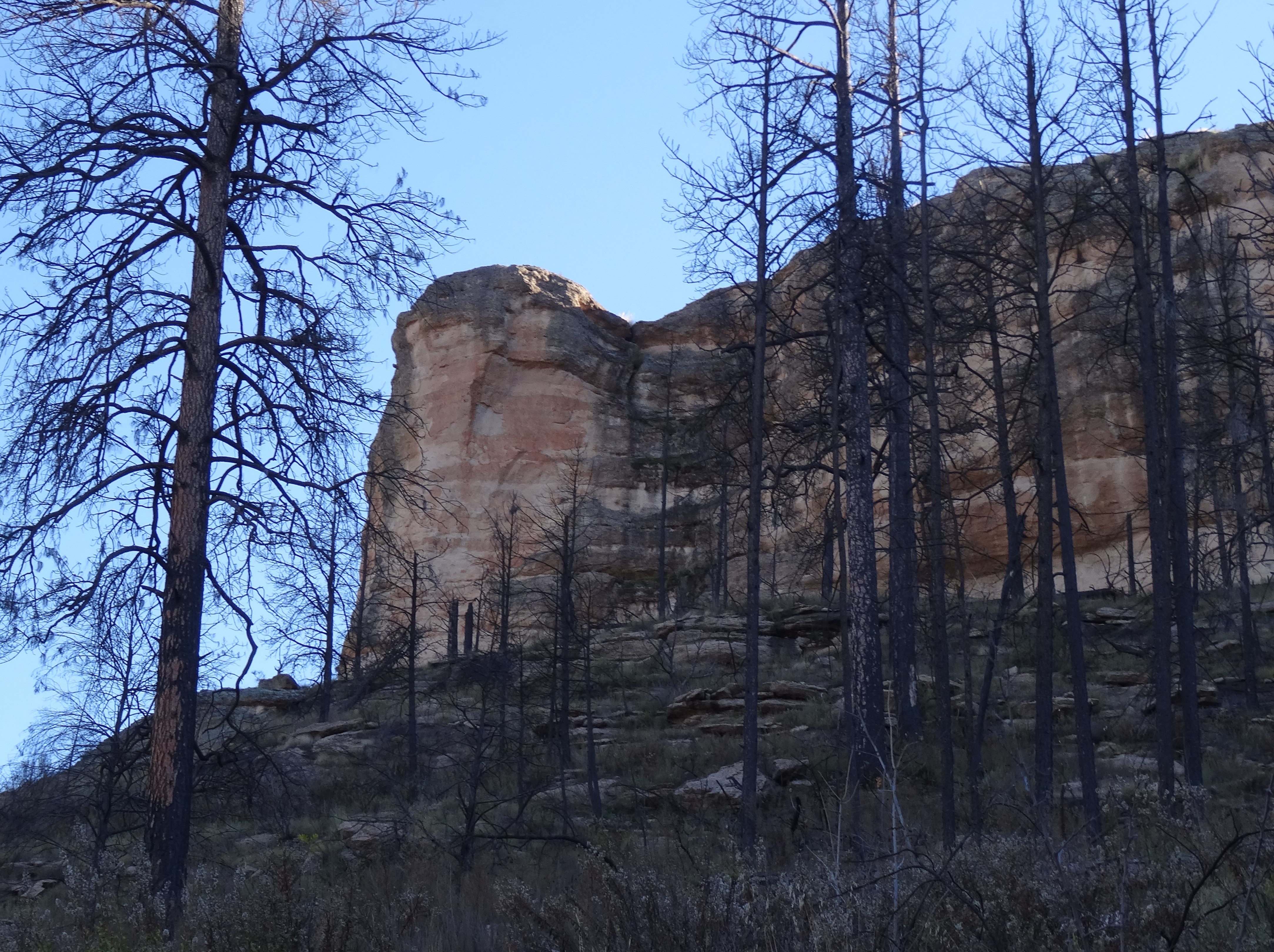
Gila Cliff Dwellings National Monument (Pronounced Hee-la)
Gila Cliff Dwellings National Monument
The remnant cliff dwellings lay deep within Gila National Forest. After turning off Silver City’s main road onto Hwy 15, we started climbing and signs of civilization soon succumbed to a verdant wilderness.
The road mostly follows the Gila River while twisting around, over, and atop the ridges of mountains for 40 miles.
Atop Ridge, Hwy 15, New Mexico
At the visitor center we watched a brief and informative video. The cliffside homes are believed to have been constructed by Mogollon (Mo-go-yone) Puebloans beginning in the 1270’s. But these original inhabitants had moved on by 1300, perhaps due to drought.
The Chiricahua Apache settled there in the 1500’s and remained in the area until the U.S. government forced their removal between 1870 and 1886. The last Apache to sadly leave this ancestral land were led by a defeated Geronimo (Goyahkla).
Gila Canyon, Cliff Dwellings Nat’l Monument
The Gila National Forest is spotted with ancient pueblo ruins, yet none as unique and Eden-like as the cliff-dwellings… seven caves high on a canyon cliff topped with fertile soil for growing corn, beans, and squash (the “three sisters”).
Caves 2, 4 and 5 (Cave 3 is between 2 & 4 but its entrance is set back and not visible from this angle)
The middle fork of the Gila River runs below the caves and in early November appeared more creek-like.
1-Mile Loop Trail to Gila Cliff Dwellings
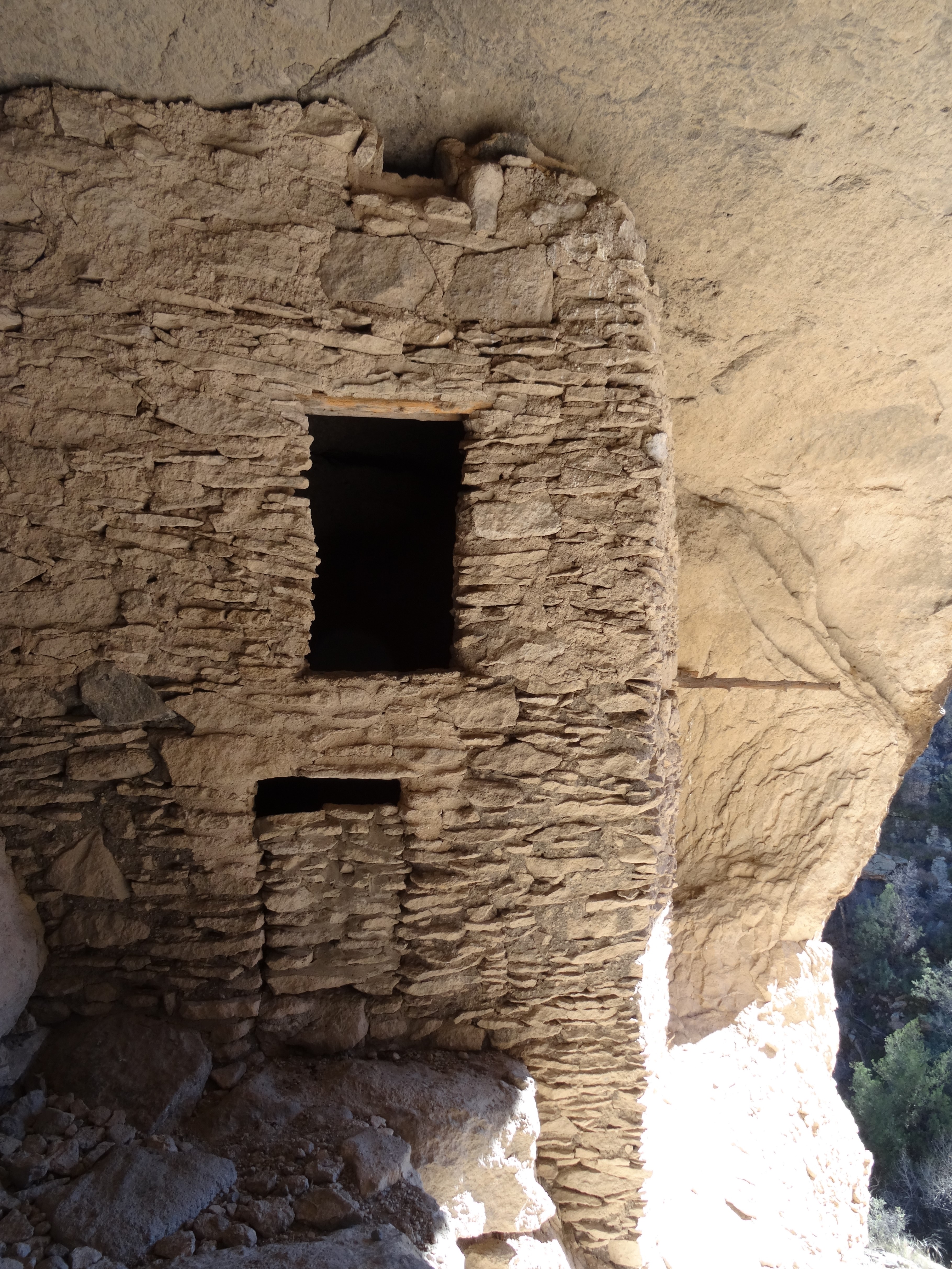
Only five of the caves were used as living quarters. Cave number 6 appeared to be used for rituals while hard-to-reach cave 7 had no trace of human occupancy.
Gila Cliff Dwellings, New Mexico
Unlike Montezuma’s castle, visitors are allowed into the Gila Cliff Dwellings. Being a weekday in November, the forest ranger and a volunteer were the only other persons inside the caves.
Inside Cave 3, Gila National Monument, NM
The ranger pointed out unique architectural details including a structure believed to be used for food storage, like a pantry.
Storage Pantry, Gila Cliff Dwellings
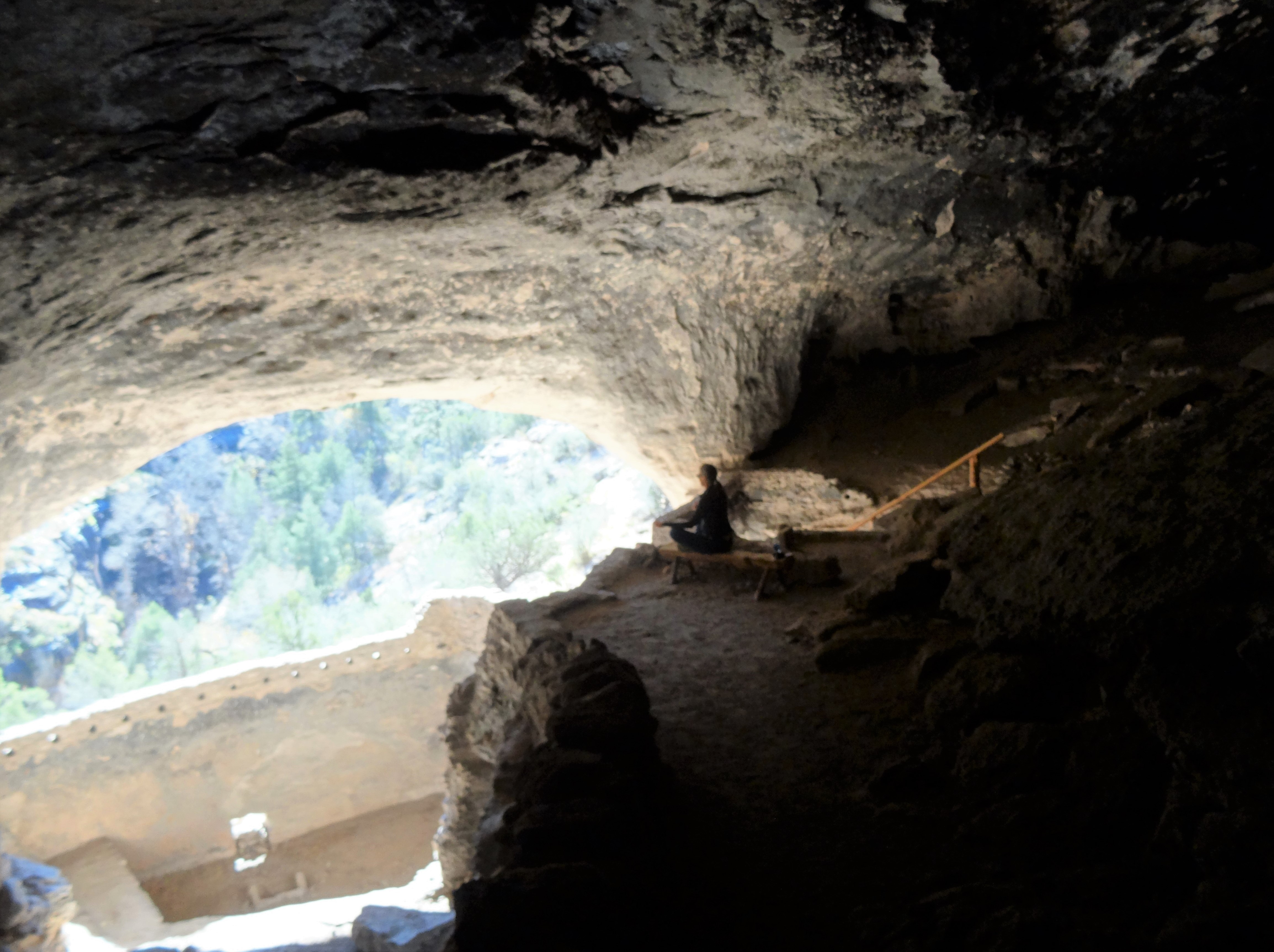
We particularly enjoyed cave 3, the largest and coolest (as in temperature), and its view was fabulous.
Meditating in Cave 3, Gila Cliff Dwellings
Having the dwellings to ourselves was special and a memorable experience.
Anjaneyasana, Gila Cliff Dwellings NM
Cave 3, Gila Cliff Dwellings
We were able to spend amble time inside the caves to fully appreciate the area’s beauty, sense of safety, and peace.
For the return trip to Silver Springs we opted to continue looping the scenic byway—the Trail of the Mountain Spirits—into San Lorenzo then back west to Silver Springs.
This only added thirty miles to our trip, but Trey and I both agreed the more picturesque route was Hwy 15.
View from Hwy 15 New Mexico
Silver City, New Mexico
Silver City is a friendly mining town nestled aside a mountain and a tad east of the Continental Divide. More modern than expected (not rustic) yet it retains a quaint, small town quality. We savored an authentic Mexican dinner at La Cocina and a hearty breakfast at the artsy Adobe Café. Highly recommend both!
Next Stop…
Alamogordo & White Sands National Park, New Mexico (via quirky Hatch New Mexico…)
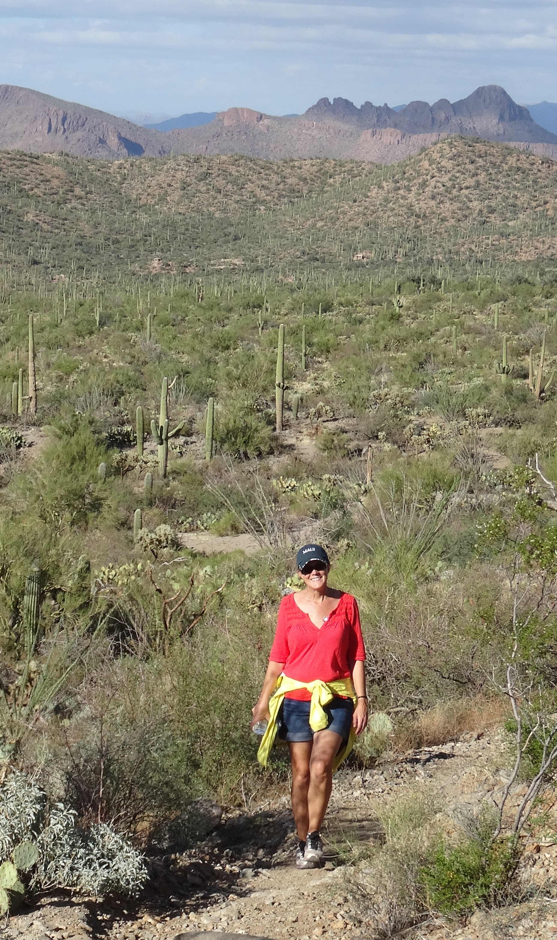
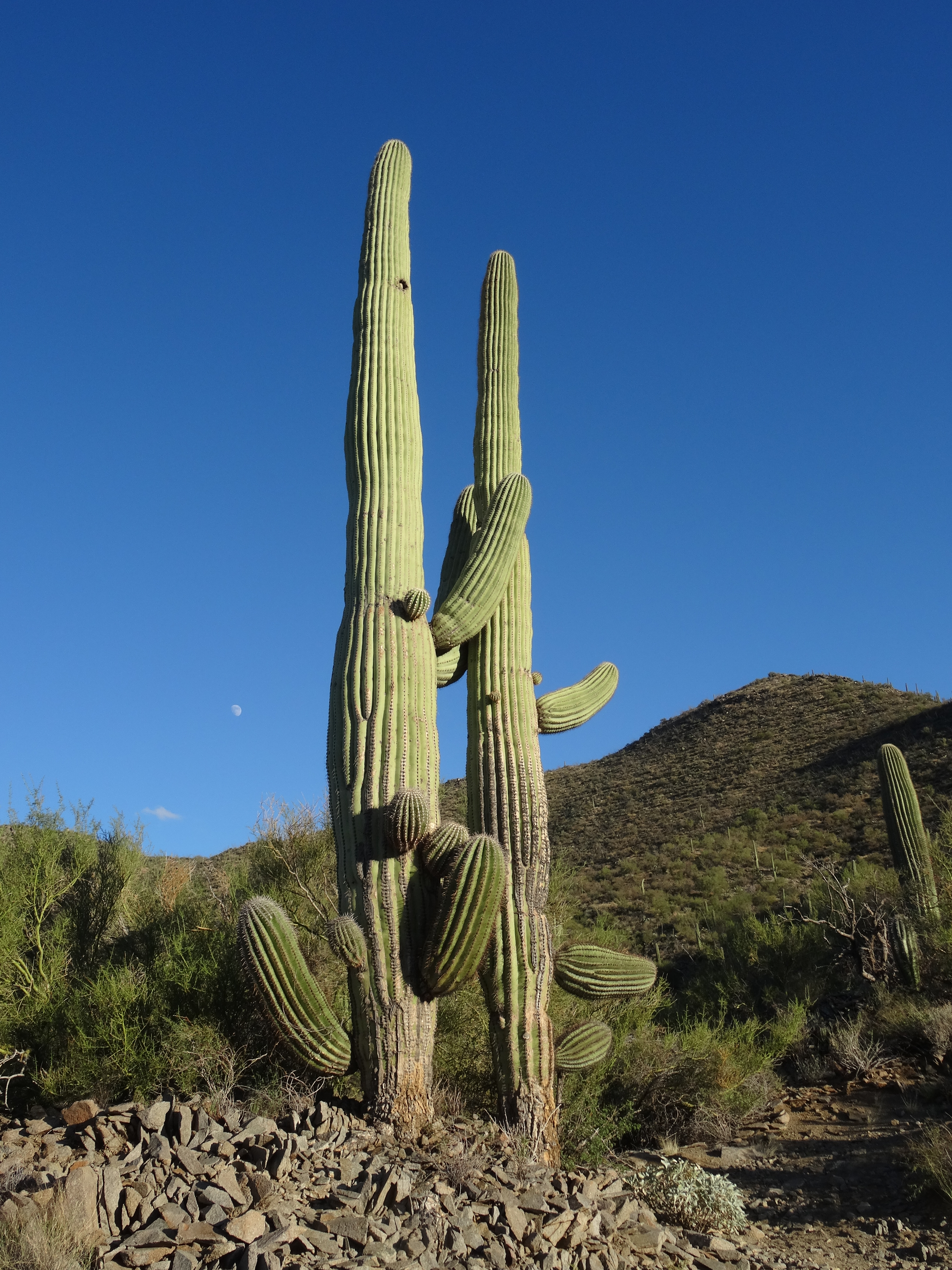
We were back among the stately saguaro cacti of the Sonoran Desert.
Tucson, Arizona has a bit of a funky college town feel. That vibe and its 530k population reminded us of our home, Austin, from when we’d first moved there in the 1980’s. Austin’s population has since exploded and it’s small-town funkiness has faded somewhat, so we relished our time in Tucson.
We’d slept in after arriving late the previous evening. By the time we waited for seating at a popular brunch spot (see below), the sun had moved well west of 90⁰. Yet, we continued as planned… to hike among the enchanting saguaros.
Saguaro National Park – West
The city of Tucson divides Saguaro National Park into west and east sides.
West Side of Saguaro Nat’l Park
East Side of Saguaro Nat’l Park
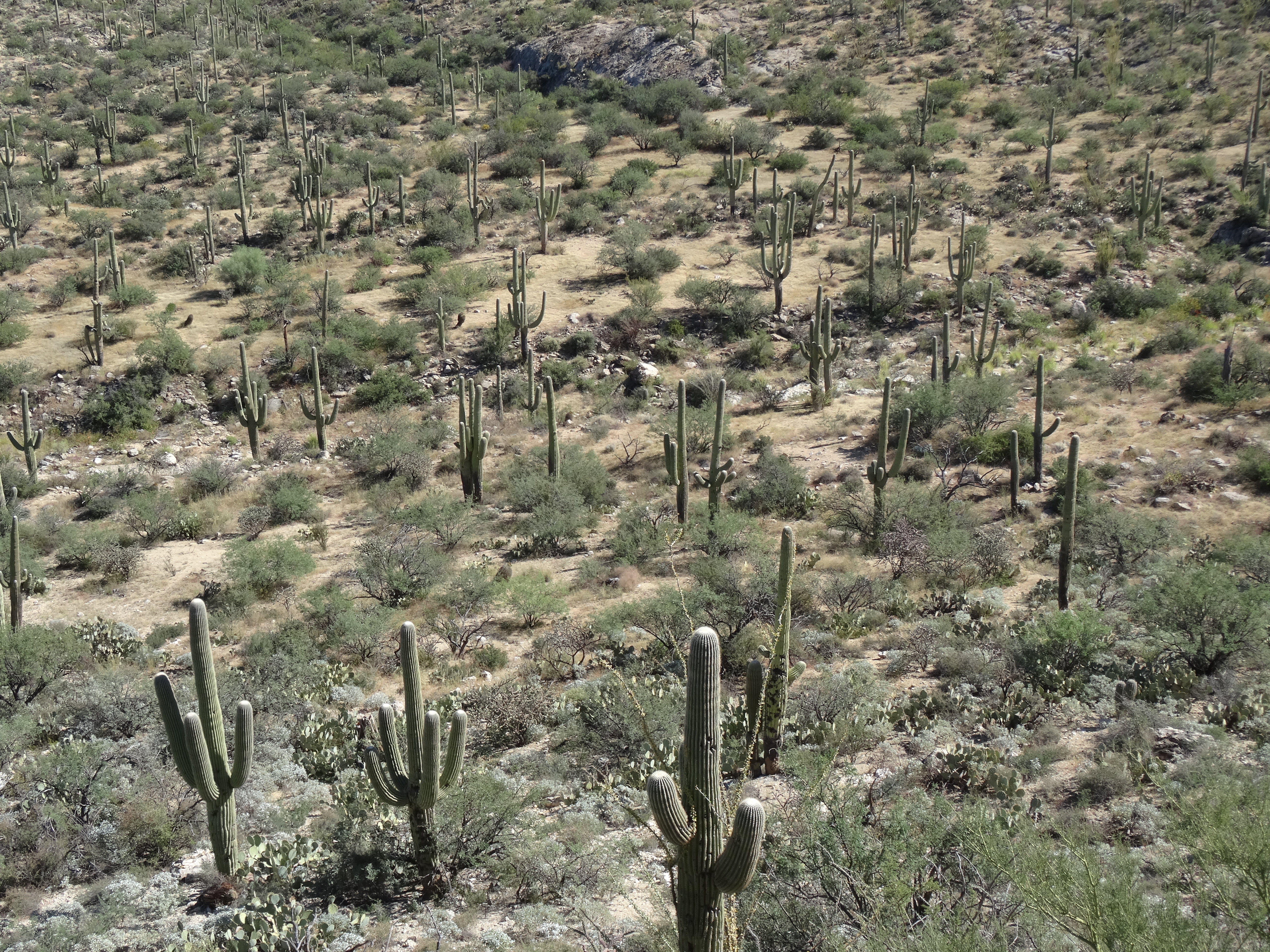
While the city seems to be encroaching the parks’ borders, both are full of saguaro cacti, and have hiking trails and scenic loop drives.
Saguaro Natl Park W, AZ
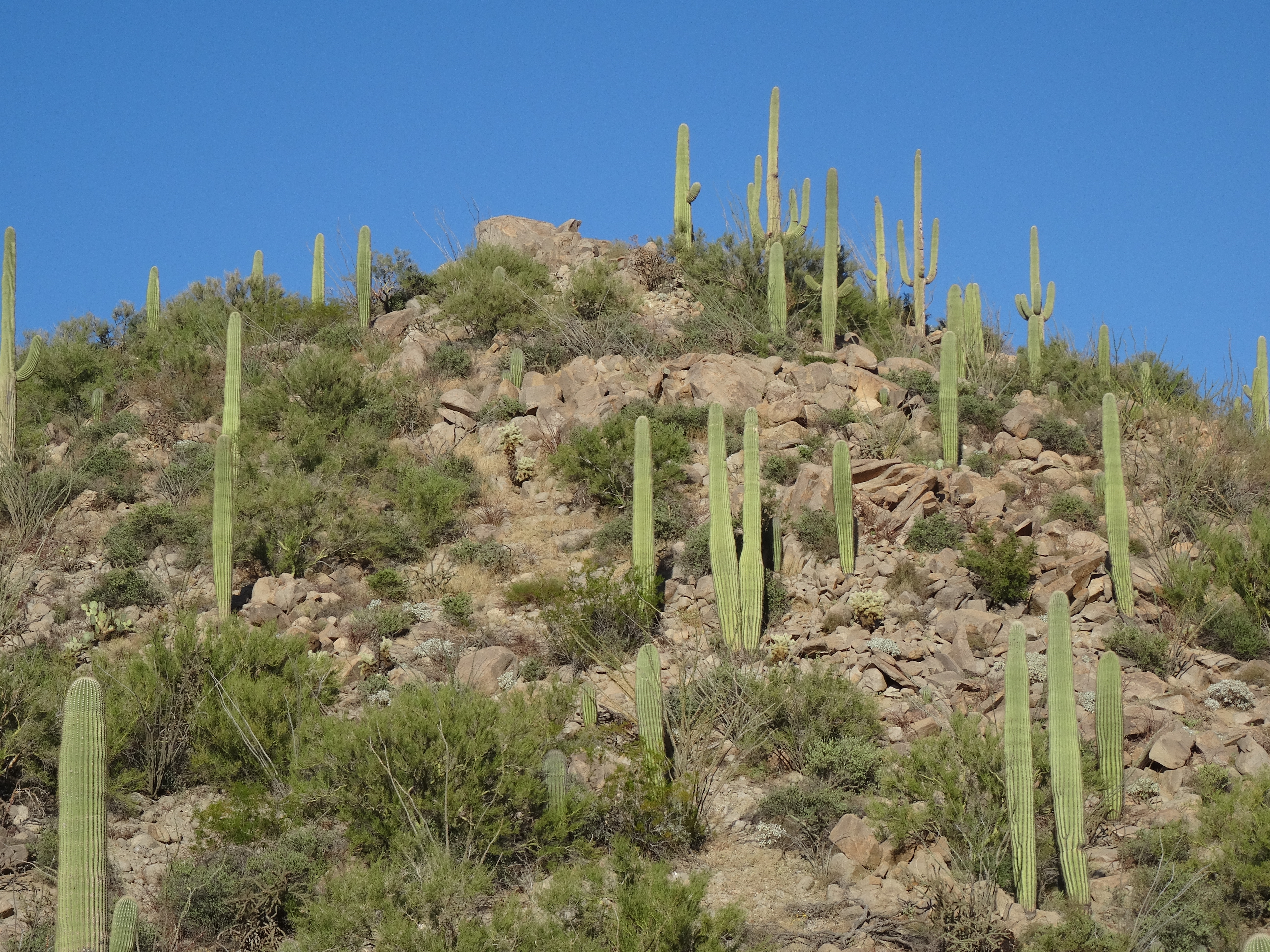
We first headed to the western section, or the Tucson Mountain District, because it is smaller and recommended for those pressed for time.
Yet, it still provided us with a sense of wilderness hiking.
The Sendero Esperanza Trail begins just off Golden Gate Road near the Ez-Kim-In-Zin picnic area where we found plenty of parking space. The first mile stays within a valley and crosses through and around sandy washes.
Sendero-Esperanza Trail, Saguaro NP W
The valley was lovely, with the trail winding through saguaro, barrel and cholla cacti.
Birdsong filled the air and critter holes dotted the trail’s sides.
Arizona Blue-Eyes, Saguaro NP W
Saguaro NP W Beetle
We saw several lizards and beetles and kept a lookout for road runners, snakes, and cactus mice.
Cactus Wren, Saguaro Nat’l Park W, AZ
As the trail began to climb the saguaros became more abundant.
We noticed how each one, with their varied appendages – twisting, pointing, displaying, signaling – seemed to have its own personality.
I Love You So Much! Saguaro Nat’l Park W, AZ
We loved hiking among them!
After a series of switchbacks, we reached a ridge and the intersection of another trail, the Hugh Norris Trail.
Trey on the Hugh Norris Ridge Trail, Saguaro NP W
Instead of continuing down the Sendero Esperanza Trail, we cut left up the ridge that leads to Wasson Peak, (4,687’).
View from Hugh Norris Ridge Trail, Saguaro NP W
Although the summit was only about 1-1/2 miles away, the sun was now low in the sky. We had to turn back to avoid hiking after dark.
Sendero Esperanza Trail, Saguaro NP W
We returned to the Escape Mobile just after the sun had set and turned the western sky a gorgeous shade of burnt orange.
Sunset, Golden Gate Road, Saguaro National Park W, AZ
The silhouettes of our new friends, the saguaros, against the backdrop of an orange sky is a favorite memory.
Saguaro National Park – East
Cool, crisp air filled the Rincon Mountain District. The morning was beautiful and perfect for touring the east side of Saguaro National Park by bicycle.
Cactus Forest Drive, Saguaro Natl Park E
Cactus Forest Drive is a one-way, 8-mile loop covering a tiny portion of the park.
Saguaro NP E Overlook from Cactus Forest Drive
But its saguaro forest, scenic overlooks, and optional ecology trail offer a taste of the vastness that stretches eastward from the road.
Access to this wilderness is by foot only so we stayed to road.
Trey on Cactus Forest Drive, Saguaro NP E
The ride is hilly, at times steep… you need durable legs and good brakes.
Fortunately, there are several areas to stop, rest, and bask in the desert vistas.
Our early arrival allowed us to take our time and return to our hotel to rest up for the evening’s adventure.
Lined Snake on Cactus Forest Drive
Kitt Peak National Observatory
“We must not allow the clock and the calendar to bind us to the fact that each moment of life
is a miracle and a mystery.”
~H.G. Wells
From every direction, mountains spring up from the desert floor and surround the city of Tucson. There are five mountain ranges within and around the city’s perimeter, and even more on its outskirts, including the Quinlan Mountains.
Kitt Peak National Observatory
At 6,877 feet, Kitt Peak is the highest of the Quinlan Mountains and is accessible off AZ Hwy 86, about forty miles west of Tucson. Kitt Peak lies on native land (Tohono O’odham) far from city lights; it’s also home to the world’s largest collection of telescopes.
WIYN Telescope (Wisconsin, Indiana, Yale, NOAO)
McMath-Pierce Solar Telescope, Kitt Peak
In addition to daily public tours, they offer nightly sky/star viewing programs, which is what we opted to do.
0.9 Meter Telescope, Kitt Peak
With temps in the 30’s and the moon close to full, the conditions weren’t ideal for star gazing. Yet, we were thrilled with the experience.
Sunset Nov 3 2014, from Kitt Peak
Our guide, Sean, explained the purpose and capabilities of each telescope and was extremely knowledgeable. We watched the sunset and then identified stars and planets as they appeared in the darkening sky.
Eventually, and with some help from Sean and a pair of binoculars, we spied our galactic next-door neighbor, Andromeda. Using one of the telescopes (not heated, but at least sheltered from the icy wind) the night sky was even more wondrous!
The 12-mile drive from the highway up to the peak is narrow and winding… not a problem in the daylight. But the return drive down the mountain was harrowing. Because headlights interfere with the telescopes, only parking lights are allowed until you’ve passed a certain point.
Moon, Nov 3 2014 from Kitt Peak
Even with a near-full moon, it was extremely dark. As we strained to assure the Escape Mobile stayed on course we also kept an eye out for wildlife. We were instructed to continue driving slowly after turning on our headlights because wildlife hang out along the road, including a great Horned Owl around mile marker 8. We had hoped to see that owl.
After safely descending Kitt Peak and soon after turning east onto AZ Hwy 86… Wowza! That Great Horned Owl cut right in front of us! His wings spanned across our entire windshield blocking our view briefly and scaring the heck out of us. We weren’t sure if he was chasing after potential prey or exclaiming, “Here I am, you dummies!”
FOOD
Blue Willow was a fun, funky, and delicious brunch spot. Fresh and local. They also have a great gift shop to peruse while waiting for a table… it is extremely popular with the locals!
Blue Willow Breakfast, Tucson, AZ
Local dive, Franks, was great for a cheap, quick, classic American breakfast. No frills and that’s the way they like it!
Cross Roads Restaurant was advertised as some of the best Mexican Food in Tucson. We skipped the buffet and ordered off the menu.
Trey was incredibly pleased with his favorite… enchiladas con huevos, as was I with a southwest version of huevos rancheros. Two yums up!
Next Stop… Gila National Forest and Silver City, New Mexico
Always looking to take advantage of good deals on accommodations, we were lured into Coachella Valley by an email received a month prior. The promotional offer was from a lavish golf resort in the town of Rancho Mirage: four nights in a luxury villa at an on-budget rate if we listened to their one-hour sales pitch.
Source: Westin Mission Hills Resort
Situated between the desert havens of Palm Springs and Palm Desert, Rancho Mirage was not on our bucket list, but Joshua Tree National Park was and lies 40 miles away. No brainer!
For the first time since Seattle (almost two months back), we had a kitchen.
Breakfast One
Breakfast Two
Cooking dinner followed by lively conversations with other guests in the hot tub became our nightly routine.
Our stay in Rancho Mirage was an extravagant gift that we appreciated fully…
Trey played a round of golf while I spent the afternoon at the spa.
Gary Player Signature Course – Source: Westin Mission Hills
We basked fully in luxury’s lap while we could.
Mt. San Jacinto
The two excursions we made outside of the resort was to drive through old school celebrities’ neighborhoods north of downtown Palm Springs, and to travel up the side of San Jacinto Mountain via the Palm Springs Aerial Tramway. (Trey also spent an evening at a local casino, but doesn’t want to talk about it.)
The rotating tram travels 2.5 miles up the mountain, dropping you off at the edge of a massive wilderness.
View from Palm Springs Aerial Tramway
The views across the valley to the Little San Bernardino Mountains are stunning.
View from atop Palm Springs Aerial Tramway
Along with restaurants, a gift shop and other amenities, the top offers access to loads of hiking trails. We hiked only about a mile down from the mountain station because it was late in the afternoon (tram ticket prices are lower), quite chilly, and the climb back up was steep. Yet, we ventured far enough to sense the wild vastness ahead. We hoped to see wildlife, but I think the cold and late hour kept them away.
If we had planned better, we would have gotten an early start and hiked to San Jacinto Peak, which is a 5.5 mile one-way trail that connects up with the Pacific Coast Trail. But alas, darkness was approaching so we dangled back down Mt. San Jacinto and drove to Rancho Mirage where we spent the remaining evening plotting our course for the next two weeks.
Lizard Outside Our Villa
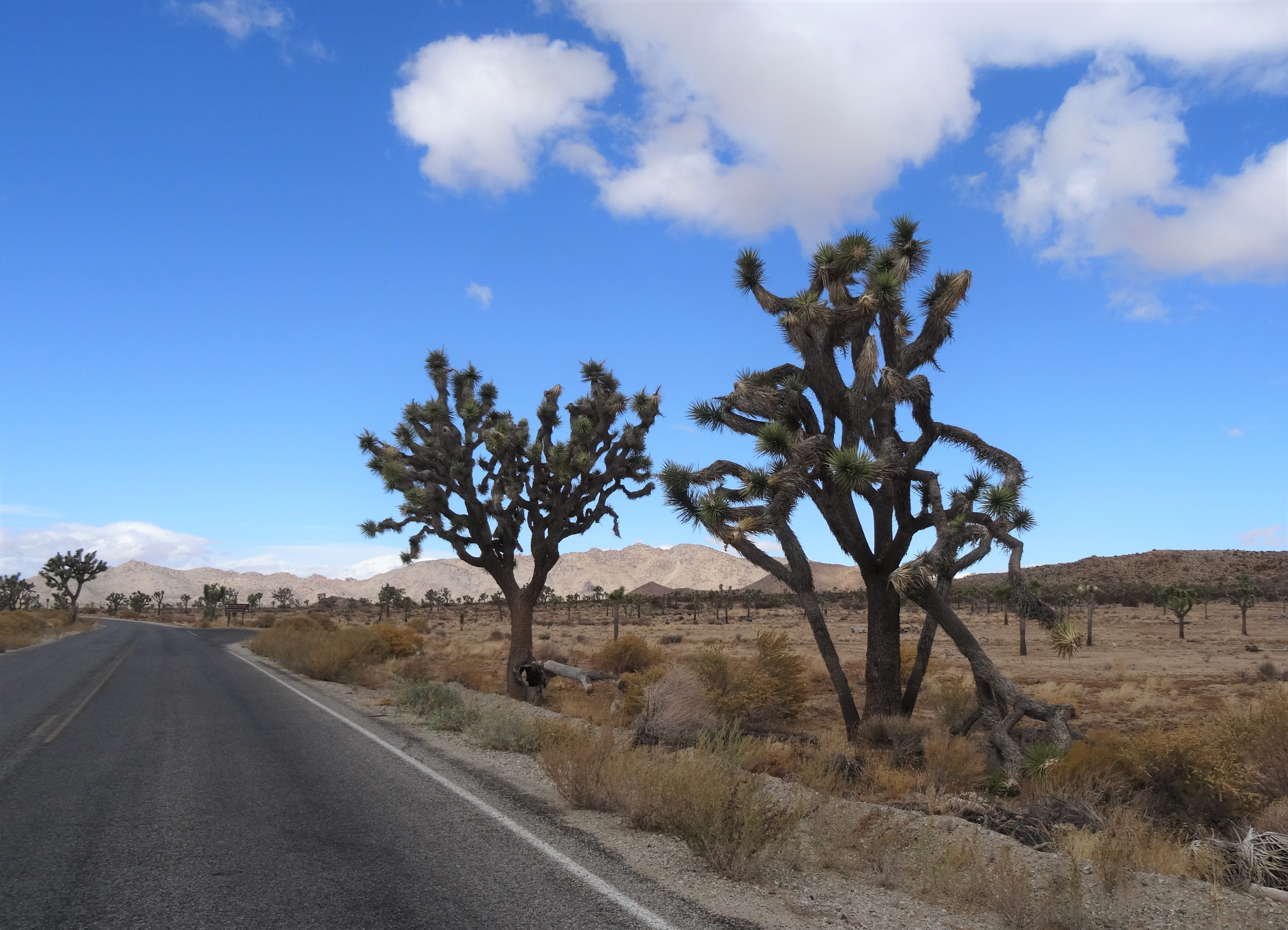
Joshua Tree National Park
We were heading eastward toward Texas, to our home. Joshua Tree was on the way, so we waited until we were leaving California to visit it.
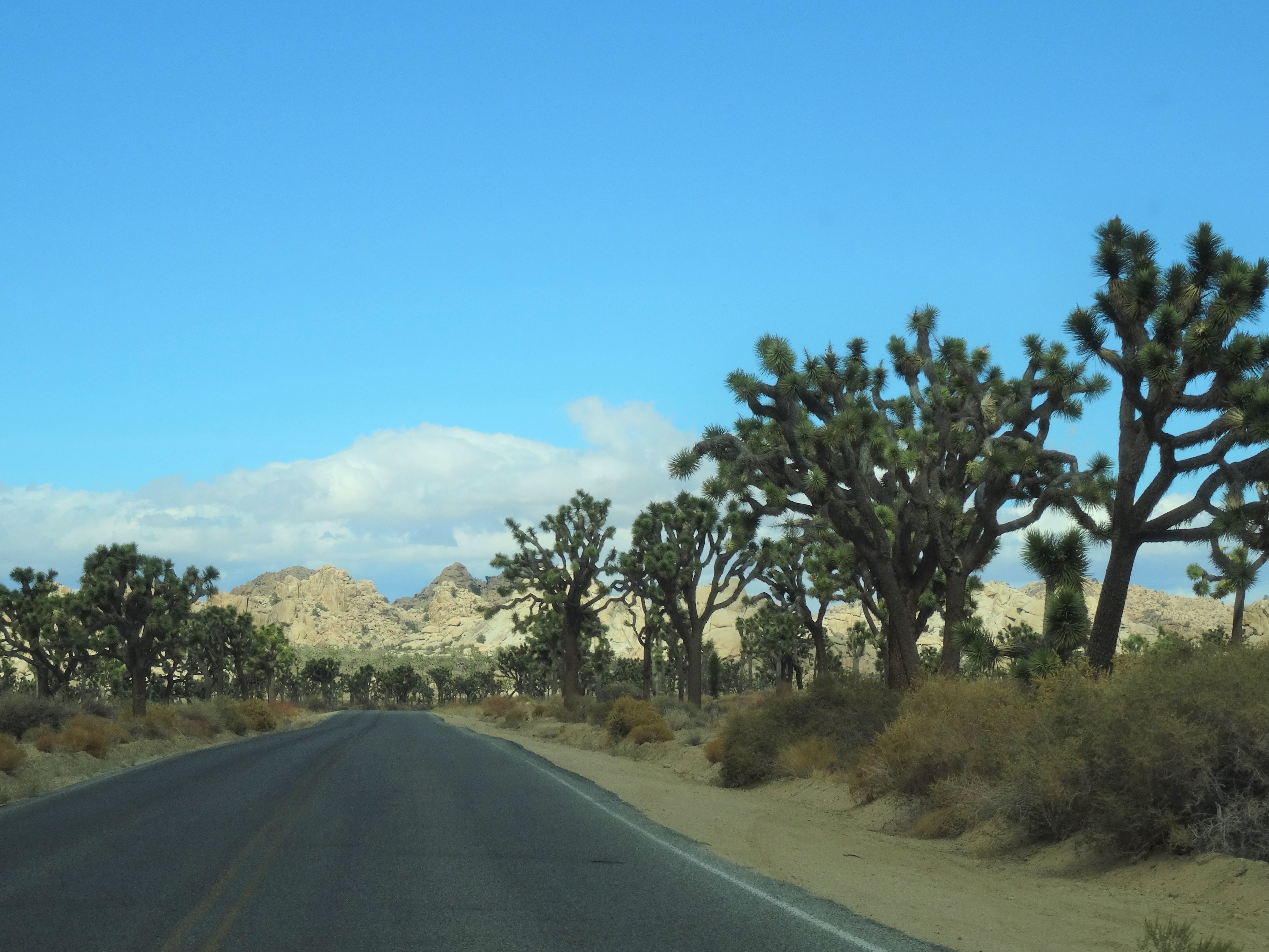
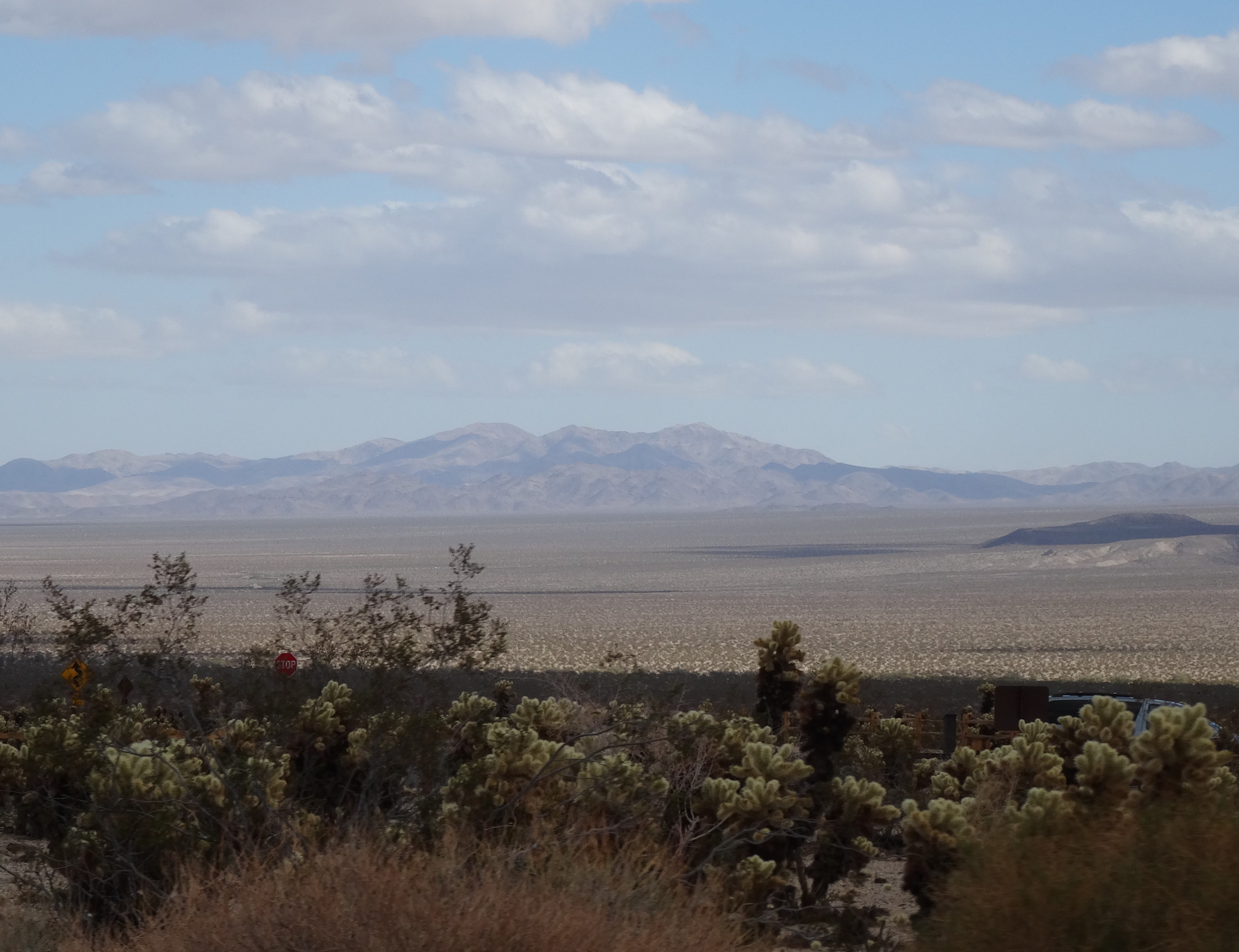
Best I can tell, the park’s 794,000 acres encompass five mountain ranges (Coxcomb, Eagle, Cottonwood, Hexie, & Little San Bernardino) and two deserts (Mojave & Colorado).
We entered from the south off Interstate 10 and through the Cottonwood Mountains.
Pinto Basin, Joshua Tree Nat’l Park
A ranger at the Cottonwood Visitor Center helped us to strategically plan our time. He suggested continuing our drive north through the heart of the park and hiking the Barker Dam Loop Trail.
The drive alone is a great way to experience the joshua trees… they’re everywhere!
Cholla Cactus, Joshua Tree Nat;l Park
Scattered among them are mojave yuccas and cholla cacti.
The Joshua Tree cactus gets its branches through a unique process. It grows straight upwards until it blooms…. no blossoms, no branches. Once it blooms and the blossoms die and fall off, a new branch will leaf out from residual scar and grows until it blooms and restarts the process.
Mature Joshua Tree, Joshua Tree NP CA
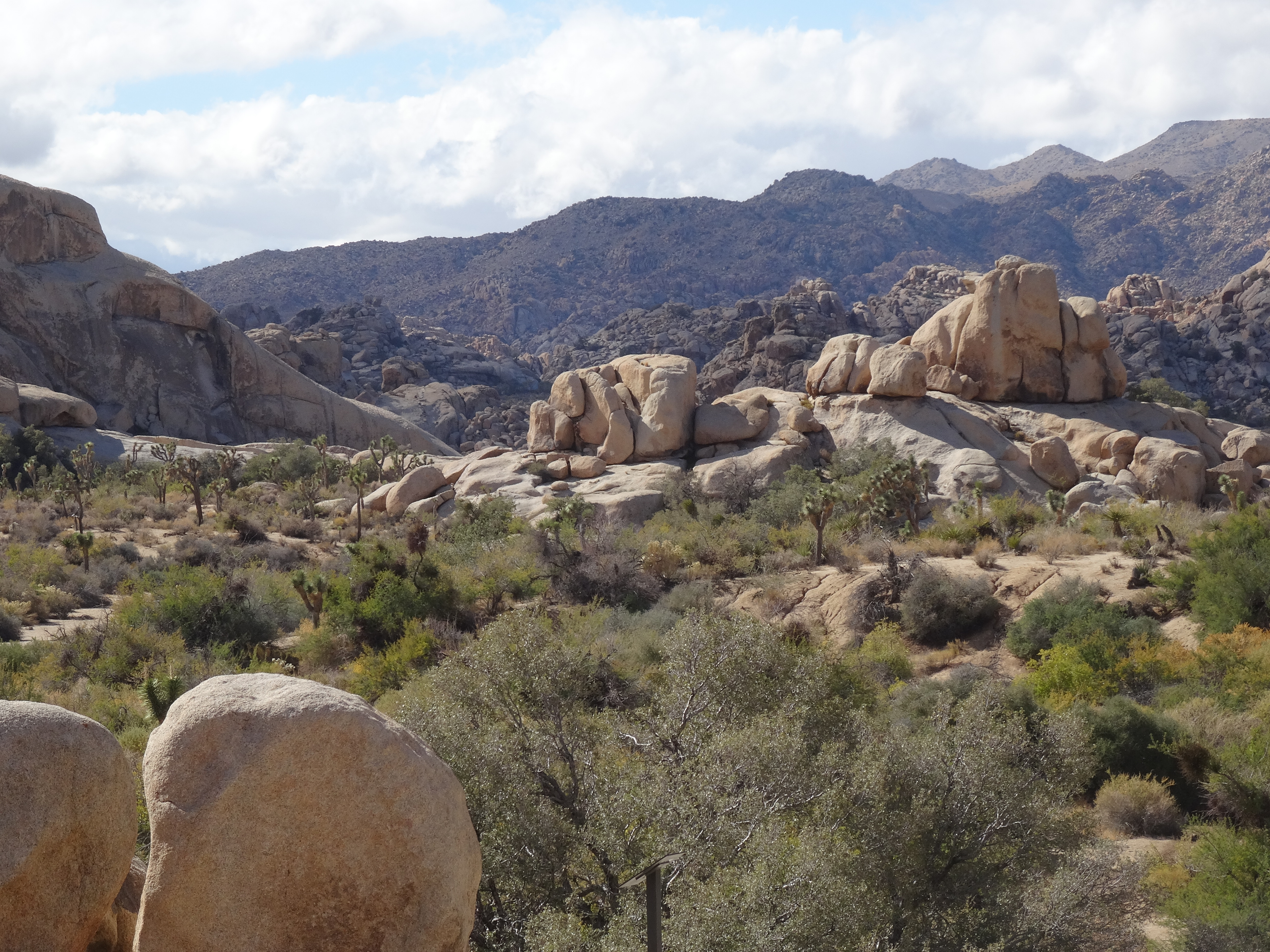
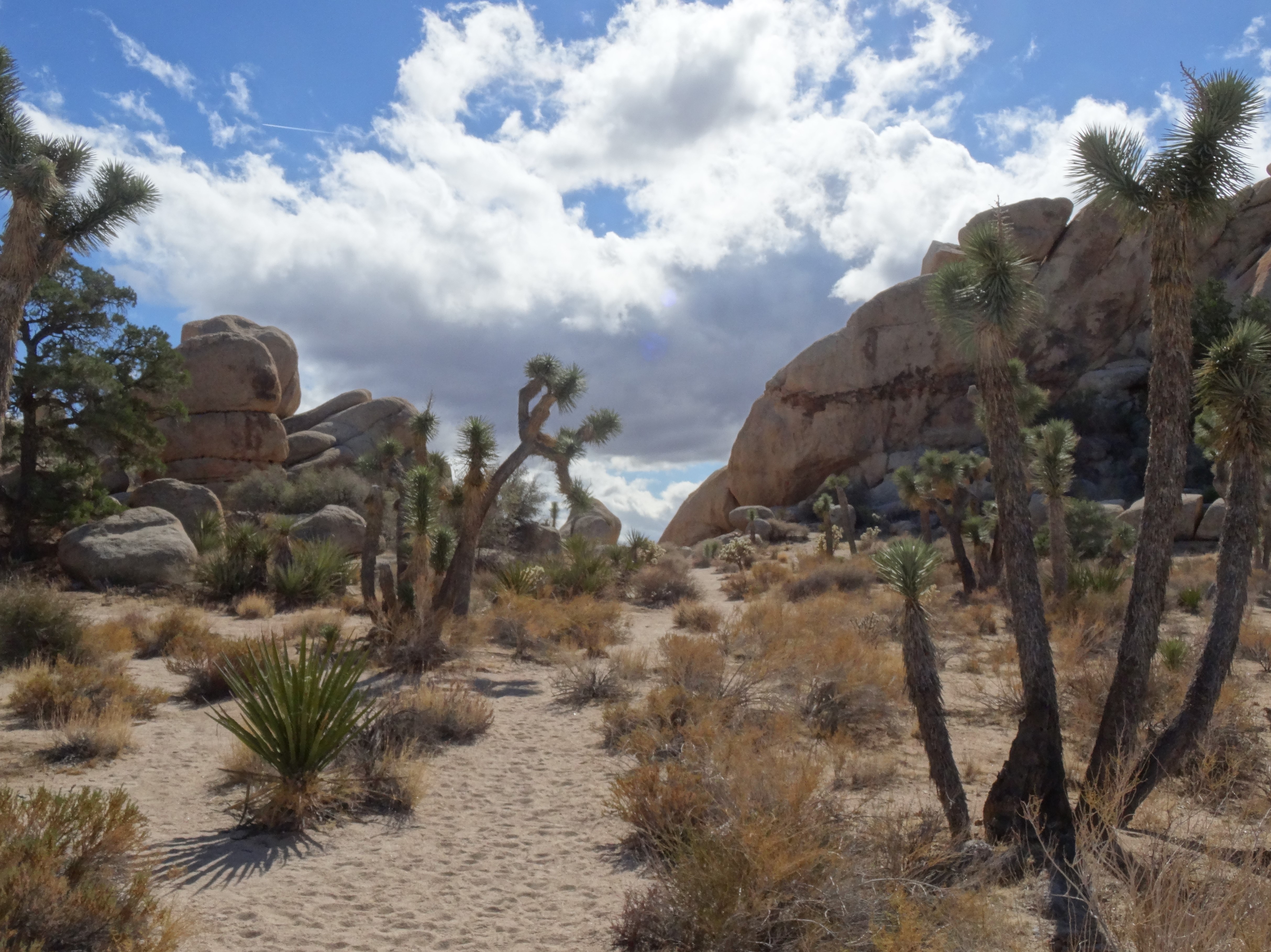
On the drive to Barker Dam, there are several places to pull over and enjoy the scenery.
Skull Rock, Joshua Tree National Park
We particularly enjoyed the Cholla Cactus Garden…
Cholla Cactus Garden, Joshua Tree Nat’l Park
and the “jumbo rocks” along Park Boulevard.
The Barker Dam loop is perfect if you’re crunched for time.
Trey on the Barker Dam Loop Trail
It’s just over a mile long, and wends through giant rock formations on a pathway lined with impressive and playful joshua trees.
Although our time was limited, we gained an appreciation for, and were inspired by, the plant-life, mountains, and deserts that make up Joshua Tree National Park.
Leaving Las Vegas we were once again traveling in “we will figure it out” mode. Oh, we knew where we were heading, Zion National Park, but had no idea whether we’d spend the night there, nearby, or move onto Bryce Canyon. Sluggishness had delayed our departure so we didn’t arrive in Zion until 4pm… much too late to snatch a camping site.
Pa’rus Trail, Zion National Park
Thinking the remaining daylight was all the time we’d spend in the park, we hopped on our bikes for a quick tour.
The Pa’rus Trail is a paved path that begins near the visitor center, wends around the campground and along the Virgin River for 1.7 miles…
Virgin River from Pa’rus Trail, Zion
…ending at the intersections of Hwy 9 and Zion Canyon Scenic Drive.
Crossing Pine Creek, Pa’rus Trail, Zion NP
We continued up (and I do mean up!) Zion Canyon Scenic Drive for an additional five miles, stopping to take in the scenes of Great White Throne, Court of the Patriarchs, ant-like hikers clinging to cables along the West Rim Trail…
…beautiful passages of the Virgin River, and wildlife.
The Virgin River, Zion National Park
At the road’s end, we were captivated by the towering Temple of Sinawava—the 3000’ canyon wall that entices hikers into its chasm, The Narrows.
Alas, we had figured it out… with hands on our breaks and feet off our pedals we sailed downhill and then back to the nearest town – Springdale, Utah – to find a hotel and prep for the next day’s hike.
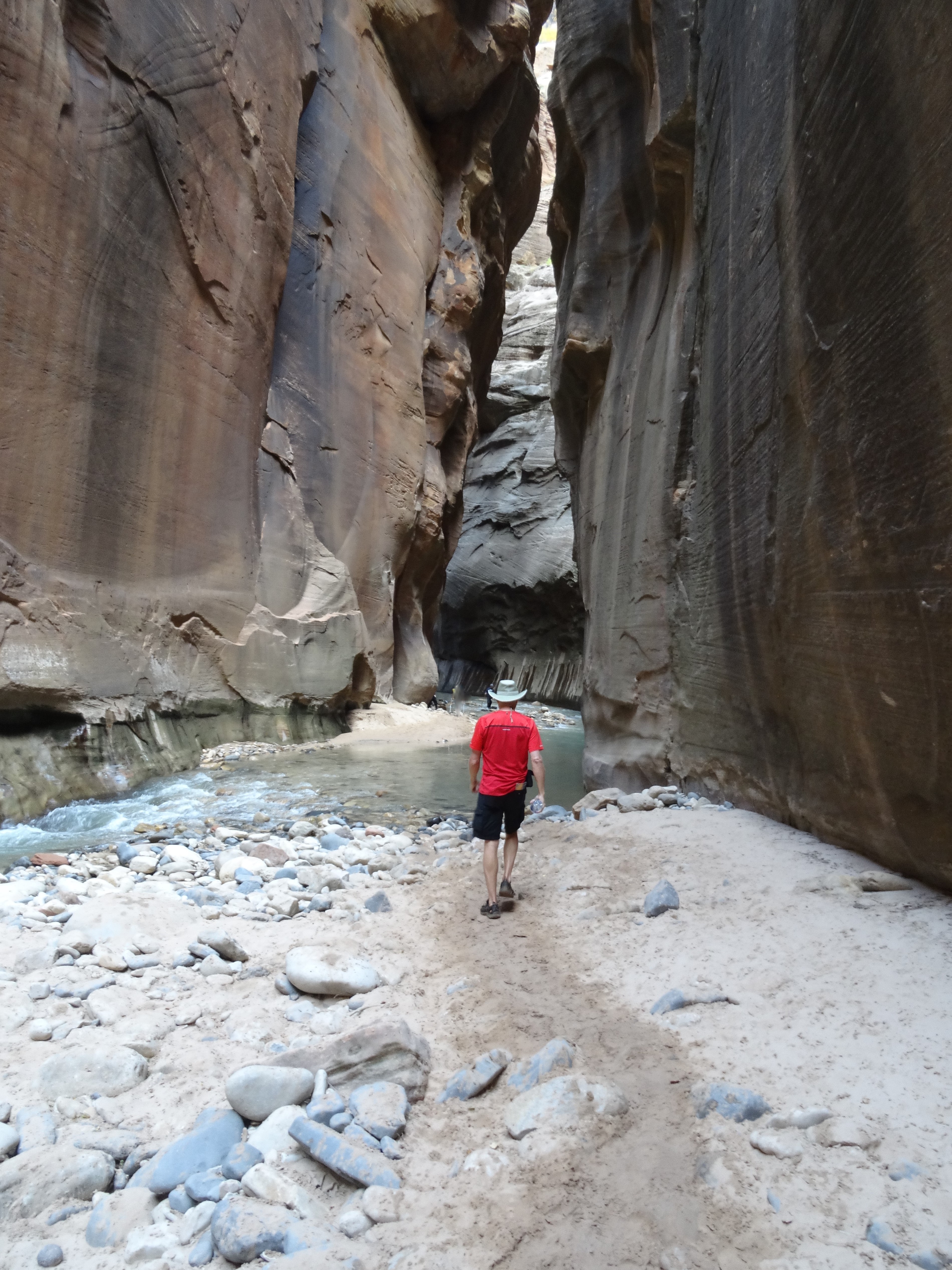
The Narrows (Virgin River) – Zion National Park
The Narrows was the most extraordinary, and probably our most memorable, hike of this six-month trek.
It’s not really a trail, or rather, the trail (Riverside Walk) ends after a mile, and to continue into The Narrows one must enter and follow the Virgin River upstream.
The water was frigid, but the heat and blood flow generated from traversing over rocks helped our toes acclimate pretty quickly.
Water and mineral stained canyon walls were capped with plant life and fall colors. We’d entered a seemingly mystical environment, surreal, but not without lurking dangers.
The river is unpredictable in flow and depth, and I once found myself suddenly waste deep.
As we slogged farther into the narrowing canyon its rock walls grew higher and more solid.
Trey in The Narrows, Zion National Park
Time passed, but without a sense of our pace in the water, we had no idea of how far we had traveled. There were no mile markers, probably because it’s not a trail, but when we reached an intersection with another canyon that broke off to the east, Trey correctly estimated we’d hiked about a mile and a half since entering the river.
We followed what ended up being Orderville Gulch for only a few hundred feet before turning around and heading back downstream.
Our turnaround point: Orderville Gulch, The Narrows, Zion
At 6pm, we left Zion National Park via Highway 9 and with senses of accomplishment and regret.
Zion National Park – East of Hwy 9 Tunnel
The Narrows was an amazing hike, a once-in-a-lifetime experience that will stay with us forever; yet Zion had many gifts and trails we were leaving uncharted. As the majestic beauty of Zion’s eastern border folded out around us…
Upon exiting Sequoia National Park we’d entered the Mojave Desert and the portion of this “great looping quest” in which I was most apprehensive… the desert.
West of Las Vegas
I had preconceived notions about desert existence, mostly negative because my perceptions weren’t based on actual experience. So, I’d anticipated a colorless, desolate environment… unfriendly and uninhabitable. After all, the Mojave has a valley named “Death!”
What I discovered was just the opposite, a welcoming beauty, thriving and very much alive. For me, establishing a sense of grounding in the desert required no conscious effort – the desert rose up firmly beneath my feet.
East of Las Vegas, NV
Within Mojave’s arid landscape, where odd and varied creatures flourished, I felt my own belonging.
The desert’s embrace forever changed my perspective, it corrected it and taught me a lesson about the ridiculous power we give to our perceptions.
~~~
A cheap (because it was undergoing a noisy renovation) Las Vegas casino/hotel served as our basecamp while we explored what lies beyond the city’s fringes… the even more wild and wonderful. First up…
Hoover Dam
For a hundred years the Hoover Dam has risen 726 feet from the floor of the Colorado River.
It is an unyielding concrete monster, a sight to behold that attracts some seven million people a year… by car, boat, and helicopter.
Mike O’Callaghan–Pat Tillman Memorial Bridge, Hoover Dam NV
Its proximity to Las Vegas—40 minutes southeast—enables this constant flow of people. Unfortunately, the flow of water for which the dam was built is not as reliable and, as in California, the effect of prolonged drought was visible through the river’s receding waterline.
Receding Colorado River Water Level
We purchased tickets to tour the dam’s power plant… $15 in 2014, and well worth it.
Inside, 30 foot pipes snake through tunnels and rows of enormous generators churn out 4 billion kilowatt hours of electricity annually for the good folks of Nevada, Arizona, and California. The dam’s structure also serves to control flooding and reserve water for California’s fruitful valleys and its southern cities.
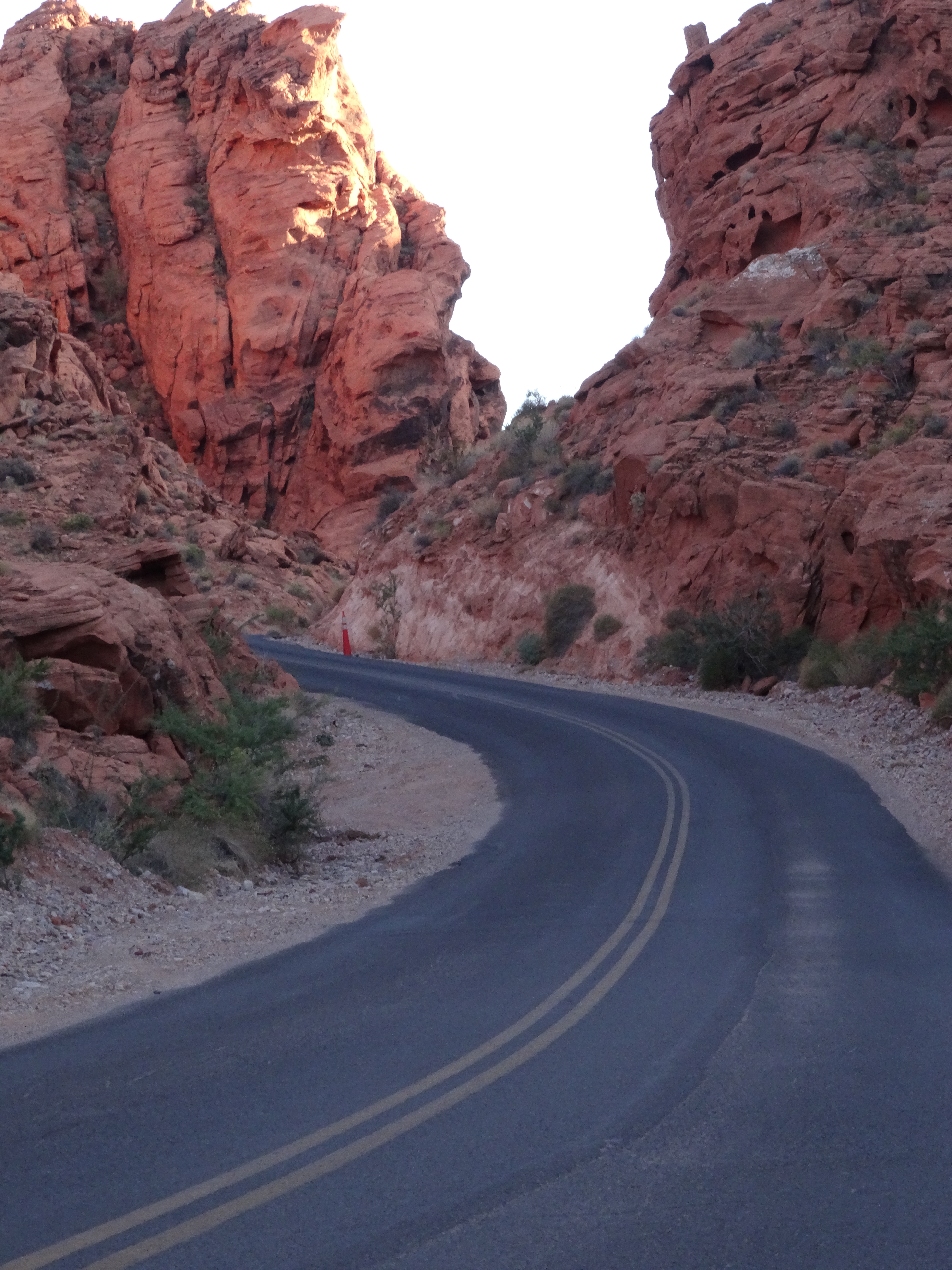
Valley of Fire State Park
Nevada’s Valley of Fire State Park is located about 50 miles (an hour’s drive) northeast of Las Vegas. Its sculpted red rocks are stacked and scattered throughout the park’s 40,000 acres.
Valley of Fire Landscape
Only one road cuts through the park, just above its southern border. The road provides access to loads of popular hikes and fun formations, more than enough to keep one occupied for a day.
The rest of the park, the vast majority of its wilderness, is a sprawling preservation area, seemingly inaccessible except by foot.
Our arrival in the late afternoon limited our hiking options, but we had the park to ourselves.
Mouse Tank Road, Valley of Fire State Park, NV
Also, the sun’s low stance illuminated the red rocks and danced through canyons making our walks even more magical.
Balanced Rock
Elephant Rock
The half-mile trail to Mouse Tank led us down a canyon marked with hundreds of petroglyphs.
Mouse Tank Trail Valley of Fire State Park, NV
These uninterpretable messages hovered just above us, holding steadfast onto the secrets of an ancient civilization.
Only the sunset, spectacular and fleeting, could force us out of the Valley of Fire and back toward the maddening lights of Las Vegas.
Death Valley National Park
We traveled northwest for 140+ miles to enter Death Valley National Park where my attitude and apprehensions about deserts were permanently altered. Death Valley’s mystique and it’s rolling, constantly changing landscapes captivated me.
View from Zabriskie Point, Death Valley National Park
We stopped often, awestruck by its colors and geology.
Near the center of Death Valley is Badwater Basin, a massive flat of salt exposed by rain runoff from the surrounding mountains.
The basin sits 282 feet below sea level, the lowest point in North America.
Badwater Basin Salt Flat, Death Valley National Park, CA
Its limited drainage results in artsy, salty shapes forming through heat induced evaporation. The salt configurations cover the basin creating an eerie, alien terrain.
We traversed over the salt and out into the basin and became mesmerized by the patterns. Before we realized it, we were about a mile in, which is nowhere near the basin’s center.
As intense heat began pulsing around us, we sensed our own vulnerability and soon turned back toward the parking area.
Artists’ Drive, Death Valley National Park, CA
Wending through a painted canyon on Artists’ Drive was like bounding through a rainbow. The one-way nine-mile road is narrow with rocky hillsides rolling up, out, and along both sides.
The palette effect is from minerals (including hematite and chlorite) altered by volcanic eruptions five million years ago. Elements aluminum, iron, magnesium and titanium also add to the mountainous canvas.
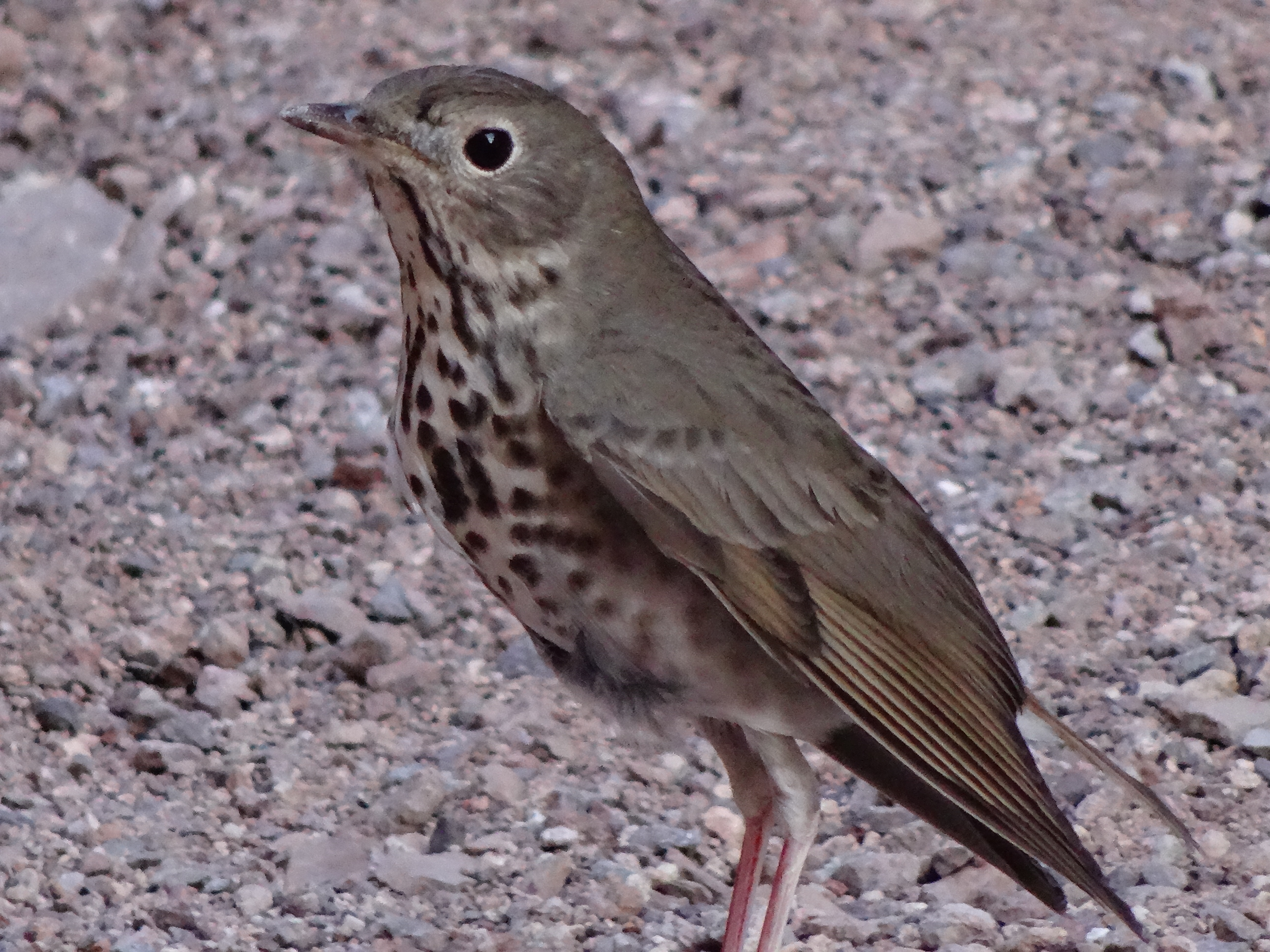
Our other hike in Death Valley, was the Natural Bridge Trail, accessible about a mile and half down a dirt road that breaks off from Badwater Road.
Trey heading down Natural Bridge Trail, Death Valley National Park
It’s an easy one-mile round-trip trail into a narrow, high-walled canyon.
The trail crosses under the bridge formation and continues into a box canyon.
Natural Bridge, Death Valley National Park, CA
We had the trail to ourselves, or at least it was devoid of other humans. This gal, a Swainson’s Thrush, accompanied us from the rock bridge to the trail’s end.
Death Valley Swainson’s Thrush
As we neared the bird, it would take flight, landing 20 or so feet up trail where it waited for us to approach again. Over and over it repeated this routine, escorting us all the way into the rocky boxed area…
and then safely back to the bridge.
We also spied a reddish fox, the Desert Kit Fox, strolling alongside Hwy 190 as we left the park, but missed photographing him.
With our bicycles snug on their sparkling new rack, we motored south, then east, to Kings Canyon National Park. Our ultimate destination was Las Vegas, and the plan was to wend through Kings Canyon and Sequoia National Parks on the way… a tree-tour-detour.
I’ve written previously, ad nauseam really, about the awe we’ve experienced walking among and connecting with these earthly giants. So, I’ll spare you from more adjectives and let the photos speak for themselves…
General Grant Tree
I’m sure all of our photos from this odyssey have been most capable of speaking for themselves all along. (Sigh)
Fallen Monarch Tree, Kings Canyon NP
Yet, I write on.
In honor of our last hours with the giants, here are some factoids that Trey recorded:
General Sherman Tree, Sequoia NP
The General Sherman Sequoia is considered the world’s largest living tree by volume; it towers approximately 275 feet; and its base circumference is just shy of 103 feet
Redwood bark can get up to 12 inches thick, while sequoias’ bark can expand outwards 31 inches
Redwoods typically grow taller, but sequoias weigh more due to the girth of their trunks and branches
The base of sequoia branches can be 40 feet in diameter stretching out to 8 feet in diameter… sequoia’s main branches look more like trees!
Sequoias tend to live longer than redwoods, about 3,500 vs 3,000 years
Heading down Generals Highway (Hwy 198)
Highway 198, also known as Generals Highway, led us away from the giants and out of Sequoia National Park.
Like the Beartooth Highway in Montana/Wyoming and the Sea-to-Sky Highway in British Columbia, the drive down Generals Highway from Sequoia NP to Three Rivers is an adventure.
Generals Highway
A must do whenever the opportunity presents itself, or even when it doesn’t. The twists are numerous, turns dizzying, and the scenery is gorgeous.
Tunnel Rock, Hwy 198
A perfect transition to where the trajectory of our “great looping quest” was taking us…
…into the desert.
By the time we pulled into Bakersfield, California, the landscape was more reminiscent of West Texas…
Beginning in Red Lodge MT, and continuing for the preceding 45 days, we’d followed the first appearances of fall colors across the west and down the Washington and Oregon coastlines. Random wisps of cool air and pronounced temperature differentials had been nipping at our backsides, nudging us forward just ahead of autumn’s arrival.
With the unanticipated deluge that forced us out of the Redwood Forest, fall had officially won the race and taken over. Its conquest coincided with a planned eastward turn into the mountains toward Nevada…
the first of several detours that had us zig-zagging across, in and out, and down the state of California for the next month and a half. (See our California path on our “About” page.)
From Arcata, we followed the Trinity River via State Highway 299.
Trinity River, Hwy 299 toward Redding
The river, changing leaves, grazing elk, along with a mix of rain and mist enhanced the gorgeous drive across northern California to Redding.
Trinity River, off Hwy 299 Northern CA 2
Still soaked and with an extra day, we stopped in Redding and checked into a hotel. After showering, we hauled our camping gear into the room, sorted and dried everything including our tent, which we pitched atop the spare bed.
Yelp and a hankering for comfort food led us to Nello’s Place for a cozy Italian dinner – one of our most memorable dining experiences in quality, service, and for being exactly what we needed when we needed it.
Dungeness Crab Cake, Nello’s Place, Redding, CA
Funny how what first appears to be a mishap ends up being a beautiful gift. These magic-of-the-Universe moments occurred often on our trip, just as they do in life.
In frustration, we tread through life’s darkness and around its rough edges as best possible only to end up somewhere completely unexpected, almost like an award for making it that far. It is only then that you recognize the past’s challenges as beautiful puzzle pieces laid out behind you, perfectly placed together.
One only needs to take the time to notice.
Elk buck along the Trinity River, Northern California
Over the last shared bites of Nello’s cherries jubilee, our favorite dessert experience on the trip, we expressed our deep gratitude for simply being in that moment, and for the obstacles that had led us there.
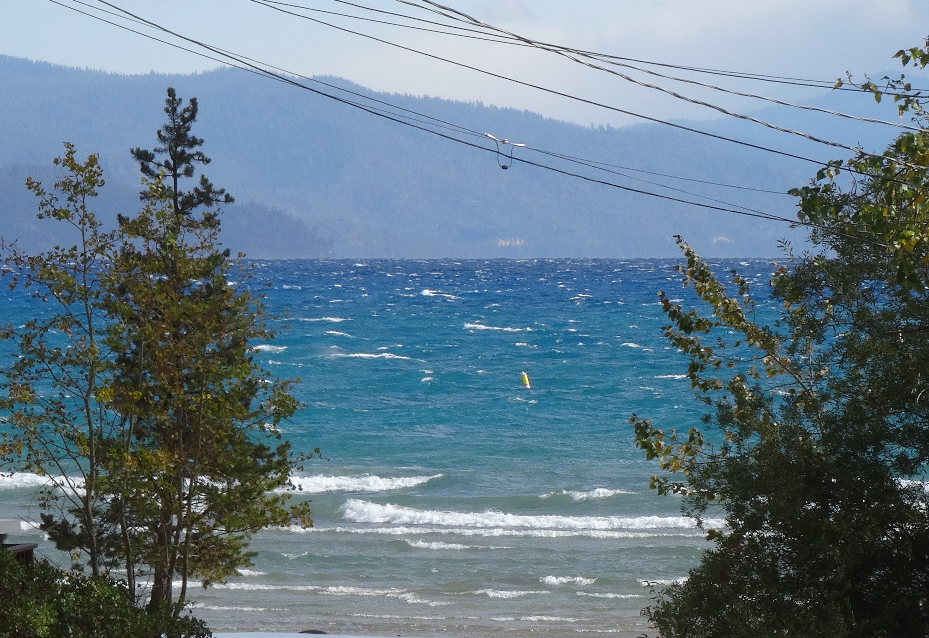
North Lake Tahoe, California
To avoid driving around Lassen Peak’s mountainous roads in a thunderstorm, we headed south from Redding along the Sacramento River and into the Central Valley. The sun and blue skies soon appeared highlighting the valley’s olive and pistachio orchards…
Barely an hour into our drive, the geography had completely changed. We found this to be true in most areas of California — if you don’t like the scenery, just drive an hour in any direction.
Heading into the Sierra Nevada Mts
The clouds and rain returned after steering eastbound again into the Sierra Nevada Mountains.
But, the weather was forgotten upon setting eyes on Lake Tahoe’s vibrant blue hues. We were captivated and regretted having less than 24-hours to enjoy them.
That is until frigid air blew in with a storm foiling our plans to bike, and keeping us inside our small rented cabin for the evening.
Public Beach, Tahoe Vista, North Lake Tahoe
All was good as our rustic cottage was comfy and adorable, and looked out onto Lake Tahoe.
Escape Mobile parked at Rustic Cottage Resort & Motel
We watched from the warmth of our cabin as wind gusts and waves knocked around boats docked along the shoreline.
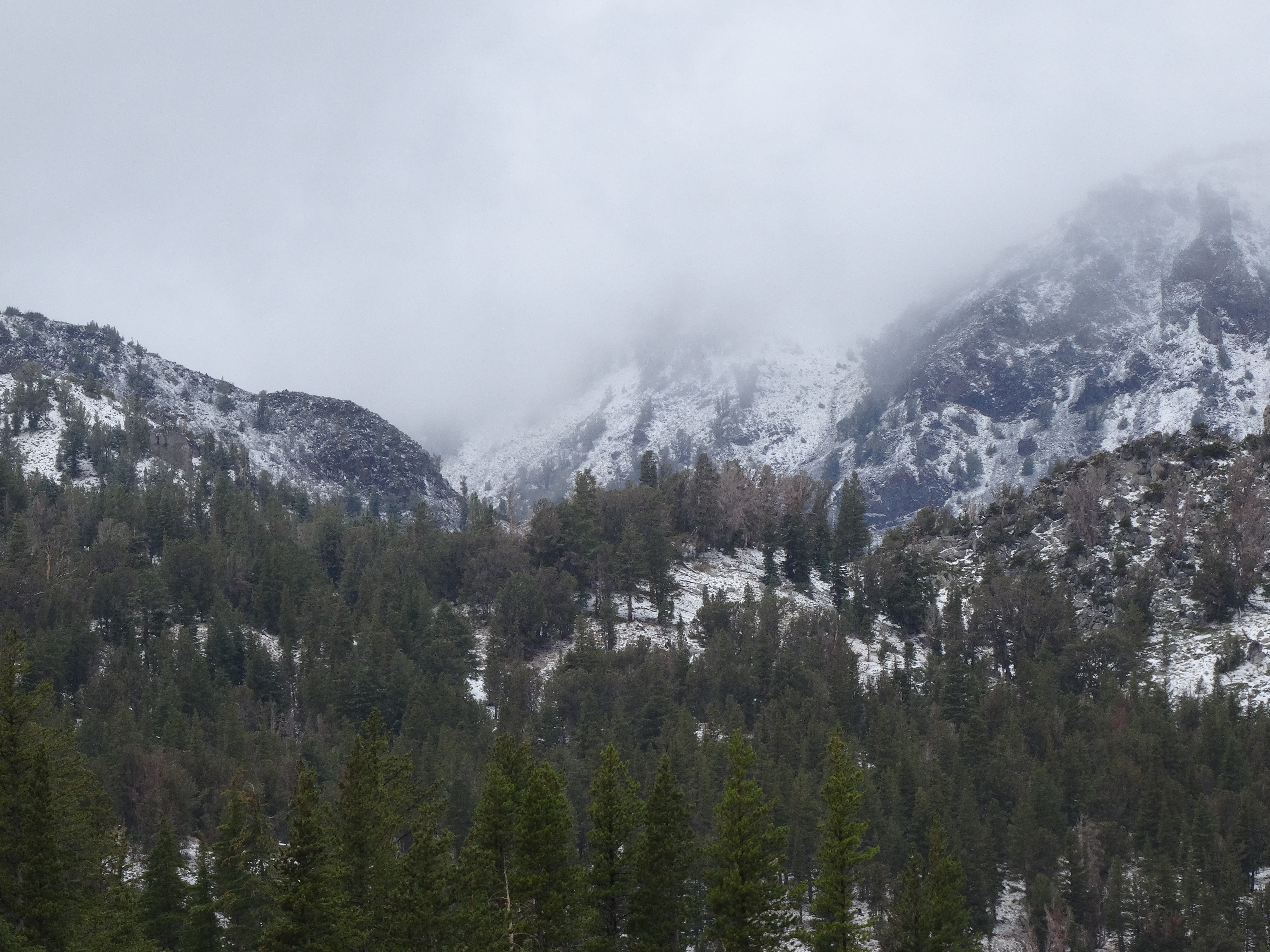
Driving across the Mount Rose Highway the next morning, we were stunned to find a light snow had dusted the mountain and roadsides. Snow in September, another first!
Snow dusting Mt. Rose in September 2014
Family Reunion – Reno, Nevada
Reno, Nevada
Because Reno is the home of my brother and most of his family, a visit to the biggest little city in the world had been on our must-do list since our trip’s onset We loved catching up with our family! And touring Reno…
Truckee River cutting through central Reno
Galena Creek Bridge near Reno, NV
a progressive, beautiful city surrounded by mountain vistas, and not at all similar to what Hollywood tends to project.
We spent an afternoon with my brother exploring the terrain and historical sites along State Highway 341, also referred to as the Virginia City Scenic Drive. We climbed along mountain edges, passing wild horses, and into the infamous silver-mining town of Virginia City.
Virginia City’s main street
Take away the paved highway cutting through town, along with all the cars and motorcycles, and Virginia City appears closely to what I imagine it did in the 1800’s. With its redbrick buildings, colorful storefronts and covered wooden walkways, Virginia City offers visitors a taste of living on the outer edge of law & order in the old west.
Virginia City, Street Vibrations Rally
Our visit happen to overlap the Street Vibrations motorcycle rally. Like in the Black Hills during the Sturgis rally, new and classic Harley’s lined Virginia City’s main street, augmenting the fun outlaw vibe.
Reno is a lovely city, and our visit with family was too short.
California Quail in my brother’s backyard
Lesser Goldfinches
It was difficult to say good-bye; this was the last of many reunions on our trek and we still had two months of travel ahead.
Up Next… back to California, the Wine Country
More Pics…
View of North Lake Tahoe heading up Mt Rose Hwy
Whiskeytown Lake, CA
Trinity River, off Hwy 299 Northern CA 2
This is a record of Trey & Martha's 2014 U.S. travel adventures


")

")


 Nevada’s Valley of Fire State Park is located about 50 miles (an hour’s drive) northeast of Las Vegas. Its sculpted red rocks are stacked and scattered throughout the park’s 40,000 acres.