Category Archives: Waterfalls

Yosemite National Park, California ~ October 8 – 11, 2014

We’d left Carmel-by-the-Sea for Yosemite National Park without plans for where we’d sleep for the next three nights. Securing a campground reservation had proven impossible, so our shaky plan B was to show up, stand in line, and hope there’d been a last minute cancellation.

As we detoured across California to avoid wildfires, the hours passed into late afternoon and we grew even less confident that shaky plan B was the way to go. Still, we progressed forward and climbed closer to Yosemite’s south entrance as the sun fell below the surrounding mountains. Three miles out, we came upon what appeared to be a forest oasis — a beautiful lodge.

tenaya-lodge-exterior-1367x600
Source: tenayalodge.com

It also appeared to be way outside of our budget, but it had spoken to both us. As we passed it, Trey and I looked at each other and in silent agreement, Trey turned the Escape Mobile around and headed back, “It can’t hurt to check it out.”

The Tenaya Lodge was definitely a splurge, but Trey and his baby blues secured a hefty discount, making it doable. Walking in without a reservation proved to us once again that, “The Universe is on our side!”  

Yosemite National Park

With only two days to explore Yosemite we planned to cram in as much as possible. We hadn’t previously visited the park, but, based on everything we’d heard, we had high expectations. 

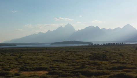
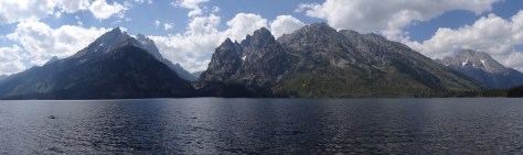
Bicycles in tow, we twisted northward along Hwy 41 toward Yosemite Valley. I thought the scenery was nice, but wondered, why all the hype? That is until a sharp curve led us into a tunnel and we emerged on the other side to this view…

01 Yosemite Valley -Tunnel View (Hwy 41)

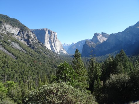
I wish there was a word for when everything you thought you knew gets thrust into proper perspective by unimaginable beauty and grace — those moments when you only feel humility and gratitude for the honor of the experience.

It would have to be a particularly full, bold word, one that rolls off the tongue, such as flumgustered or hyperevoluted. Well, I guess there is wonderstruck, but no; I was flumgustered to tears, my conscious was hyperevoluted as I grasped the immense power of nature’s mass and force.

01.5 El Capitain from Tunnel View (Hwy 41)
Majestic El Capitan

We had a full day of exploring ahead, but the “Tunnel View” beckoned us to stay. So spying a trailhead above the parking lot, we headed up Inspiration Point Trail for a higher vantage. The 1.3 mile path provided even more magic:  flying squirrels soared across the trail in front of us; mosaic pine tree trunks enticed us upwards…

and massive madronas painted the pathway with white blooms and redbrick limbs.

03 Inspiration Point Hike 3

The path to Inspiration Point is steep but the views are truly inspiring and worth the climb.

04 Yosemite Valley - Inspiration Point

03.6 Yosemite Valley - Inspiration Point 2

By the time we left the Tunnel View area and arrived in Yosemite Valley we were famished, so we shared a generous bowl of chicken rigatoni at the majestic Ahwahnee Lodge.

05 Climbers on Washington Column

Our bicycle tour was delayed further as we stuck around the Ahwahnee parking lot to gawk at freestyle climbers inching their way up Washington Column.

With its 12 miles of pathways, Yosemite is perfect for exploring by bicycle.

bike-path-map

06 Yosemite Bike Path

The remaining afternoon was spent peddling the length of the valley, crossing historic stone bridges…

06.7

…and stopping for short hikes through meadows and up to Lower Yosemite Falls, which was almost a trickle.

08 Lower Yosemite Falls

The afternoon’s highlight was spotting a momma bear and her cubs loading up on ripening apples in preparation for the approaching winter.

07 Cub catching up to his momma in Yosemite Valley

California was in extreme drought, this was evident on the drive from Carmel, and it was obvious throughout Yosemite Valley.

06.5 Merced River and Half Dome, Yosemite

The Merced River was barely flowing and the mountain creeks feeding it were bone dry. That, however, did not take away from the beauty of Yosemite.

The sun’s descent was progressing as we re-secured our bicycles to the back of the Escape Mobile — a timing that we hadn’t planned, but was perfect for sidetracking up Glacier Point Road.

The drive-in-and-out road is just shy of 16 miles (each way).  It cuts up from Wawona Road (Hwy 41) just south of Tunnel View, and twists deep into the wilderness. (We spotted what appeared to be a wolf on the drive up, and a coyote on the return trip.)

14 Half Dome from Glacier Point, Yosemite

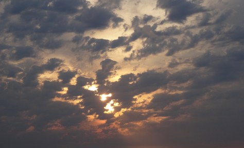
The sunset panoramas were spectacular as was the view of the valley below. From the height of Glacier Point one easily sees how and where ancient monster glaciers cut through mountains to carve out the valley.

15-yosemite-valley-from-glacier-point-2.png
Yosemite Valley from Glacier Point

We hadn’t anticipated the bonus of the setting sun’s colors reflecting off the eastern rocky cliffs.

18 Half Dome from Glacier Point at Sunset
Half Dome from Glacier Point at Sunset

We stood mesmerized, flumgustered, until we noticed stars beginning to dot the darkening sky.

19 On Top of the World, Glacier Point, Yosemite

We secured ourselves among boulders a safe distance away from the mountain’s ledge and watched as the stars slowly painted the sky. We also noticed mysterious lights appearing one-by-one on the face of half-dome… climbers tethered to its ledges for the night.

20 Camper's Light, Half Dome from Glacier Point, Yosemite
Camper’s light on the ledge of Half Dome

As blackness fell over us, we hoped to see the milky way. However, due to a significant decrease in temperature coupled with the realization that we had no flashlight for the half-mile rocky trek back to the car, we decided to follow another couple down from the observation deck. (They had a flashlight.)

Mariposa Grove

Mariposa Grove 02

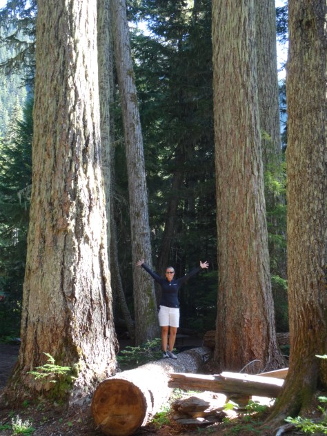
We’d already fallen in love with the giants of Redwood National Park, but had yet to experience the noble Sequoias.

Mariposa Grove 12

A planned short hike through Mariposa Grove turned into an all-day 8-mile journey.

Mariposa Grove 15 - Telescope Tree

With soft intent we strolled through the grove, communing with the giants along the way.

The grove was declared as “Mariposa Grove” after a couple of white dudes, Galen Clark and Milton Mann, happened upon it in 1857.

Mariposa Grove 09 - Historic Museum

However, evidence of indigenous people occupying the area dates back 3,000 years; Grizzly Giant would have been a mere sapling.

Grizzly Giant, Mariposa Grove

The Universe is on Our Side… Again

A reversing incident in Yosemite had somewhat destabilized our bicycle rack. So before heading to Kings Canyon National Park, Trey tightened each bolt and balanced the rack securely enough to make it the 60 miles to Fresno. (We had assumed that Fresno was the closest city large enough to have a proper bike shop.)

We’d traveled only 14 miles, to the tiny town of Oakhurst, when the rack’s arm flailed backwards and dangled our bikes sideways a few feet above the pavement. We immediately pulled into a parking lot and checked for phone service. Two bars allowed me to search for the nearest bike shop.

Gmaps seemed to be confusing our location with that of the nearest bike shop, so I looked up and around for assurance. Right there in the same parking lot, and directly in front of where our bikes had nearly crashed to the road, was Yosemite Bike & Sport. It wouldn’t open for another 10 minutes, but we walked over to the store front anyway to check out the shop while we waited.

Driving through terra incognita and having one’s bicycle rack deconstruct directly in front of the only bike shop within in a 60-mile radius is magical enough. Right? Well, not this day. As we approached the store’s display window we couldn’t believe what we saw… our exact bicycle rack sat new, fully assembled, and ready for use. (And no, it wasn’t a common brand or model.)

More Pics

07.5 Lower Yosemite Falls Trail

17 Yosemite Valley from Glacier Point at Sunset


Portland, Oregon ~ September 18-21, 2014

Having heard of Portland’s similarities to Austin (music scene, laid back feel, open-minded residents, etc.), we were ready to experience a taste of home.

Staying in downtown Portland wasn’t feasible, in either dollars or hotel points. Instead, we used points to stay near the Portland International Airport and used Portland’s MAX Light Rail system to get around. The Red Line stopped directly in front of our hotel; from there it was a straight shot into the heart of Portland, so the Escape Mobile remained parked for most of our stay!

Waterfront Biking

Portland’s most notable similarity to Austin is its river, the Willamette, which cuts through the city’s center.

City and Hawthorne Bridge View, Portland

Both banks of the Willamette River are aligned with businesses, hot spots, public parks, gathering spaces, and walking/jogging/biking paths.


Carrying our bikes onto the Red Line, we stopped west of the river to begin a clockwise 11-mile waterfront ride. The Sellwood Bridge Loop led us alongside downtown and across the iconic Steel Bridge, a double-decker vertical-lift bridge completed in 1912.

Steele Bridge Portland

Biking along the Willamette was a great way to explore the city and spot wildlife.


Trey was thrilled at the site of a decommissioned naval submarine, the USS Blueback (SS-581)…

USS Blueback (SS-581)

and we both loved the row of float houses near Sellwood Bridge!

Floating Homes on the Willamette River, Portland

Columbia River Gorge

Columbia River Gorge
View of Columbia River Gorge from Vista House

The Columbia River Gorge begins about twenty miles east of Portland and is accessible via U.S. Highway 30, also known as the Historic Columbia River Highway. The first must stop is Vista House…


an overlook and information center completed in 1918 located on Crown Point, one of the gorge’s highest points. Vista House offers great panoramas of the gorge, river valley and surrounding hills.

Wind Sailing on the Columbia River

We were surprised to see windsurfers whisking atop the Columbia River, but the area below Crown Point is a popular spot for the sport.

Waterfalls dropping from rocky cliffs dot the riverbank as you head east into the gorge. Most, including Latourell Falls and Shepperd’s Dell, are either visible from the highway or a short hike.


Bridal Veil was our favorite. The trail crosses a creek that may deter some from completing the half-mile trek, but keep going. The two-tiered waterfall is definitely worth it!

bridal-veil-falls.jpg
Trey at Bridal Veil Falls

We climbed atop a huge boulder and basked in the sun while red and yellow leaves rained down upon us.

Multnomah Falls, photographers’ favorite, was packed and we had to nudge our way across Benson Bridge to access the trail to the top of the falls.

Multnomah Falls
Multnomah Falls, Columbia River Gorge

The roundtrip 2.2 mile hike climbs 700 feet via eleven switchbacks. Although it’s labeled as moderate, wear hiking boots or tennis shoes and allow time for breath breaks if you’re not in good shape.

The 4.8 mile loop trail we’d planned to take from the top of Maltnomah Falls over to Wahkeena Falls was closed, so it was down the switchbacks to the car for a backtrack drive west.

Wahkeena Falls, Columbia River Gorge

Trey hopped over the concrete barrier, across mossy rocks, and balanced on the creek’s ledge to get the above shot.

Portland Night Life

While visiting downtown for dinner the evening of our arrival, we were surprised to find Portland streets subdued with only a few people out and about. We figured that was because it was a Thursday. The next evening, and after a long day of bicycling, we explored the Pearl District, an area described as “buzzing” with loads of unique dining options. While there were a few more folks walking around the Pearl District, there was neither buzz nor music. This was consistent throughout our stay.

Portland lacked Austin’s vibe, that definable energy evident upon deboarding at Austin-Bergstrom International Airport where one is met with local eats and live music.

Although the weather was gorgeous, maybe our visit coincided with Portland’s downtime, or we turned down the wrong street and missed music venues. I don’t know.


The most excitement we observed were the long, munchie lines outside of Voodoo Doughnuts. Maybe that’s why all the good people of Portland were so quiet and laidback?

Mountainous Horizon

On the Red Line from the airport, there’s a five-second window where Mt. Hood, Mt. Saint Helens and Mt. Rainier can all be viewed.

Mount Hood from MAX Light Rail
Mount Hood from MAX Light Rail Red Line

You need a clear day and good neck flexibility; we managed it once.

A local informed us of another vantage point in town where there’s time to appreciate the views and take photographs. In the late afternoon and on our way out of town, we stopped by Pittock Mansion, a restored chateau built in the early 1900’s by one of Portland’s legacy families.

Pittock Mansion, Portland

We arrived too late to tour the home, but enjoyed strolling the magnificent grounds and the views of Portland.


Unfortunately, clouds and haze prevented us from seeing any mountains before it was time to hit the road again.

Destinations Known: Coos Bay for the night, then into the Redwood Forest!

More Pics…

West side of Willamette, Portland Harbor
Boat dock near Hawthorne Bridge


Trey on hike to Bridal Veil Falls
Elmer's German Pancake
Elmer’s German Pancake, Yum!

Olympic National Park ~ August 13-15, 2014

The last morning of our Alaskan cruise, breakfast table-mates recommended hiking Hurricane Ridge, along the northern border of Olympic National Park. With our late departure from Seattle, we decided to spend the night in Port Angeles, a 160 mile drive from Bainbridge Island, and hike the nearby ridge the following morning.

Located on the U.S. side of the Strait of Juan de Fuca and with a ferry crossing to Victoria, Port Angeles was a bit of a tourist destination.

View of Port Angeles and Victoria BC
View of Port Angeles with Victoria BC in the distance

We hadn’t accounted for that, nor the fact that it was Saturday. Pulling into town, scores of hotels greeted us… all full or over budget. Before continuing westward, we looped back into town and noticed the Riviera Inn. The unassuming, yet comfortable and clean motel had a few vacancies available.

Also surprised by the many culinary options, we decided on Italian for dinner at Bella Italia and breakfast at First Street Haven, both on East 1st Street (Hwy 101 East). And both good and on budget.


Olympic National Park North – Hurricane Ridge

Olympic National Park Map

Encompassing more than 1,400 square miles and the Olympic Mountain Range, with Mount Olympus near its center, one doesn’t drive through Olympic National Park. Like Mount Rainier, you steer around it and enter through various access roads along its changing ecological perimeter.

Relative to the rest of the park, the north is dry with a mix of meadows and foothills leading into the steeper heart of the park.

Trey on Hurricane Ridge

After a stop at the Hurricane Ridge Visitor Center, we were able to continue onto, and park at, the trailhead.

Hurricane Ridge Trail

Rising 700 feet over 1.6 miles, the hike up Hurricane Hill is easy to moderate, and the stunning panoramas are absolutely worth it!

Olympic National Park Panorama

Olympic Natl Park from Hurricane Ridge

Lots of wildlife, too!

Hurricane Ridge Marmot

The amazing 360 views beckoned us to stay longer, so we settled down under the shade of a tree to fully absorb the beauty.


It wasn’t long before we were surrounded by treat-seeking chipmunks and bunnies.


Lake Crescent & Marymere Falls

Sunsetting on a lake

About thirty miles west of Port Angeles, we came across Crescent Lake and a sign post for Marymere Falls. The trail to the falls was just shy of a mile, wound through giant firs and hemlock trees, and deer grazed just off the trail.


Marymere Falls
Marymere Falls

That excursion, the extra time spent atop Hurricane Hill, and a stop for hamburgers in Forks, positioned us in a race with the setting sun to the pacific coast.

Ruby Beach, Washington

Arriving at Ruby Beach with just enough light to capture a few photos, we were happy to have officially arrived at the Pacific Ocean. A gorgeous welcome and a memorable setting for what I consider our third left turn around the U.S.


Olympic National Park South – Quinault Rainforest

Most National Parks we visited had park-owned lodges that are historic in some context related to the parks’ origin. And all of these lodges are well over our price point, as was the case for Lake Quinault Lodge.

Lake Quinault Lodge
Lake Quinault Lodge

Due to its remoteness along with our eagerness to experience a national park lodge, we made a one-night exception.

Arriving after 9pm, and tired from the day’s hikes, we were thrilled with the prospect of a warm comfortable bed over pitching the tent and blowing up air mattresses.

The next day, we’d arranged an early morning educational tour with a park ranger, so we grabbed breakfast to go and jumped into a van.

Olympic National Park Ranger

Over four hours, we learned about river restoration efforts and the rainforest’s trees and plants. We discovered how the Olympic Mountains were formed by glaciers, and visited the “world’s largest spruce tree…”


several waterfalls…

Rainforest Waterfall

and this guy:

Mossquatch
MOSSQUATCH

Before departing Lake Quinault Lodge, we took the time to explore its tranquil grounds and enjoy a quick lunch.


The lodge is operated and well maintained by the Quinault Indian Nation, an indigenous sovereign nation. We regretted not being able to spend more time there.

Not included on the tour, the ranger told us of nearby “Big Cedar,” assuring it was worth the half-mile hike.

Quinnault Big Cedar
Quinnault Big Cedar

Located across the lake from the lodge, we decided to visit the ancient tree (1,500 years old) on our own. So glad we did, as it has since fallen due to a storm in July 2016.


US Hwy 101 Coastline Drive – Part One

The sun had set by the time we left Ruby Beach and turned southward down the coastline, so we missed what I imagine are magnificent views of the Pacific. On the way to Astoria, we got a taste of what we had missed, and of what was to come…

Between Lake Quinault and Astoria

sunsetting-near-astoria-oregon.jpg
Sun setting near Astoria, Oregon

More Pics…

Sully's, Forks
Sully’s in Forks, Washington (We didn’t realize we were in the Twilight zone until we stopped to eat and saw this on the menu.)

Mart with Mossquatch

Ruby Beach, Washington 2
Arriving at Ruby Beach

And because I love trees…


Fall Colors


Mount Rainier National Park ~ August 19-21, 2014

The immensity of Mt Rainier dominates the landscape from every approachable vantage point.View of Rainier from Sunrise Road2

After connecting up with US-12 in Yakima, we entered the park’s east border via state highway 410.

The 14k+ mountain also dominates its national park. Within the park, it is not possible to traverse around the mountain by car. Getting from one area to another takes time and planning.

map_driving_tours
Photo source: http://www.visitrainier.com

After much research, we chose White River Campground located more centrally within the park along the northeast facing slope.

White River Campground 

White River offers convenient access to the hiking trails that attracted us. Plus, it sprawls along the bank of the White River, a raging storm of a river furiously fed by three glaciers.

White River from campground

We loved the non-stop sound of water forcing its way down Rainier’s slope, tossing boulders out of its way.

Mart among the gian fir trees
Excitement could not be contained at the sight of these giant Douglas firs!

Because White River campsites are issued on a first-come-first-serve basis, we had a “Plan B” reservation at a campground an hour and half away in the southern end of the park. We were able to cancel that reservation after securing site D17…


located directly across from the Glacier Basin Trailhead and a short walk to the Wonderland Trail.

The nearest supply and grocery store is 25 miles away in the community of Greenwater.

Greenwater outfitters
Greenwater Outfitters — good coffee, breakfast and deli style sandwiches.

Glacier Basin Trail

Glacier Basin Trail - Hiking
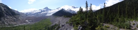
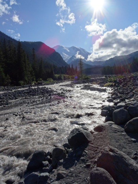
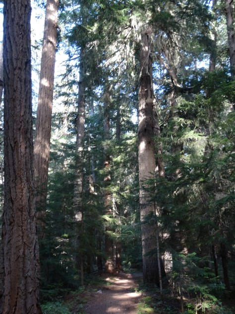
From our campsite, we followed Glacier Basin Trail into a thick grove of fir trees and past numerous creeks and waterfalls.

Glacier Basin Trail 2
Glacier Basin Trail

Just shy of a mile, we veered onto the Emmons Moraine Trail:  a one-mile (roundtrip) excursion overlooking Emmons Glacier and a beautiful glacial lake.

Emmons tRAIL
Glacial Lake below Emmons Moraine Trail

Instead of trekking the additional 2.2 miles to Glacier Basin, we headed back to camp for lunch and a nap (I was fighting a cold).

Emmon Trail
Trey on the Emmons Moraine Trail

Re-energized, we hopped on our bikes and coasted downhill for six miles, past the Ranger Station to Highway 410. In hindsight, we both agreed the roundtrip hike to Glacier Basin would have been easier than the steep ride back up to our campsite.

Henry Weinhard Private Reserve
Henry Weinhard’s Private Reserve – NW Style Lager

Sunrise Area & Wonderland Trail-North

Sitting more than 2,000 feet above the White River Campground, Sunrise has a restaurant, lodge and visitor center. It’s accessible by heading north (away from the river) on the Wonderland Trail for three miles, a strenuous hike due to the rise in elevation.

We opted to drive since we’d planned to hike some of the area’s many trails. Sunrise Park Road climbs up from the campground access road, through a series of sharp curves, switchbacks, and outlook points. Gorgeous drive! northwest panoramic from Sunset Area
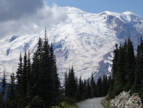
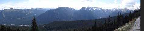
It provides many photographic opportunities of Mt. Rainier and its surrounding mountains, valleys, and glacial lakes.

Sunrise Lake, from Sunrise Park Road

Sunrise has ample hiking options for every level. From Sourdough Ridge we headed west to Frozen Lake…


looped south around Sunrise camp and Shadow Lake, then caught the Wonderland Trail back up to the Sunrise parking area.


The loop provided varied hiking environments, conditions and wildlife experiences.

Wonderland Trail-South

The Wonderland Trial encircles Mt. Rainier for 93 miles across varied terrains and elevations. It is a popular trail for fit and fervent thru-hikers.

Wonderland Trail Bridge, White River
Wonderland Trail Bridge Crossing the White River

With our tent and camping gear broken down and packed away in the “Escape Mobile,” we had yet to brave crossing the “bridge” over the White River to venture southward on the trail.


Trey went first.

Wonderland TrailSince we lacked the time and transportation to one-way hike to an access point along the campground road, we hiked only about 1/2 mile in before turning around and departing the campground.

Sunrise Area Panoramic

Mt. Rainier stands out as a highlight among our camping adventures – it was our first experience among glaciers, and is a truly majestic towering beast of a mountain.

We will be back.


Yellowstone & Grand Teton National Parks, Wyoming ~ August 13-17, 2014

Upon entering Yellowstone National Park’s northeast entrance (located on the Montana-Wyoming border) we were greeted by Buffalo, and more buffalo escorted us throughout the 85 mile drive to the Grant Village Campground.

First stop along the trek was an overlook view of Tower Fall, the famous 132 foot waterfall of the Yellowstone River.

Tower Fall, Yellowstone River
Tower Fall, Yellowstone River (namesake taken from the surrounding rock spirals)

The overlook sits at the junction of the Yellowstone River and Tower Creek which also permitted us to experience the strength of the water forcing its way through the canyon.

Yellowstone River
Convergence of Tower Creek and the Yellowstone River south of Tower Fall

There is no shortage of wonders along Grand Loop Road which wends through the heart of Yellowstone and around the north shore of Yellowstone Lake.  For this reason, the two-and-a-half hour drive took us about four hours, getting us to our campground with just enough daylight to set up camp and grab dinner at Lake View Cafe.

Yellowstone Lake @ Sunset


Grant Village Campground

Grant Village is located in the southern end of the park on the “west thumb” of Yellowstone Lake, and within the volcano’s caldera. Our third experience camping, and our third experience pitching our tent in the rain.

Grant Village Campsite
Grant Village Campsite, Loop K #391

What a great camping experience! Our site, 391 on Loop K, was spacious and sits near the ledge of a shallow ravine.

Yellowstone is wild, and camping provides a great opportunity to experience that wild. On several nights we were awakened to the howls and barks of wolves running through the ravine below.

The third morning we woke with the sun and to a strange snorting noise outside our tent. A quick look out the window eased our minds – the noises were from two elk cows and four calves grazing just outside.

The calves decided to nestle down in the grass around our tent and keep us company through breakfast.

With everything one would need from restaurants, showers, a post office, and general store, Grant Village is truly a village. We particularly enjoyed exploring the campground by bicycle and the Ranger’s educational presentations at the visitors’ center.

We learned:

  • Yellowstone’s supervolcano incurred three major eruptions over the past 2.1 million years, and it’s doubtful another one will take place within the next 10,000 years.
  • Grizzlies’ forage after dark in the summer months and during the day in the spring and fall.
  • The native lodgepole pine tree has a second type of cone that opens only under the extreme heat of fire assuring the species’ survival


Thermal Geysers

There are more than 10,000 thermal geysers in Yellowstone, and Trey attempted to see them all! Kidding, but at times it seemed as if that was his goal.

Of course Old Faithful was a must-see, and due to its southern location, it was our first stop.

Old Faithful
Old Faithful erupting on schedule

Most of the geyser touring areas line Highway 191 on the park’s west side. Raised boardwalks varying in distances from a quarter mile to two miles cut between geysers and keep visitors safe from the unstable, scalding hot ground.

Sapphire HOle
Sapphire Geyser

While visiting each geyser area was impossible over a five-day period, we exhausted ourselves checking out Old Faithful Basin, Biscuit Basin, Fire Hole Loop, and Norris Geyser Basin.

Morning Glory Geyser


Grand Teton National Park

0816141902.jpg

Grand Teton’s north entrance is located 54 miles south of Yellowstone’s Grant Village which made it ideal for a day trip. After checking out Lewis Falls, we headed out of Yellowstone via the John D. Rockefeller, Jr. Memorial Parkway.

The Parkway follows the Snake River and then Jackson Lake, with the Tetons laid out along the other (west) side of the lake.

The day was spent mostly touring the park in the “Escape Mobile.” There is much to see by car including Signal Mountain, which offers great vantage points for both the Tetons and the Snake River Valley to the east.

View from Signal Mountain
Looking east from Signal Mountain

The initial plan was to hike around Lake Jenny, but we decided to explore more of the park rather than spend the day on a 7-mile hike.

Jenny Lake
A short, but steep, hike to Jenny Lake’s edge, we arrived just as a swimmer made it across from the west side. (his arm is visible in lower left of photo)

As an alternative, we chose the shorter Taggart Lake-Beaver Creek Trail, a 3.8 mile loop. Instead of looping, we hiked about a mile-and-a-half in and backtracked. The trail offered gorgeous shots of the Tetons.

A lovely day that we ended with a fabulous dinner at the Jackson Lake Lodge, donated to the park by JD Rockefeller, Jr. Despite being under-dressed in our hiking clothes, we were seated at window table with a prime view of the Tetons.

Great food! Afterwards, we stepped outside and onto the Lunch Tree Hill trail for a short hike up a ridge overlooking the valley and Grand Tetons. Trey was hoping to see moose, but the sun set while we waited.

Outside of Jackson Lake Lodge


Leaving Yellowstone

Having depleted most of our energy, we opted to pull up stakes in Yellowstone a day early, breaking up the 500+ drive to Spokane. We toured another geyser basin on our way to the west exit, where we were escorted out by more buffalo.

DSC02989

Note, though visiting Yellowstone in mid-August, we kept our jackets handy at all times. The evening temperatures fell into the 30’s, and some afternoons brought sudden, but short-lived, storms and hail.

More Yellowstone Wildlife…