

The last morning of our Alaskan cruise, breakfast table-mates recommended hiking Hurricane Ridge, along the northern border of Olympic National Park. With our late departure from Seattle, we decided to spend the night in Port Angeles, a 160 mile drive from Bainbridge Island, and hike the nearby ridge the following morning.
Located on the U.S. side of the Strait of Juan de Fuca and with a ferry crossing to Victoria, Port Angeles was a bit of a tourist destination.

We hadn’t accounted for that, nor the fact that it was Saturday. Pulling into town, scores of hotels greeted us… all full or over budget. Before continuing westward, we looped back into town and noticed the Riviera Inn. The unassuming, yet comfortable and clean motel had a few vacancies available.
Also surprised by the many culinary options, we decided on Italian for dinner at Bella Italia and breakfast at First Street Haven, both on East 1st Street (Hwy 101 East). And both good and on budget.
Olympic National Park North – Hurricane Ridge

Encompassing more than 1,400 square miles and the Olympic Mountain Range, with Mount Olympus near its center, one doesn’t drive through Olympic National Park. Like Mount Rainier, you steer around it and enter through various access roads along its changing ecological perimeter.
Relative to the rest of the park, the north is dry with a mix of meadows and foothills leading into the steeper heart of the park.
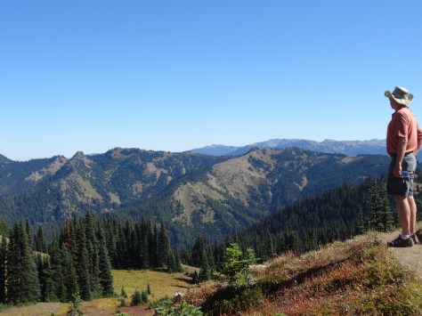
After a stop at the Hurricane Ridge Visitor Center, we were able to continue onto, and park at, the trailhead.

Rising 700 feet over 1.6 miles, the hike up Hurricane Hill is easy to moderate, and the stunning panoramas are absolutely worth it!

Lots of wildlife, too!

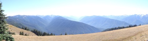
The amazing 360 views beckoned us to stay longer, so we settled down under the shade of a tree to fully absorb the beauty.


It wasn’t long before we were surrounded by treat-seeking chipmunks and bunnies.
Lake Crescent & Marymere Falls

About thirty miles west of Port Angeles, we came across Crescent Lake and a sign post for Marymere Falls. The trail to the falls was just shy of a mile, wound through giant firs and hemlock trees, and deer grazed just off the trail.


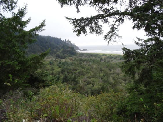
That excursion, the extra time spent atop Hurricane Hill, and a stop for hamburgers in Forks, positioned us in a race with the setting sun to the pacific coast.

Arriving at Ruby Beach with just enough light to capture a few photos, we were happy to have officially arrived at the Pacific Ocean. A gorgeous welcome and a memorable setting for what I consider our third left turn around the U.S.
Olympic National Park South – Quinault Rainforest
Most National Parks we visited had park-owned lodges that are historic in some context related to the parks’ origin. And all of these lodges are well over our price point, as was the case for Lake Quinault Lodge.

Due to its remoteness along with our eagerness to experience a national park lodge, we made a one-night exception.
Arriving after 9pm, and tired from the day’s hikes, we were thrilled with the prospect of a warm comfortable bed over pitching the tent and blowing up air mattresses.
The next day, we’d arranged an early morning educational tour with a park ranger, so we grabbed breakfast to go and jumped into a van.

Over four hours, we learned about river restoration efforts and the rainforest’s trees and plants. We discovered how the Olympic Mountains were formed by glaciers, and visited the “world’s largest spruce tree…”


several waterfalls…

and this guy:

Before departing Lake Quinault Lodge, we took the time to explore its tranquil grounds and enjoy a quick lunch.


The lodge is operated and well maintained by the Quinault Indian Nation, an indigenous sovereign nation. We regretted not being able to spend more time there.
Not included on the tour, the ranger told us of nearby “Big Cedar,” assuring it was worth the half-mile hike.

Located across the lake from the lodge, we decided to visit the ancient tree (1,500 years old) on our own. So glad we did, as it has since fallen due to a storm in July 2016.


US Hwy 101 Coastline Drive – Part One
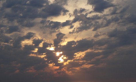
The sun had set by the time we left Ruby Beach and turned southward down the coastline, so we missed what I imagine are magnificent views of the Pacific. On the way to Astoria, we got a taste of what we had missed, and of what was to come…
More Pics…


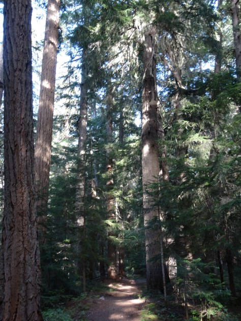
And because I love trees…


")


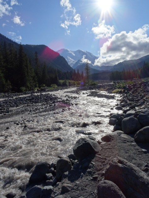
 From our campsite, we followed Glacier Basin Trail into a thick grove of fir trees and past numerous creeks and waterfalls.


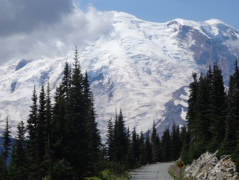
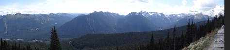 It provides many photographic opportunities of Mt. Rainier and its surrounding mountains, valleys, and glacial lakes.


 Since we lacked the time and transportation to one-way hike to an access point along the campground road, we hiked only about 1/2 mile in before turning around and departing the campground.
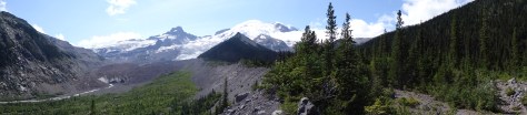

 while traversing the east bank of the Madison River, between canyon walls, and along the shorelines of several lakes.
 Quake Lake had been formed exactly fifty-five years prior when the combination of an earthquake, massive landslide, and subsequent rushing, rising water flooded the valley.


 included a seventy-four mile trek across the top of Idaho.

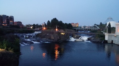 The Spokane River runs through the city’s center. A river walking path was being extended as a part of a larger Riverfront Park renovation plan.
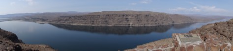 Ginkgo Petrified Forest State Park lay just beyond the opposite bank and was once home to the Wanapums, an indigenous, peaceful tribe of fishermen who are near extinction.

 The sighting renewed our energy and enthusiasm for the remaining two hour drive to our campsite.