

The immensity of Mt Rainier dominates the landscape from every approachable vantage point.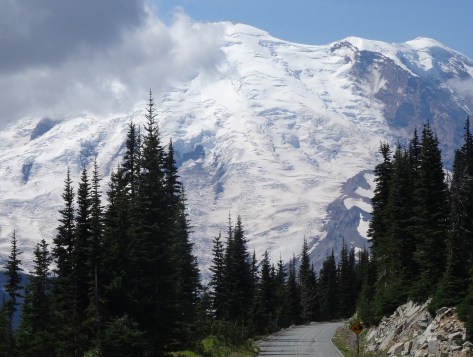
After connecting up with US-12 in Yakima, we entered the park’s east border via state highway 410.
The 14k+ mountain also dominates its national park. Within the park, it is not possible to traverse around the mountain by car. Getting from one area to another takes time and planning.

After much research, we chose White River Campground located more centrally within the park along the northeast facing slope.
White River Campground
White River offers convenient access to the hiking trails that attracted us. Plus, it sprawls along the bank of the White River, a raging storm of a river furiously fed by three glaciers.
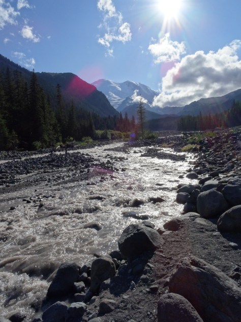
We loved the non-stop sound of water forcing its way down Rainier’s slope, tossing boulders out of its way.
Because White River campsites are issued on a first-come-first-serve basis, we had a “Plan B” reservation at a campground an hour and half away in the southern end of the park. We were able to cancel that reservation after securing site D17…

")

located directly across from the Glacier Basin Trailhead and a short walk to the Wonderland Trail.
The nearest supply and grocery store is 25 miles away in the community of Greenwater.

Glacier Basin Trail
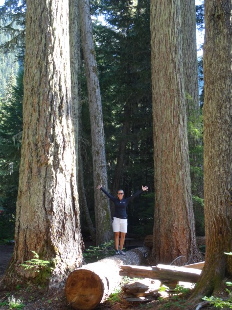
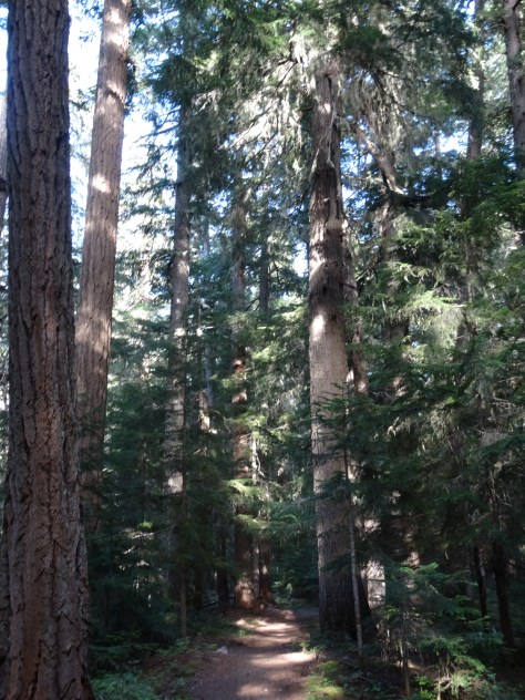
 From our campsite, we followed Glacier Basin Trail into a thick grove of fir trees and past numerous creeks and waterfalls.

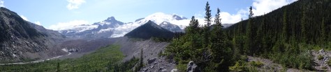
Just shy of a mile, we veered onto the Emmons Moraine Trail: a one-mile (roundtrip) excursion overlooking Emmons Glacier and a beautiful glacial lake.

Instead of trekking the additional 2.2 miles to Glacier Basin, we headed back to camp for lunch and a nap (I was fighting a cold).

Re-energized, we hopped on our bikes and coasted downhill for six miles, past the Ranger Station to Highway 410. In hindsight, we both agreed the roundtrip hike to Glacier Basin would have been easier than the steep ride back up to our campsite.

Sunrise Area & Wonderland Trail-North
Sitting more than 2,000 feet above the White River Campground, Sunrise has a restaurant, lodge and visitor center. It’s accessible by heading north (away from the river) on the Wonderland Trail for three miles, a strenuous hike due to the rise in elevation.
We opted to drive since we’d planned to hike some of the area’s many trails. Sunrise Park Road climbs up from the campground access road, through a series of sharp curves, switchbacks, and outlook points. Gorgeous drive! 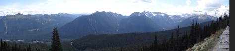 It provides many photographic opportunities of Mt. Rainier and its surrounding mountains, valleys, and glacial lakes.

Sunrise has ample hiking options for every level. From Sourdough Ridge we headed west to Frozen Lake…


looped south around Sunrise camp and Shadow Lake, then caught the Wonderland Trail back up to the Sunrise parking area.


The loop provided varied hiking environments, conditions and wildlife experiences.
Wonderland Trail-South
The Wonderland Trial encircles Mt. Rainier for 93 miles across varied terrains and elevations. It is a popular trail for fit and fervent thru-hikers.

With our tent and camping gear broken down and packed away in the “Escape Mobile,” we had yet to brave crossing the “bridge” over the White River to venture southward on the trail.


Trey went first.
 Since we lacked the time and transportation to one-way hike to an access point along the campground road, we hiked only about 1/2 mile in before turning around and departing the campground.
Mt. Rainier stands out as a highlight among our camping adventures – it was our first experience among glaciers, and is a truly majestic towering beast of a mountain.
We will be back.
