Category Archives: State Park

Mojave Desert: Hoover Dam, Valley of Fire State Park & Death Valley National Park ~ October 12 – 17, 2014

Upon exiting Sequoia National Park we’d entered the Mojave Desert and the portion of this “great looping quest” in which I was most apprehensive… the desert. 

01 Approaching Las Vegas
West of Las Vegas

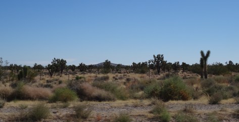
I had preconceived notions about desert existence, mostly negative because my perceptions weren’t based on actual experience. So, I’d anticipated a colorless, desolate environment… unfriendly and uninhabitable. After all, the Mojave has a valley named “Death!”

What I discovered was just the opposite, a welcoming beauty, thriving and very much alive. For me, establishing a sense of grounding in the desert required no conscious effort – the desert rose up firmly beneath my feet.

10 East of Las Vegas
East of Las Vegas, NV

Within Mojave’s arid landscape, where odd and varied creatures flourished, I felt my own belonging.

13 Valley of Fire Lizard

The desert’s embrace forever changed my perspective, it corrected it and taught me a lesson about the ridiculous power we give to our perceptions.

~~~

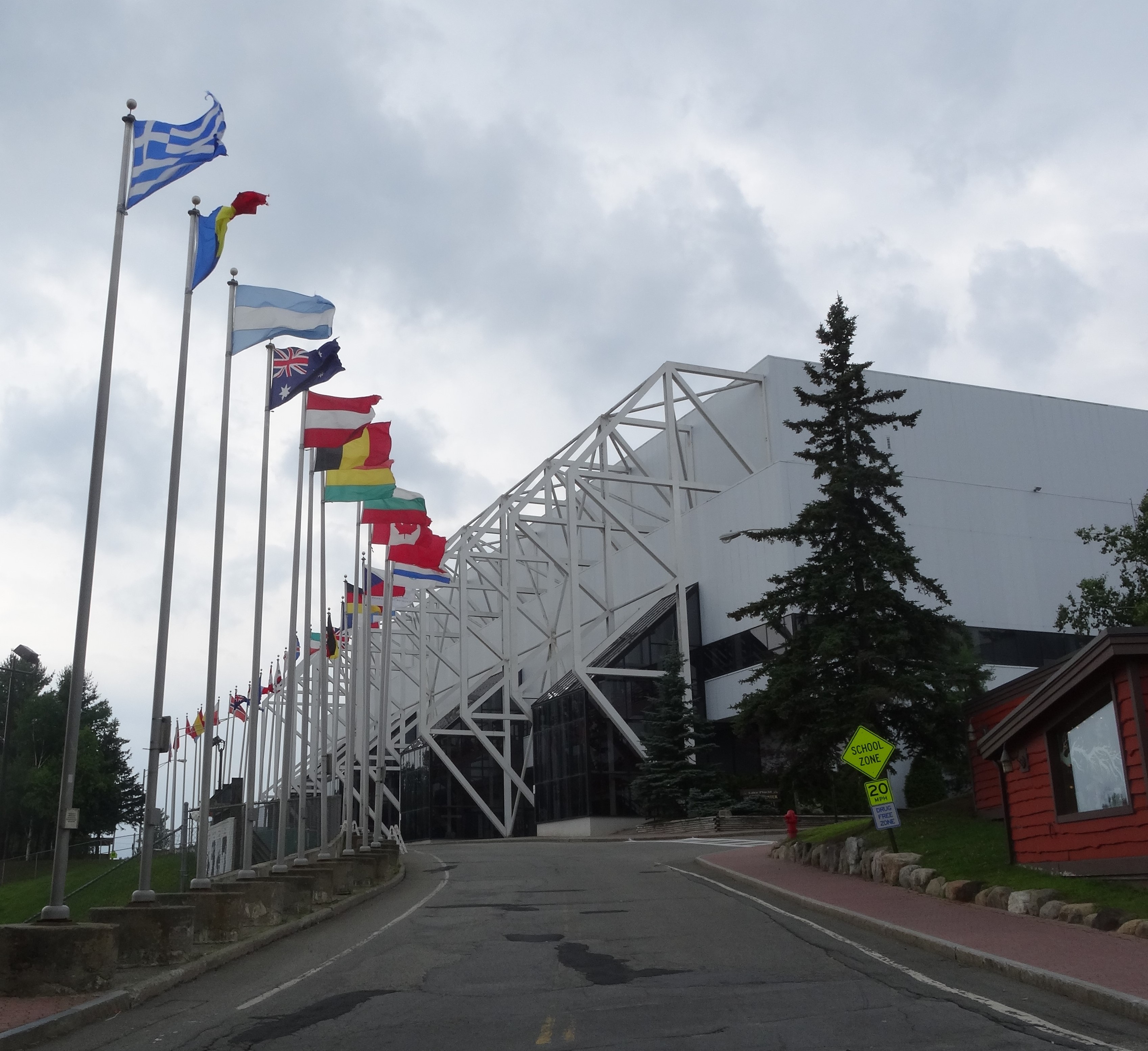
A cheap (because it was undergoing a noisy renovation) Las Vegas casino/hotel served as our basecamp while we explored what lies beyond the city’s fringes… the even more wild and wonderful. First up…

Hoover Dam

02 Inside Hoover Dam

05.5 Hoover Dam

For a hundred years the Hoover Dam has risen 726 feet from the floor of the Colorado River.

09 Hoover Dam

It is an unyielding concrete monster, a sight to behold that attracts some seven million people a year… by car, boat, and helicopter.

07 Mike O'Callaghan–Pat Tillman Memorial Bridge
Mike O’Callaghan–Pat Tillman Memorial Bridge, Hoover Dam NV

Its proximity to Las Vegas—40 minutes southeast—enables this constant flow of people. Unfortunately, the flow of water for which the dam was built is not as reliable and, as in California, the effect of prolonged drought was visible through the river’s receding waterline.

06 Receding Colorado River from Hoover Dam
Receding Colorado River Water Level

We purchased tickets to tour the dam’s power plant… $15 in 2014, and well worth it.

Inside, 30 foot pipes snake through tunnels and rows of enormous generators churn out 4 billion kilowatt hours of electricity annually for the good folks of Nevada, Arizona, and California. The dam’s structure also serves to control flooding and reserve water for California’s fruitful valleys and its southern cities.

Valley of Fire State Park

11 Valley of Fire State Park
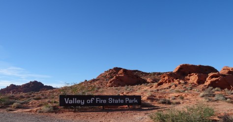
Nevada’s Valley of Fire State Park is located about 50 miles (an hour’s drive) northeast of Las Vegas. Its sculpted red rocks are stacked and scattered throughout the park’s 40,000 acres.

12 Valley of Fire landscape
Valley of Fire Landscape

Only one road cuts through the park, just above its southern border. The road provides access to loads of popular hikes and fun formations, more than enough to keep one occupied for a day.

17 Valley of Fire SP Map

The rest of the park, the vast majority of its wilderness, is a sprawling preservation area, seemingly inaccessible except by foot.

Our arrival in the late afternoon limited our hiking options, but we had the park to ourselves.

18 Mouse Tank Road, Valley of Fire SP
Mouse Tank Road, Valley of Fire State Park, NV

Also, the sun’s low stance illuminated the red rocks and danced through canyons making our walks even more magical.

16 Valley of Fire SP, NV

The half-mile trail to Mouse Tank led us down a canyon marked with hundreds of petroglyphs.

19 Mouse Tank Trail, Valley of Fire SP
Mouse Tank Trail Valley of Fire State Park, NV

These uninterpretable messages hovered just above us, holding steadfast onto the secrets of an ancient civilization.

26 Sunset heading to Las Vegas

Only the sunset, spectacular and fleeting, could force us out of the Valley of Fire and back toward the maddening lights of Las Vegas.

Death Valley National Park

We traveled northwest for 140+ miles to enter Death Valley National Park where my attitude and apprehensions about deserts were permanently altered. Death Valley’s mystique and it’s rolling, constantly changing landscapes captivated me.

26.8 Zabriskie Point, Death Valley NP
View from Zabriskie Point, Death Valley National Park

We stopped often, awestruck by its colors and geology.

Near the center of Death Valley is Badwater Basin, a massive flat of salt exposed by rain runoff from the surrounding mountains.

27 Badwater Basin Salt Flat, Death Valley NP

The basin sits 282 feet below sea level, the lowest point in North America.

29.5 Badwater Basin Salt Flat, Death Valley NP
Badwater Basin Salt Flat, Death Valley National Park, CA

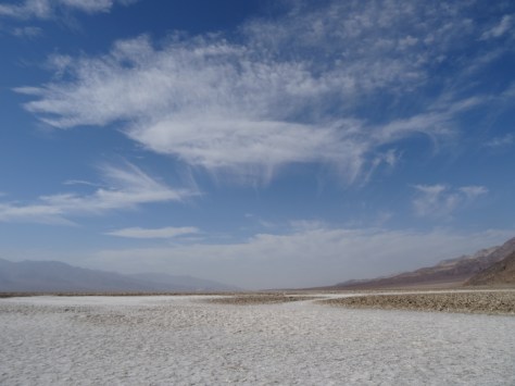
Its limited drainage results in artsy, salty shapes forming through heat induced evaporation. The salt configurations cover the basin creating an eerie, alien terrain.

28 Salt Formations, Badwater Basin, Death Valley NP

We traversed over the salt and out into the basin and became mesmerized by the patterns. Before we realized it, we were about a mile in, which is nowhere near the basin’s center.

30.5 Badwater Basin

As intense heat began pulsing around us, we sensed our own vulnerability and soon turned back toward the parking area.

37 Artists' Drive, Death Valley NP
Artists’ Drive, Death Valley National Park, CA

Wending through a painted canyon on Artists’ Drive was like bounding through a rainbow. The one-way nine-mile road is narrow with rocky hillsides rolling up, out, and along both sides.

36 Artists' Drive, Death Valley NP

The palette effect is from minerals (including hematite and chlorite) altered by volcanic eruptions five million years ago. Elements aluminum, iron, magnesium and titanium also add to the mountainous canvas.

Our other hike in Death Valley, was the Natural Bridge Trail, accessible about a mile and half down a dirt road that breaks off from Badwater Road.

31 Trey heading down Natural Bridge Trail, Death Valley NP2
Trey heading down Natural Bridge Trail, Death Valley National Park

It’s an easy one-mile round-trip trail into a narrow, high-walled canyon.

35 Natural Bridge, Death Valley NP

The trail crosses under the bridge formation and continues into a box canyon.

34 Natural Bridge, Death Valley NP
Natural Bridge, Death Valley National Park, CA

We had the trail to ourselves, or at least it was devoid of other humans. This gal, a Swainson’s Thrush, accompanied us from the rock bridge to the trail’s end.

32 Swainson's Thrush, Trail Escort
Death Valley Swainson’s Thrush

As we neared the bird, it would take flight, landing 20 or so feet up trail where it waited for us to approach again. Over and over it repeated this routine, escorting us all the way into the rocky boxed area…

33 Trail End, Natural Bridge Trail, Death Valley NP

and then safely back to the bridge.

We also spied a reddish fox, the Desert Kit Fox, strolling alongside Hwy 190 as we left the park, but missed photographing him.

More Pics

23 Petroglyph Canyon, Valley of Fire SP


Up next…  Zion and Bryce Canyon National Parks

Redwood National & State Parks ~ September 22 – 24, 2014

The “Redwood Forest” is a patchwork of federal and state parks along California’s northern coastline.

map

Together, they’re a UNESCO World Heritage site with joint missions to manage and preserve the remaining old growth forests. Before effective efforts to protect the giant redwoods were established, logging had wiped out 70% of them. Yes, 70%!

Stout Grove, JS Redwoods State Park

Arriving at the Jedediah Smith Redwoods State Park, located in the northern end, we’d officially traveled from the gulf stream to the redwoods.

Being surrounded by new growth trees and thick underbrush provided our campsite some privacy. And for me, senses of comfort and safety came with sleeping among the giants.

We spent our afternoon exploring the campground and forest. Trey and I had previously encountered a few giants – a young transplanted sequoia in Victoria’s Butchart Gardens, and firs around Mount Rainier and Mount Olympus – but those trees did not prepare us for the magnitude, majesty, and grace of the old growth redwoods.

It was love at first sight!

Giants, JS Redwood State Park

The park’s campground sits alongside the Smith River.

Smith River, JS Redwoods SP

Being September, it was unlikely we’d catch a trout or salmon, so we didn’t purchase licenses. Instead, each evening we walked along the riverbank, admiring river rocks and wildlife, and keeping an eye out for bears.

While Stout Memorial Grove is near the campground—it sits just across the river—the old growth grove is not easily accessible by car. The grove is off a narrow dirt road about two miles from the main highway, US 199.

Because of its isolation, we had the grove mostly to ourselves. Taking a loop trail and then a break-off trail down to the river, we walked among the giants…

Giant Redwood, Stoutgrove

and basked in our quiet communion.

JSRSP, Stout Grove 4

We were thrilled to come across another banana slug because 1) they’re awesome!, and 2) we missed photographing the first one we spotted in our campground.

Banana Slug, JSRSP

Leaving the grove, we continued down the dirt road, Howland Hill Road, into the community of Crescent City.

Howland Hill Road2
Howland Hill Road, Jedediah Smith Redwoods State Park

We highly recommend this drive! In all, it’s only about six miles, but allow plenty of time for winding through the giants, braking and backing for passing cars, and stopping for photos.

JSRSP, Stout Grove 3

Once in Crescent City, we shared a beer and filled up with good Tex-Mex at Perlita’s before heading back to camp for the evening. The sky was overcast, but the chance for rain was only ten percent.

Claps of thunder woke us at midnight followed by a downpour that continued through the night. Though dry inside, by 6:00 a.m. our tent’s floor felt more like a waterbed.

Rainy Campsite, JSRSP

Stepping out to go to the bathroom before breaking camp, we discovered our shoes had floated away with the small stream running thru our campsite and under our tent. We found them in the brush behind the tent, then packed up our soaking selves and threw our gear into the Escape Mobile to leave.

Still raining, we took refuge in The Chart Room, a seafood restaurant that happened to be open for breakfast. The rustic restaurant sits on a narrow peninsula dividing Crescent Harbor and the Pacific Ocean, and its windows provide great views of both.

As we ate, we watched a sea otter catching his breakfast and frolicking in the calm harbor, while across the restaurant, we saw 10-foot waves crashing over the levy onto the road.

Driving south down the coastline on U.S. 101, the waves continued roaring just off the highway. Before reaching the cutoff to our detour to Redding, we stopped at Lady Bird Johnson Nature Grove.

The first First Lady from Texas played an active role in the conservation and beautification of many of our nation’s natural treasures, including a section of the Colorado River that runs through Austin. Of course we had to stop!

Lady Bird Grove & Nature Trail

The rain let up as we arrived, but we’d trekked only a quarter mile and had taken a couple of photos before it started pouring again. Still, a great departing experience and perfect location to say goodbye to the lovely giants.

More pics..

Two Giants, Stout Grove


Astoria, Oregon & US Hwy 101 Coastline Drive, Part 2 ~ September 15-17, 2014

Quaint Astoria sits on a peninsula barely east of where the Columbia River clashes with the Pacific Ocean. Outlined by Young’s Bay and River on its southern shoreline, with the mighty Columbia River comprising its north border.

astoria-columbia-and-young-rivers.jpg
Above Astoria, looking west: Views of the Pacific and Columbia, Young, and Lewis & Clark Rivers.

Yes, water is the heart, soul, and breath of the community. Its sustenance, and existence.

Accessing Astoria from Washington State requires either a boat or crossing the massive Astoria-Megler Bridge, a cantilever through-truss design. As we drove the 4.1 miles across to Oregon, my thoughts turned to my sister. Many times, she had relayed her dizzying experience bicycling over the Columbia River while water rushed in one direction below and crisscrossing cars whizzed past her side. I was grateful to be inside the Escape Mobile.

Welcome Party
Astoria’s Welcome Party

Checking into our riverfront hotel just before sunset, we were greeted with an unrecognizable noise permeating throughout the lobby. Curiosity led us down a corridor and out a back door where the now recognizable barks overwhelmed our senses. Seals, hundreds of them, had taken over docks and landings sitting 150-ish yards away. Gladly, the barking did not disrupt our sleep.

With one full day to explore Astoria, we made the most of our time. First order was a must-visit to the Goondocks…

Gonnies House
The Goonies House

a row of Victorian houses made famous in the 1985 Goonies movie. While we easily found parking and walked up to the primary “Goonies’ House” to snap photos, increased tourist traffic and mishaps have since halted such practices.

Next, a walk around and up into the Astoria Column provided both a historical accounting and scenic overview of the area.

Styled after Rome’s Trajan Column (which Trey has since visited), its spiraling pictorials tell of the “discovery” of the Columbia River, Lewis and Clark’s expedition, and the arrival of John Jacob Astor’s merchant ship which was instrumental in establishing Astoria as a key outpost in North America’s fur trade, helping Astor to control much of that trade. How ironic, or perhaps “offensive’ is more fitting, that Astor’s descendants later dedicated the column as a memorial to the Chinook Indians.

The remainder of Astoria was explorable by bicycle via The Riverwalk…

Astoria Bikepath, Trey
Trey on The Riverwalk near base of Astoria-Megler Bridge

a roughly 5-mile pathway following the Columbia River bank from the peninsula’s westernmost point, and turning into forested hills at the eastern end.

Astoria Bikepath
Eastern end of Astoria’s Riverwalk bike path

Along the way, The Riverwalk provides easy access to downtown shops and restaurants. Note, a trolley line follows much of the pathway.

During our bike ride, we enjoyed eating wild blackberries growing aside the pathway, watching the day’s catch being unloaded, the ever-present wildlife, and being entertained by Coast Guard drills while eating pizza.

Astoria gulls

Astoria is charming with a laid-back, fun vibe that balances well with the hard work and challenges that I imagine accompany living at the convergence of three rivers and an ocean. Also apparent was Astoria’s reliance on tourism.

Downtown Astoria

Astoria Food experiences…

A bit of a foodie city, there were several on-budget options. Five stars to T Paul’s Supper Club for dinner, Street 14 Café for coffee and lunch, and the chain restaurant Pig N’ Pancake was a breakfast favorite for locals and tourists.

Fort Clatsop – Lewis and Clark National Historical Park

Fort Clatsop is just south of Astoria so we saved this historical site for the morning of our departure. The fort sits where the Lewis and Clark expedition settled in for winter, awaiting and planning for their return east.

All structures are replicas based on surviving journal entries. A footpath leads to the Lewis and Clark River and follows the shore 1-1/2 miles to Netul Landing (Netul is the river’s original name).

Fort Clatsop View
View of Lewis & Clark River from footpath to Netul Landing

US Hwy 101 Coastline Drive – Part Two

Astoria to Lincoln City

Mesmerized with our first Oregon coast drive, we stretched the 2 hour and forty minute trip to Lincoln City into most of the day; stopping at numerous overlooks…

Oregon Coast - Drive to Lincoln City 6

touring Tillamook Cheese Factory…

and traipsing between homes to access a public beach…

Lovely day best expressed through photographs:

Oregon Coast - Drive to Lincoln City

Oregon Coast - Drive to Lincoln City 5

We arrived in Lincoln City at sunset, without hotel reservations, and famished. Trey had spotted Puerto Vallarta Mexican Restaurant as we entered town — best Tex-Mex fix since Pittsburgh, margaritas included of course.

Sailor Jack Inn, Lincoln City
Trey checking in

Lincoln City’s Sailor Jack Inn stands out as one of our more memorable sleeping experiences; notable in a unique, funny, and lets-not-do-that-again way. It was a cheap motel with a million dollar view.

Oregon Coast - Drive to Lincoln City 4

Slinking carefully into bed, we drifted to sleep easily to the sound of crashing waves. I’m sure the margaritas were helpful, too!

Woke the next morning to clear skies, and another Pig N’ Pancake breakfast fueled our bodies for the drive inland to Portland.

More pics…

Oregon Coast - Drive to Lincoln City 2

Oregon Coast - Drive to Lincoln City 3

Lewis & Clark Routes


Drive Between Yellowstone & Mount Rainier National Parks ~ August 17-19, 2014

After grabbing dinner at the Old Town Café in West Yellowstone, we gassed up the “Escape Mobile” and headed north to connect with U.S. 287 — a highway we had traveled countless times across north Texas, but never across Montana.

Hands down, the Montana portion is more interesting and beautifulLake Hebgenwhile traversing the east bank of the Madison River, between canyon walls, and along the shorelines of several lakes.

Positioned in the lower western sky, the sun provided great photo opportunities of the lakes. (Photo above is Hebgen Lake.)

A particularly long stretch of a lake prompted our curiosity and called for us to stop at its overlook point. Quake Lake, MontanaQuake Lake had been formed exactly fifty-five years prior when the combination of an earthquake, massive landslide, and subsequent rushing, rising water flooded the valley.

Just minutes after the quake and slide, the new lake began forming. In the following weeks, it grew to encompass an area five miles long and 190 feet deep.


The formation of the lake came at a great cost – twenty-eight people died the evening of the earthquake, either by drowning or being crushed in the landslide.

For Trey and I to be the only individuals standing above the former campground on the 55th anniversary date of its tragic demise, was surreal and humbling.

Tree tops emerging from Quake Lake
Dead silver treetops emerge from Quake Lake as an eerie reminder of the past.

Before continuing the drive to Butte, where we would spend the night, we said a short prayer in honor of the lost souls.

Spokane, Washington

The 316 mile trip from Butte to Spokane…Montana Landscapeincluded a seventy-four mile trek across the top of Idaho.

As we approached Idaho, the trees grew dense, steep ravines began crossing under Interstate 90, and fall colors dotted the hillsides.


We were in Idaho just long enough to realize we should have planned a stay there. Next time.

After settling into a hotel on the outskirts of Spokane, we headed downtown for dinner and a walking tour of the city. Spokane was a pleasant surprise because we had no expectations. No thoughts whatsoever, other than a place to sleep for the night. I think perhaps its location in eastern Washington, and its lack-luster name, conjures up images of dust and doldrums.

Spokane is the opposite — lively and lovely. Spokane, Wa
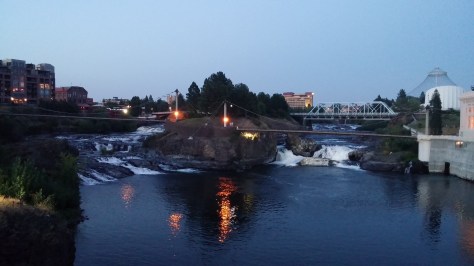
The Spokane River runs through the city’s center. A river walking path was being extended as a part of a larger Riverfront Park renovation plan.

Spokane Riverfront Park Improvements
Part of Spokane’s new river-walk and Riverfront Park revitalization efforts

On to Mt. Rainier…

We stopped at a lookout point outside of Vantage, Washington to bask in our first sight of the immense Columbia River. Columbia River
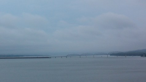
Ginkgo Petrified Forest State Park lay just beyond the opposite bank and was once home to the Wanapums, an indigenous, peaceful tribe of fishermen who are near extinction.


A few hours after crossing the Columbia, and after refueling both the car and our bodies in Ellensburg, we soon caught our first glimpse of the mammoth Mount Rainier. Mt Rainier in the distanceThe sighting renewed our energy and enthusiasm for the remaining two hour drive to our campsite.

Across the Mid-West and The Black Hills ~ August 4 – 9, 2014

ACROSS THE MID-WEST

We actually took three days to drive the 1,000 miles across the remaining mid-west to its western edge in the Black Hills National Forest. Neither Trey nor I recall the exact reason, but agree that the difficulty booking accommodations in the Black Hills may have influenced that decision.

As it was, we spent the first evening after departing Chicago in Des Moines, Iowa. Not a completely unremarkable city in that we could see for miles from the unobstructed view of our third floor hotel room where we had arrived just in time to see a somewhat remarkable sunset.

We had not traveled far down Interstate 80 the next morning when I saw a sign for the turn off to Madison County and its famed bridges. We did not turn and I felt a tinge of disappointment at the time which has since turned into regret — I will have to get back there.

We were to cut up Interstate 29 just east of the Missouri River which serves as the border between Iowa and Nebraska. Instead, we detoured across the Missouri and looped through the city of Omaha just so we could say we’d been to Nebraska – a first for both of us.

The reasons behind our Black Hills booking difficulty began appearing more numerously as we headed further west – Motorcycles. As in Chicago, our visit to the Black Hills had unknowingly coincided with a major tourist event – this time it was the 74th Annual Sturgis Black Hills Motor Classic.

Bridge Across the Missouri between Chamberlain & Oacoma, SD

After crossing the Missouri a third time and into the town of Oacoma, South Dakota, ours was one of only a few automobiles spattered among the Harley Davidsons parked outside of the Howard Johnson’s for the evening.

Soon after departing Oacoma, the landscape changed to rolling mounds of a golden color that I had never seen in nature. I failed to capture a photo so the image lies solely in my memory.

Wall, South Dakota
Wall, South Dakota

THE BLACK HILLS

We had felt lucky to have snagged the last available room at the Coyote Blues Village Bed and Breakfast when we had called the owner from a payphone in Ottawa. We hadn’t know just how lucky we were until we had arrived at the secluded, yet conveniently located inn outside of Hill City, in the heart of Black Hills National Forest.

View from Coyote Blues
View from our patio at Coyote Blues Village

The owners are from Switzerland and were just as charming and welcoming as the surrounding environment. It was full of European charm from the Swiss chalet feel of the inn to the traditional breakfasts of cured meats, cheeses, eggs and fruit. Each guest room is decorated in a different theme. We stayed in the Turkish room and had a private patio and sauna overlooking the valley below the inn. We took advantage of the views, patio and sauna each of the three nights of our stay.

Private Patio at Coyote Blues Village B&B
Private Patio at Coyote Blues Village

We also enjoyed breakfast each morning on an outdoor deck with friendly bikers and travelers, and loved the comradery and sharing stories of the road.

Mount Rushmore

Once we had settled into our room, we headed to nearby Mt. Rushmore with the excitement of children. It was raining and the wet winding roads were challenging for the bikers, but provided us with a unique photo opportunity.

Mt Rushmore - Crying Presidents

Mt Rushmore - Crying George

The park service has done a nice job in tastefully accommodating thousands of daily visitors while preserving, best as possible, the mountain’s and surrounding area’s natural states. The walk way up to view the monument, along with the amphitheater at its base are a bit over the top, yet successfully achieve the goal of provoking patriotism.

Mt Rushmore Walkway
Mt Rushmore Walkway

We highly recommend an evening visit for the film on the monument’s history and stories of each of its presidents.

Rushmore at Night
Rushmore at Night

The evening program ended with a touching tribute to our country’s armed services’ veterans.

Honoring Veterans
Honoring Veterans

Hiking in Custer State Park

Sylvan Lake in Custer State Park provides access to over a dozen trails including South Dakota’s 111-mile Centennial Trail that wends through the Black Hills from Butte Bear in the north to Wind Cave National Park in the south.

Sylvan Lake, Custer State Park

We chose, at the recommendation of a fellow traveler, to tackle the less lengthy trek to Little Devil’s Tower. The trailhead is located a mile east of Sylvan Lake’s parking lot and the trail is an easy walk through a grassy birch forest for about the first half mile…

Little Devil's Tower Hike
Little Devil’s Tower Hike

at which point it becomes increasingly more difficult.

Little Devil's Tower Path
Path to Little Devil’s Tower

It is the last section that earns this hike the label of “strenuous” as the trail sharply ascends through and over rocky passages to the apex.

Little Devil's Tower - Up to the Summit!
Up to the Summit!

The surrounding views from the top of Little Devil’s Tower are well worth the trip — being surrounded by the Black Hills with Black Elk Peak (Harney’s Peak at the time) and its stone tower to the north…

Black Elk Summit and Lookout Tower
Black Elk Peak and Lookout Tower

and Cathedral Spires to the southeast.

View from Little Devil's Tower
View from Little Devil’s Tower

Gorgeous!

We then drove east on Highway 87 from Sylvan Lake and through a section called “Needles Highway” for the towering spires that the road twists around.

Spires along Needles Highway

Several narrow tunnels on the route limit traffic to automobiles and motorcycles, so no RV’s or trucks.

Entering Needles Tunnel, Hwy 89
Entering Needles Tunnel, Hwy 87

Crazy Horse Monument

Crazy Horse Monument

This massive sculpture has been a work in progress since 1948 and has received no federal funding, per the wishes of Oglala Lakota Chief Henry Standing Bear who had envisioned such a memorial to honor all Native Americans. Chief Standing Bear had been inspired, so to speak, by the carving of nearby Mt. Rushmore.

The design is based on a pointing gesture and response that Crazy Horse is said to have given a snarky U.S. Calvary man who had asked him, “Where are your lands now?” Crazy Horse’s response was, “My lands are where my dead lie buried.”

Crazy Horse Model with Sculpture in Background

The carving efforts have been in the hands of a single family, the Ziolkowskis, who rely on admission fees, gift shop and concession sales, and private donations to continue their work.

To provide some idea as to how tedious the hand carving process is, Crazy Horse’s face was unveiled in 1998. To provide a sense of the size the finished sculpture is to be at some point in the future, that will mostly likely be beyond my lifetime, Crazy Horse’s pointing arm is 263 feet long and his horse’s nostrils are to be 26 feet in diameter.

~~~

The Black Hills were a fitting first step into the wild and beautiful west and provided us with a taste of the wonder that laid before us.

Up Next, Devils Tower and the Battle of Little Bighorn National Monuments…

Meanwhile, here’s some more of our favorite pics!


Adirondacks and Lake Placid, New York ~ July 10 – July 13, 2014

Adirondacks Park, Northeastern New York State

Adirondacks Park is large — 6 million acres, in fact, and although it is a designated protected area by the State of New York, it is not a state administered park.  Instead, the hundreds of campgrounds scattered across the park are individually run either privately or by various public entities.  The park’s lack of having a central authority and website made researching where we wanted to camp within the 6 million acres challenging.  Not that there’s a lack of information on the internet; there is tons of information across numerous websites that we found a bit overwhelming.

We knew we wanted a semi-secluded lakeside campsite close to hiking trails.  After many hours of research spread over several weeks, we settled on Little Sand Point located in the south-central part of the park.  Its website included a couple of picturesque lake photos and one of a campsite.  The description of the campground included the words “serenity”, “nestled” and “secluded.”

To get there, we chose a 150 mile driving route from Plattsburgh, New York that entered the park from the north and took us directly through the middle of the park, along several lakes and through numerous small towns — we were surprised at how rustic and isolated some of the communities seemed.  Although the road was a bit rough for having bicycles on the back, it was a lovely drive.  It is easy to imagine the area as a giant beautiful bouquet of color in the fall.

We arrived at the Little Sand Point campground about 5 p.m. to find that campsites were about 100 feet off of the main highway and that our site was located directly below where the campground’s dirt road turned around.  There were car tracks where someone had missed turning that led directly to where we were to pitch our tent!  Although our site was directly on beautiful Lake Piseco, it was also located next to a house with a barking dog and an upset baby.  The campground was mostly vacant so we walked through other sites looking for a better option.  We found no site with a level tent area, decent fire pit, nor any that were “serene” or “nestled.”

After about 45 minutes of weighing our best options and trying to be positive about this campground, we climbed back into the Escape Mobile and headed north.  Our plan was to stay in Lake Placid unless we found a lodge or cottages along the route where we felt we’d be comfortable.

Lake Placid, New York

We arrived in Lake Placid about 9:00 p.m. with no place to stay.  Trey cruised Main Street a couple of times looking for vacancy signs while I searched from my phone.  Out of frustration, we pulled off of Main into a parking lot and connected a laptop to our mobile Wi-Fi.  Initial results for the few name brand hotels were well over budget, and, I suspect due to the late hour, calls we made to locally owned lodges were not answered.

Just as I began to worry about our situation, I was startled by a sudden knocking and the appearance of a disheveled man at my passenger side window.  A better look at his face revealed that there was no need to worry and I rolled down the window.  In a British accent he asked us if we needed help.  I explained that we were just looking for a place to stay.  Turns out, the parking lot was for a lodge, Wildwood on the Lake, and was owned by the family of the gentleman’s wife – he handled maintenance and supervised the cleaning staff.  He had just stepped outside to make sure something was locked when he spotted us.

He stated that he had a couple of rooms available, that he would ask his wife to reopen the office, and that they’d give us good deal.  This is just one example of several on our North America travels where the solution found us – when and wherever we had a significant need, the universe quickly responded.

We were most grateful, and ended up spending three restful nights on the bank of beautiful Lake Placid.  The inn was rustic, quiet and clean, and its stretch of shoreline more than provided the peaceful lakeside experience we had sought.

View of Lake Placid from the back of WIldwood Lodge

Lake Placid’s Main Street is the city’s business and tourist center and runs along the west bank of Mirror Lake – not Lake Placid.

Main Street, Lake Placid, New York

Although Lake Placid is nearby, it is the much smaller Mirror Lake that is the hub for water related recreation, lakeside dining and accommodations.

Trey had no luck with the fish in Mirror Lake

We enjoyed strolling and window shopping along Main Street.  This charming city is a mix of early 20th century buildings at its center, bookended by expansions resulting from the 1980’s Winter Olympics economic boost.

Both the 1936 and 1980 Olympic Centers sit at the south end of Main along with the outdoor skating area where Eric Heiden won five gold medals for the U.S.

Olympic Center, Lake Placid, NY

The original 1936 center is now a museum commemorating both the games.

Original Olympic Center, Lake Placid, NY

The village  now hosts an annual Iron Man competition.  This was the cause for our difficulty in finding accommodations.  Athletes were beginning to arrive to acclimate and train for the July 27th race.

Recreation

Trey heading out to fish on Lake Placid - caught a small bass
Trey heading out to fish on Lake Placid – caught a small bass

One afternoon we rented a canoe and slowly paddled around the perimeter of the Mirror Lake — two swim lanes had been set up in the middle of the lake for the Iron Man competition and several swimmers were using them.

When we completed our circle the sun was low in the sky and the other watercraft and swimmers were heading to shore.  We instead headed to the middle point of the lake to get check out the swim lanes.  Soon after, we found that we were alone on the lake – it was entirely ours.  A gift.

Sun beginning to set on Mirror Lake

As stated in the “About” page of this blog, Trey and I both were responsible for the care of our ailing parents.  Over a period of 10 years from April of 2001 to August of 2011, we did our best to ensure they were safe, well cared for, and maintained the best quality of life possible despite their various diseases.  The latter part of this period was particularly stressful.  A frequent fantasy of mine was to row a canoe out to the middle of a calm, empty lake and simply lie down in the canoe, look at the sky, and in that moment be responsible for nothing.

Trey snapped this one of me enjoying the serenity of Mirror Lake

I have learned when one receives a gift, it should be embraced and appreciated fully.  So, I laid down in the canoe, and simply admired the sky, feeling so very grateful for the peace that I now enjoy.

As for Lake Placid, we also experienced it via the Peninsula Nature Trails that wind through a landmass on the southern part of the lake.  The trails provide a wonderful natural retreat within walking distance of the city.

Lake Placid's Peninsula Trail
Lake Placid’s Peninsula Trail

The trails’ access point is not well marked – it is simply an unmarked road that appears to be a driveway and is located between the Comfort Inn and Howard Johnson’s restaurant.

The Village of Lake Placid is a bit off the beaten path, particularly for us Texans, but it was a wonderful refuge and allowed us to experience the beauty of the Adirondacks.

Main Street, Lake Placid, New York

Food

My favorite Lake Placid meal was enjoyed at Milano North.  It was well out of our budget but at least we were satisfied that we received what we paid for.  Milano North provided a comfortable, but upscale setting and, for me, the best formal fish dish experienced on our trip.

Baarramundi with Coconut Rice, Milano North, Lake Placid, NY

Trey preferred the spaghetti and meatballs at Jimmy’s 21, which offers an affordable and quality dining experience on Mirror Lake.

The Breakfast Club is a popular breakfast spot and we found that the food was well worth the wait we encountered on both of our visits — yes, it was good and reasonable enough to merit a return trip.

Robin, Lake Placid, NY