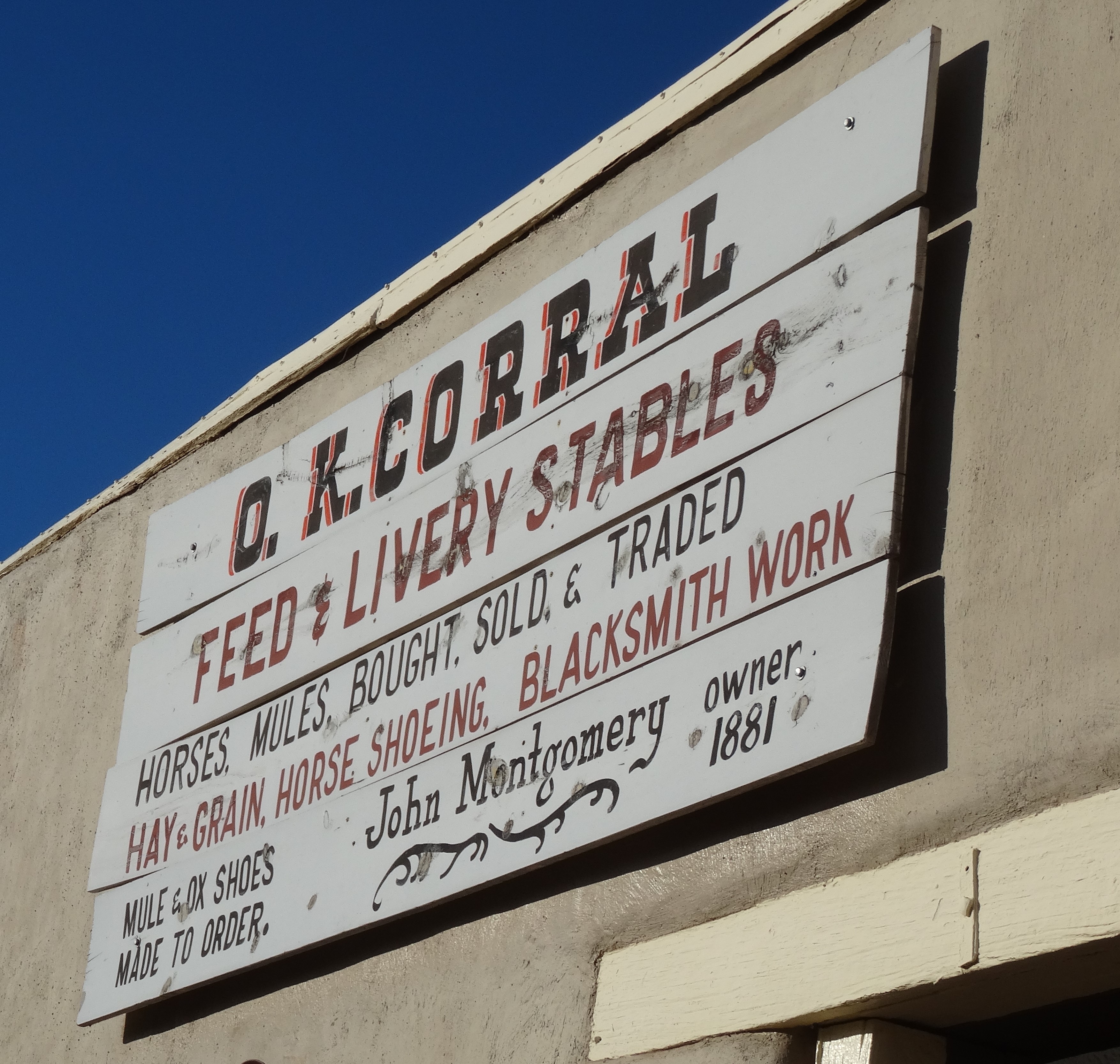
Tag Archives: Arizona

Tombstone, AZ & Gila National Monument, NM ~ November 4 – 5, 2014

Tombstone, Arizona

Tombstone, AZ 1
Tombstone, Arizona

Between I-10 and the Mexican border lies the infamous town of Tombstone, Arizona. It’s an easy drive from Tucson —about 75 miles—and the cutoff (Hwy 80) was on the way to New Mexico.

Tombstone, AZ 2
Tombstone, Arizona

Like Virginia City, Nevada, Tombstone’s classic western scape is preserved and attracts tourists now rather than cowboys, miners, and outlaws.

OK Corral, Tombstone AZ

Since we weren’t interested in souvenirs or saloons, there wasn’t much to do except walk around, bask in the nostalgia, and read historical markers.

In 1877, and after being told he was foolish and would only discover his own tombstone, Edward Schieffelin found silver in the surrounding hills. By the mid-1880’s, his small encampment had grown into the town of Tombstone with a population upwards of 15,000.

Yet, Tombstone is worth the detour whether you love the lore of the American West or are simply curious. In fact, it enticed us longer than we’d meant to stay.

Heading East on I-10

The detour to Tombstone added 50 miles to the 200-mile drive to southwestern New Mexico, and it was already late afternoon. By the time we were again heading east on I-10, the sun was setting.

Waxing Moon, I-10 east of Tucson
Waxing Moon, I-10 heading toward New Mexico

Cookies, it’s what’s for dinner!

After the deluge in Redwoods National Forest, we had no more camping plans. We also knew there’d be no kitchen access for the remaining eleven days of this adventure, so there was no need to tote food, other than a few snacks. Plus, we’d filled our bellies with a hearty breakfast at Cross Roads Restaurant in Tucson and felt satisfied enough to get through to evening. But, the long day and drive had us arriving in Silver City, NM just after restaurants had closed. Luckily Petit Écolier cookies, leftover from making s’mores, sustained us to morning. This wasn’t the first time we had cookies for dinner.

Gila Cliff Dwellings National Monument (Pronounced Hee-la)

Gila Cliff Dwellings NM 9
Gila Cliff Dwellings National Monument

The remnant cliff dwellings lay deep within Gila National Forest. After turning off Silver City’s main road onto Hwy 15, we started climbing and signs of civilization soon succumbed to a verdant wilderness.

GNF Map

The road mostly follows the Gila River while twisting around, over, and atop the ridges of mountains for 40 miles.

Atop Ridge, Hwy 15, New Mexico

At the visitor center we watched a brief and informative video. The cliffside homes are believed to have been constructed by Mogollon (Mo-go-yone) Puebloans beginning in the 1270’s. But these original inhabitants had moved on by 1300, perhaps due to drought.

The Chiricahua Apache settled there in the 1500’s and remained in the area until the U.S. government forced their removal between 1870 and 1886. The last Apache to sadly leave this ancestral land were led by a defeated Geronimo (Goyahkla).

Gila Canyon, Cliff Dwellings Nat'l Monument
Gila Canyon, Cliff Dwellings Nat’l Monument

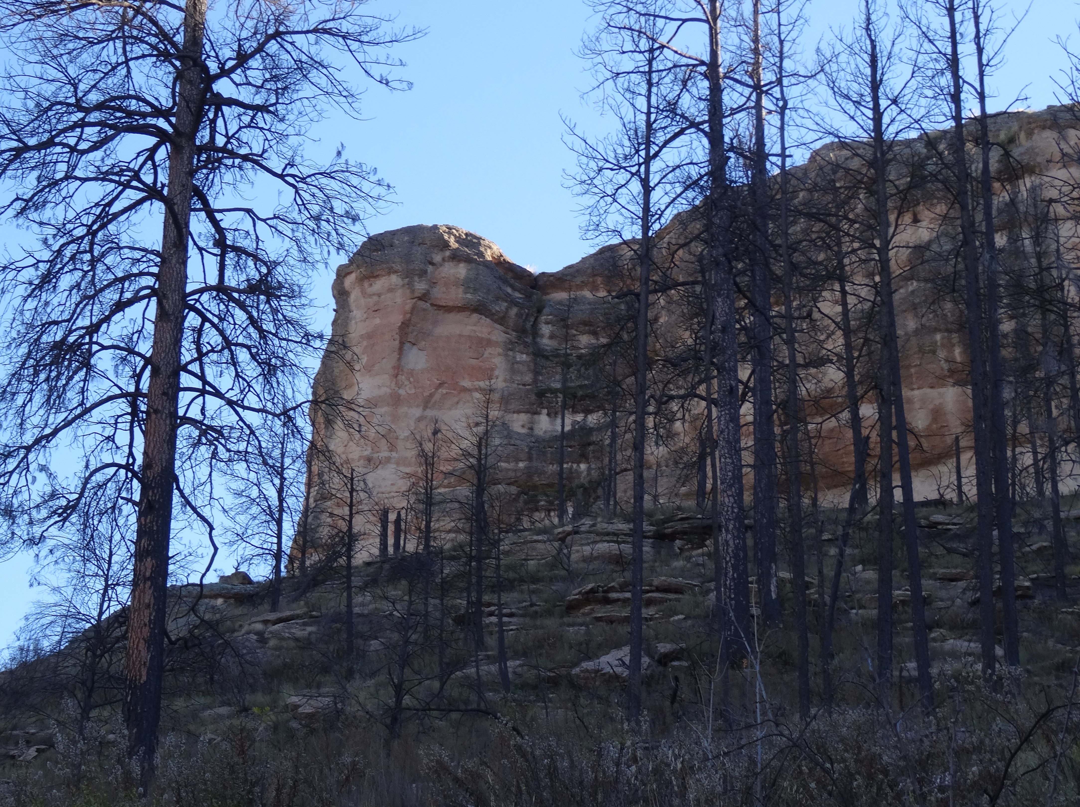
The Gila National Forest is spotted with ancient pueblo ruins, yet none as unique and Eden-like as the cliff-dwellings… seven caves high on a canyon cliff topped with fertile soil for growing corn, beans, and squash (the “three sisters”).

Gila Cliff Dwellings
Caves 2, 4 and 5 (Cave 3 is between 2 & 4 but its entrance is set back and not visible from this angle)

The middle fork of the Gila River runs below the caves and in early November appeared more creek-like.

1-Mile Loop Trail to Gila Cliff Dwellings

Only five of the caves were used as living quarters. Cave number 6 appeared to be used for rituals while hard-to-reach cave 7 had no trace of human occupancy.

Gila Cliff Dwellings NM 4
Gila Cliff Dwellings, New Mexico

Unlike Montezuma’s castle, visitors are allowed into the Gila Cliff Dwellings. Being a weekday in November, the forest ranger and a volunteer were the only other persons inside the caves.

Gila Cliff Dwellings NM 1
Inside Cave 3, Gila National Monument, NM

The ranger pointed out unique architectural details including a structure believed to be used for food storage, like a pantry.

Storage Pantry, Gila Cliff Dwellings

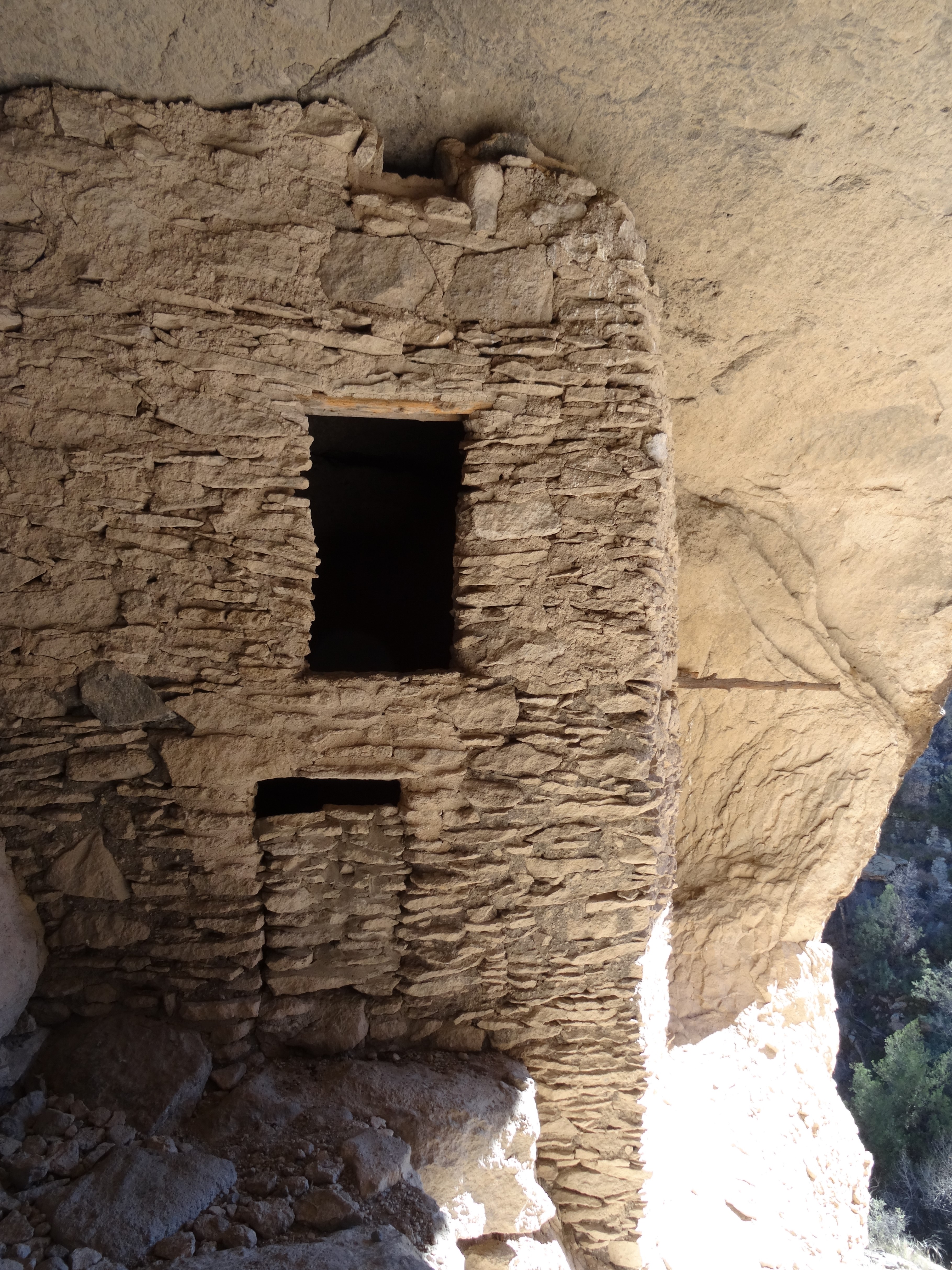
We particularly enjoyed cave 3, the largest and coolest (as in temperature), and its view was fabulous.

Meditating, Cave 3, Gila Cliff Dwellings
Meditating in Cave 3, Gila Cliff Dwellings

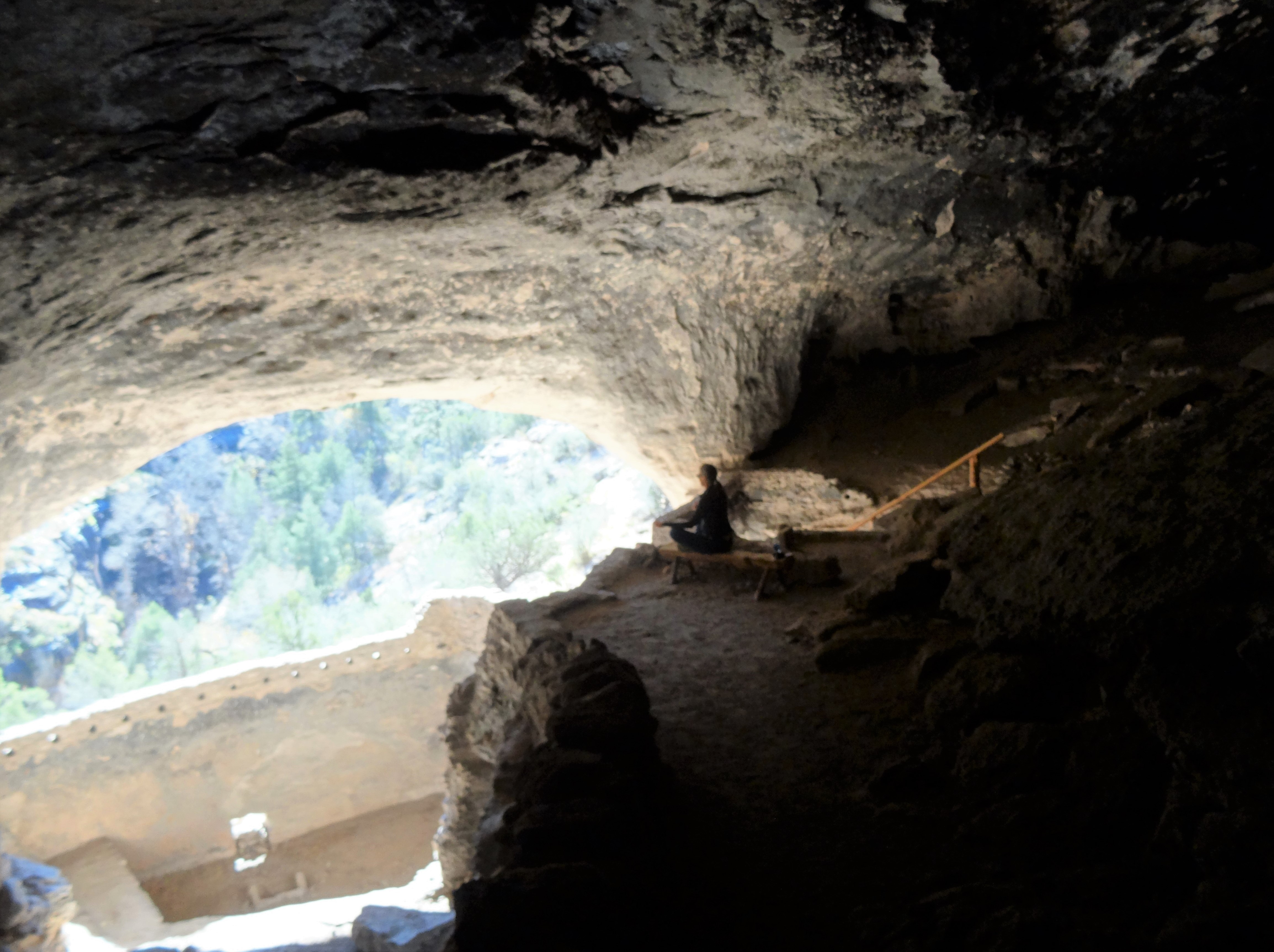
Having the dwellings to ourselves was special and a memorable experience.

We were able to spend amble time inside the caves to fully appreciate the area’s beauty, sense of safety, and peace.

Gila Cliff Dwellings NM 8

For the return trip to Silver Springs we opted to continue looping the scenic byway—the Trail of the Mountain Spirits—into San Lorenzo then back west to Silver Springs.

Trail of the Mountain Spirts Byway

This only added thirty miles to our trip, but Trey and I both agreed the more picturesque route was Hwy 15.

View from Hwy 15 New Mexico

Silver City, New Mexico

Silver City is a friendly mining town nestled aside a mountain and a tad east of the Continental Divide. More modern than expected (not rustic) yet it retains a quaint, small town quality. We savored an authentic Mexican dinner at La Cocina and a hearty breakfast at the artsy Adobe Café. Highly recommend both!

Next Stop…

Alamogordo & White Sands National Park, New Mexico (via quirky Hatch New Mexico…)
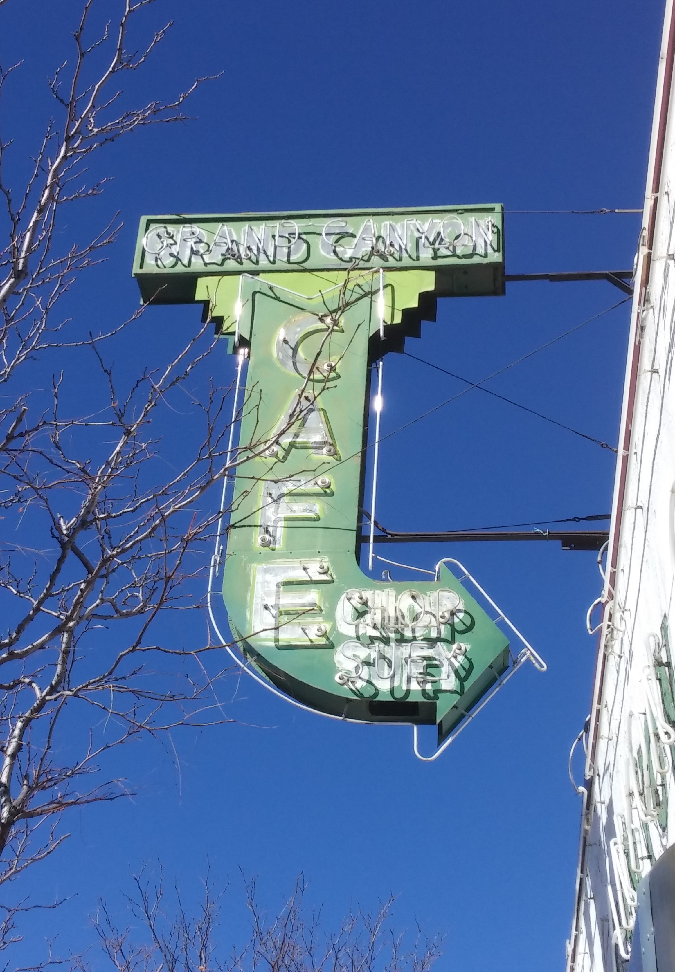
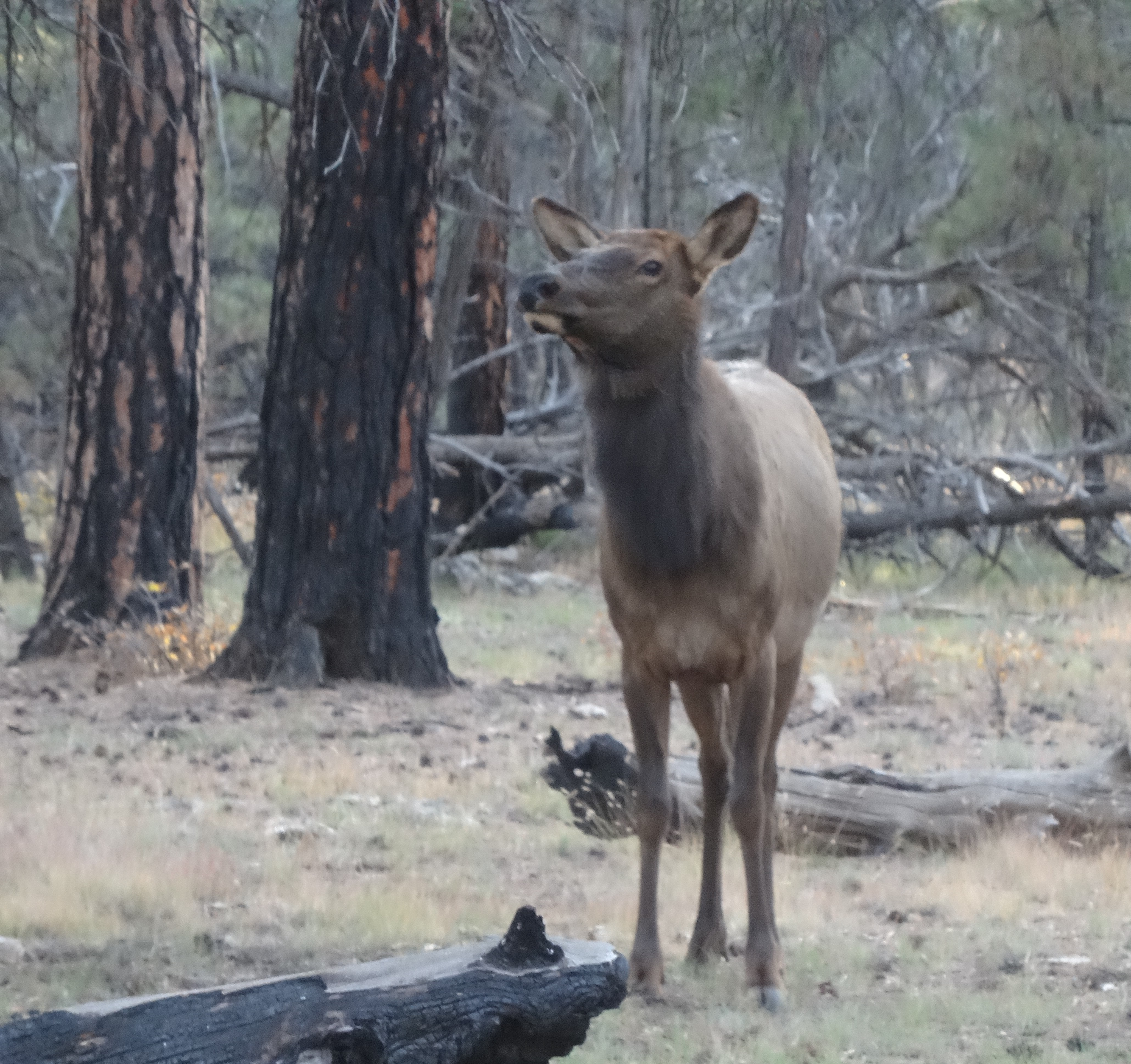
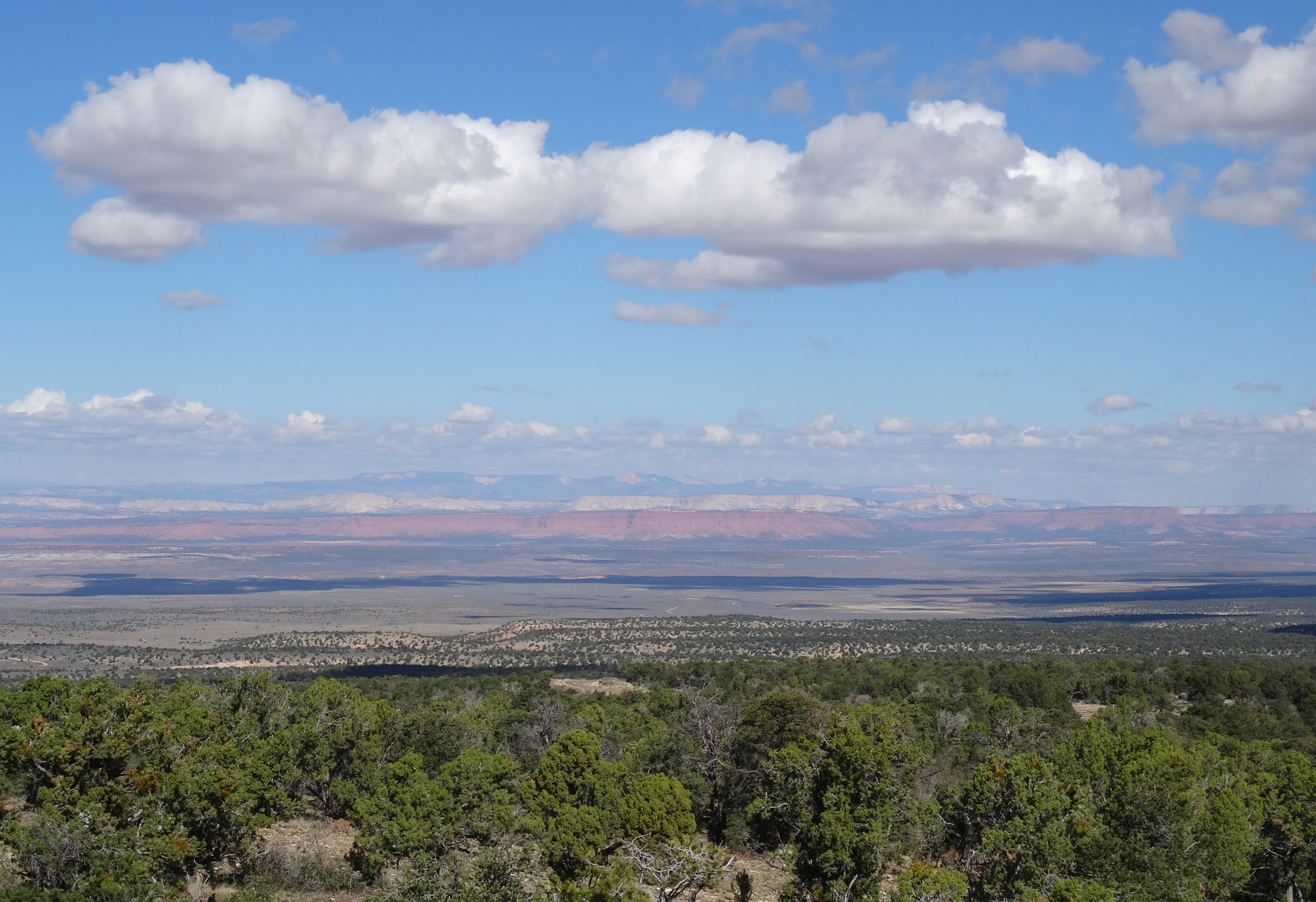
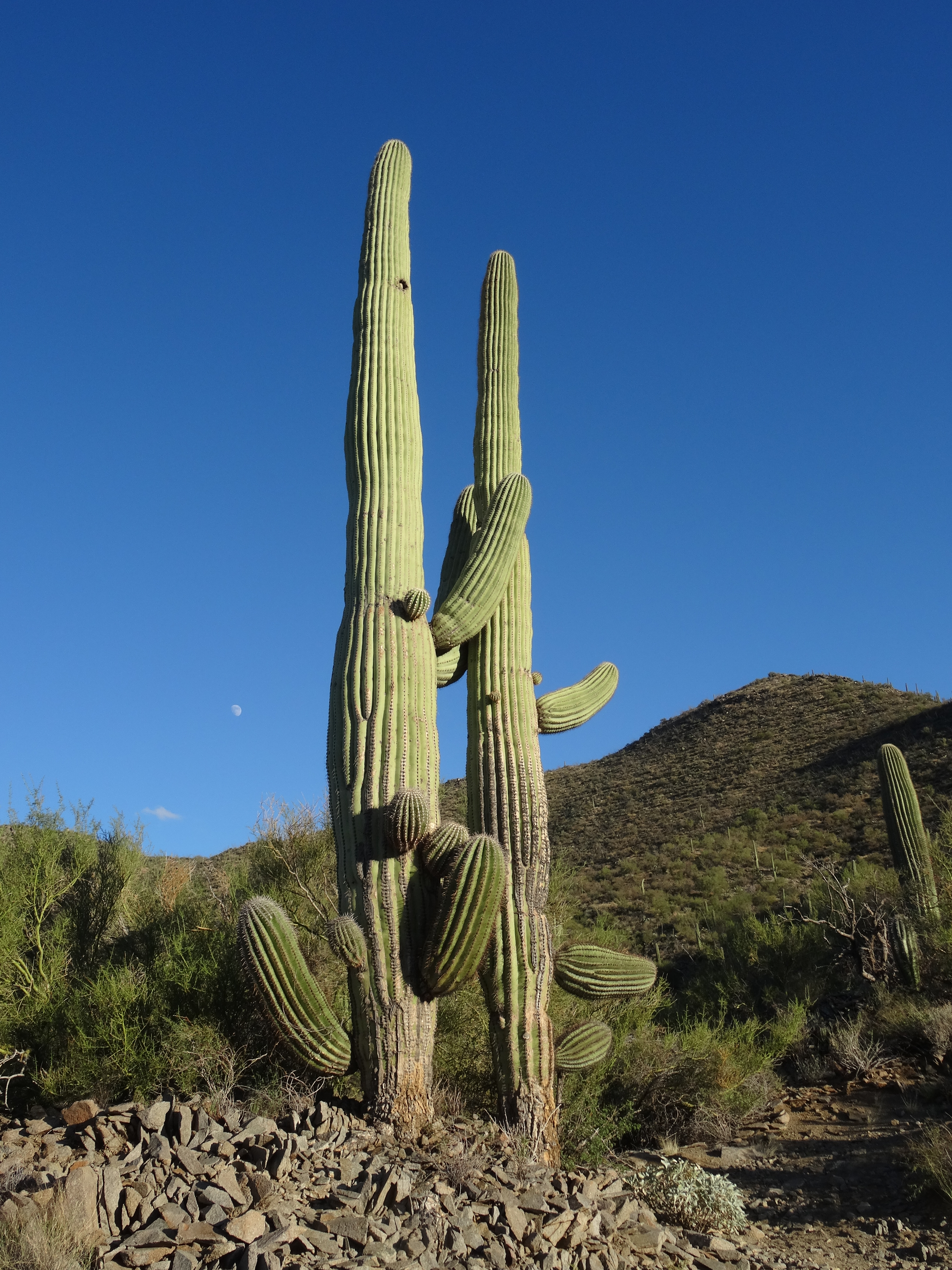
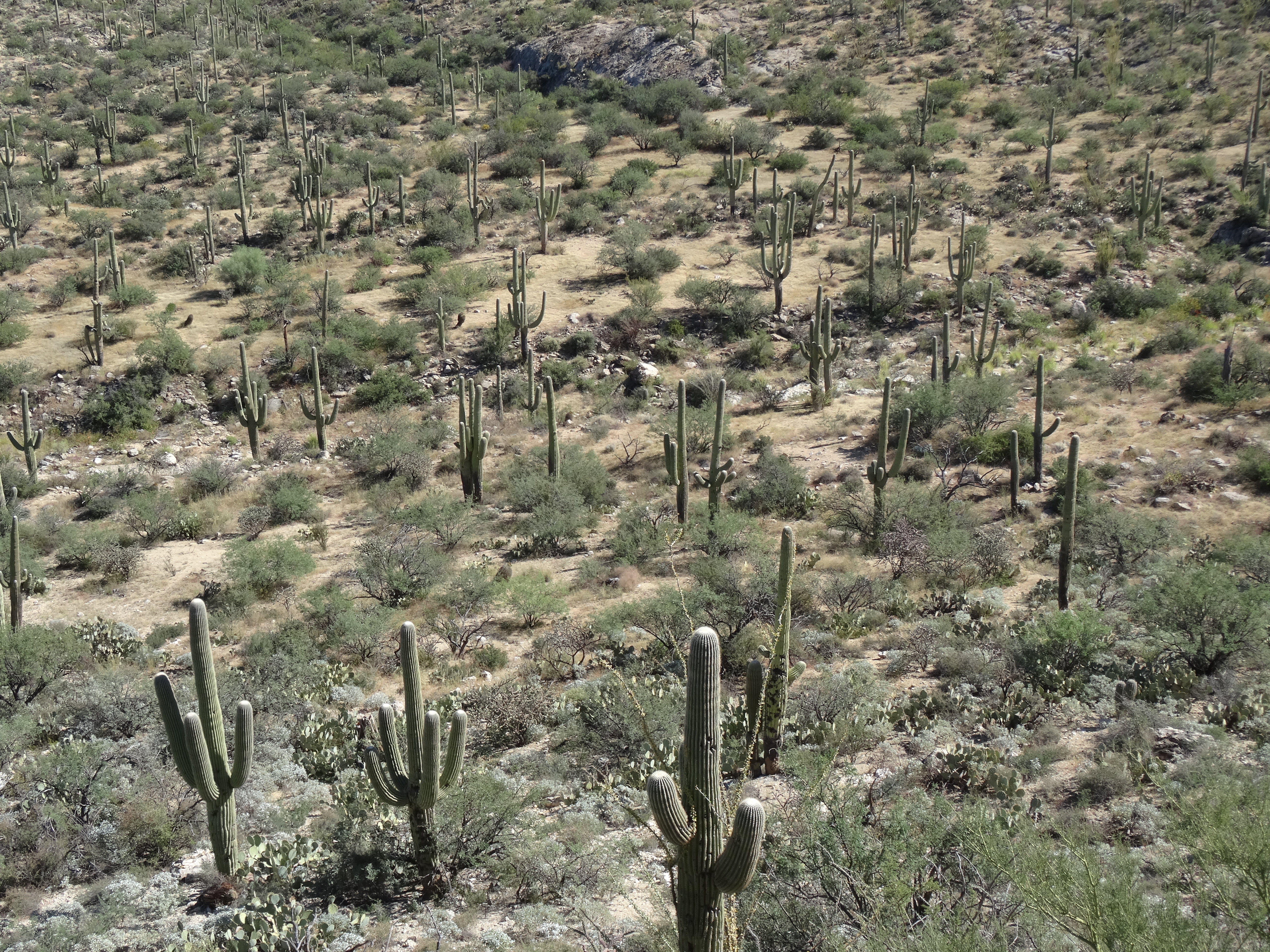
More pics…

Lizard, Gila Nat'l Monument, NM
Gila National Forest Lizard 🙂
Casting Shadows, Gila Natl Monument, NM
Casting Shadows, Gila National Monument

Saguaro National Park & Kitt Peak National Observatory ~ November 2 & 3, 2014

We were back among the stately saguaro cacti of the Sonoran Desert.

Sun setting over Saguaro Natl Park W, AZ (Golden Gate Rd)

Tucson, Arizona has a bit of a funky college town feel. That vibe and its 530k population reminded us of our home, Austin, from when we’d first moved there in the 1980’s. Austin’s population has since exploded and it’s small-town funkiness has faded somewhat, so we relished our time in Tucson.

We’d slept in after arriving late the previous evening. By the time we waited for seating at a popular brunch spot (see below), the sun had moved well west of 90⁰. Yet, we continued as planned… to hike among the enchanting saguaros.

Saguaro National Park – West

The city of Tucson divides Saguaro National Park into west and east sides.

SNP Maps

While the city seems to be encroaching the parks’ borders, both are full of saguaro cacti, and have hiking trails and scenic loop drives.

Saguaro Natl Park W, AZ 1
Saguaro Natl Park W, AZ

We first headed to the western section, or the Tucson Mountain District, because it is smaller and recommended for those pressed for time.

Sendero-Esperanza Trail, Saguaro NP W 2

Yet, it still provided us with a sense of wilderness hiking.

The Sendero Esperanza Trail begins just off Golden Gate Road near the Ez-Kim-In-Zin picnic area where we found plenty of parking space. The first mile stays within a valley and crosses through and around sandy washes.

Sendero-Esperanza Trail, Saguaro NP W 1
Sendero-Esperanza Trail, Saguaro NP W

The valley was lovely, with the trail winding through saguaro, barrel and cholla cacti.

Birdsong filled the air and critter holes dotted the trail’s sides.

We saw several lizards and beetles and kept a lookout for road runners, snakes, and cactus mice.

Cactus Wren, Saguaro Nat'l Park, AZ
Cactus Wren, Saguaro Nat’l Park W, AZ

As the trail began to climb the saguaros became more abundant.

Saguaro NP W

We noticed how each one, with their varied appendages – twisting, pointing, displaying, signaling – seemed to have its own personality.

I Love You So Much! Saguaro Nat'l Park W, AZ
I Love You So Much! Saguaro Nat’l Park W, AZ

We loved hiking among them! 

After a series of switchbacks, we reached a ridge and the intersection of another trail, the Hugh Norris Trail.

Hugh Norris Ridge Trail, Saguaro NP W 2
Trey on the Hugh Norris Ridge Trail, Saguaro NP W

Instead of continuing down the Sendero Esperanza Trail, we cut left up the ridge that leads to Wasson Peak, (4,687’).

Saguaro Natl Park W from Hugh Norris Ridge
View from Hugh Norris Ridge Trail, Saguaro NP W

Although the summit was only about 1-1/2 miles away, the sun was now low in the sky. We had to turn back to avoid hiking after dark.

Saguaro Natl Park W
Sendero Esperanza Trail, Saguaro NP W

We returned to the Escape Mobile just after the sun had set and turned the western sky a gorgeous shade of burnt orange.

Saguaro National Park W, AZ
Sunset, Golden Gate Road, Saguaro National Park W, AZ

The silhouettes of our new friends, the saguaros, against the backdrop of an orange sky is a favorite memory.

Saguaro National Park – East

Cool, crisp air filled the Rincon Mountain District. The morning was beautiful and perfect for touring the east side of Saguaro National Park by bicycle.

Cactus Forest Drive, Saguaro Natl Park E, AZ (2)
Cactus Forest Drive, Saguaro Natl Park E

Cactus Forest Drive is a one-way, 8-mile loop covering a tiny portion of the park.

Saguaro NP E
Saguaro NP E Overlook from Cactus Forest Drive

But its saguaro forest, scenic overlooks, and optional ecology trail offer a taste of the vastness that stretches eastward from the road.

Access to this wilderness is by foot only so we stayed to road.

Cactus Forest Drive, Saguaro Natl Park E, AZ
Trey on Cactus Forest Drive, Saguaro NP E

The ride is hilly, at times steep… you need durable legs and good brakes.

Saguaro Natl Park E, AZ

Fortunately, there are several areas to stop, rest, and bask in the desert vistas.

Our early arrival allowed us to take our time and return to our hotel to rest up for the evening’s adventure.

Kitt Peak National Observatory

“We must not allow the clock and the calendar
to bind us to the fact that each moment of life
is
a miracle and a mystery.”
~H.G. Wells

 From every direction, mountains spring up from the desert floor and surround the city of Tucson. There are five mountain ranges within and around the city’s perimeter, and even more on its outskirts, including the Quinlan Mountains.

Kitt Peak Natl Observatory, AZ 1
Kitt Peak National Observatory

At 6,877 feet, Kitt Peak is the highest of the Quinlan Mountains and is accessible off AZ Hwy 86, about forty miles west of Tucson. Kitt Peak lies on native land (Tohono O’odham) far from city lights; it’s also home to the world’s largest collection of telescopes. 

In addition to daily public tours, they offer nightly sky/star viewing programs, which is what we opted to do.

0.9 Meter Telescope, Kitt Peak

With temps in the 30’s and the moon close to full, the conditions weren’t ideal for star gazing. Yet, we were thrilled with the experience.

Sunset from Kitt Peak
Sunset Nov 3 2014, from Kitt Peak

Our guide, Sean, explained the purpose and capabilities of each telescope and was extremely knowledgeable. We watched the sunset and then identified stars and planets as they appeared in the darkening sky.

Kitt Peak Natl Observatory, AZ 2

Eventually, and with some help from Sean and a pair of binoculars, we spied our galactic next-door neighbor, Andromeda. Using one of the telescopes (not heated, but at least sheltered from the icy wind) the night sky was even more wondrous!

The 12-mile drive from the highway up to the peak is narrow and winding… not a problem in the daylight. But the return drive down the mountain was harrowing. Because headlights interfere with the telescopes, only parking lights are allowed until you’ve passed a certain point.

Moon, Nov 3 2014 from Kitt Peak

Even with a near-full moon, it was extremely dark. As we strained to assure the Escape Mobile stayed on course we also kept an eye out for wildlife. We were instructed to continue driving slowly after turning on our headlights because wildlife hang out along the road, including a great Horned Owl around mile marker 8. We had hoped to see that owl.

After safely descending Kitt Peak and soon after turning east onto AZ Hwy 86… Wowza! That Great Horned Owl cut right in front of us! His wings spanned across our entire windshield blocking our view briefly and scaring the heck out of us. We weren’t sure if he was chasing after potential prey or exclaiming, “Here I am, you dummies!”

FOOD

Blue Willow was a fun, funky, and delicious brunch spot. Fresh and local. They also have a great gift shop to peruse while waiting for a table… it is extremely popular with the locals!

Blue Willow Breakfast, Tucson, AZ

Local dive, Franks, was great for a cheap, quick, classic American breakfast. No frills and that’s the way they like it!

1103140909

Cross Roads Restaurant was advertised as some of the best Mexican Food in Tucson. We skipped the buffet and ordered off the menu.

Crossroads Restaurant, Tucson AZ 3

Trey was incredibly pleased with his favorite… enchiladas con huevos, as was I with a southwest version of huevos rancheros. Two yums up!

Next Stop… Gila National Forest and Silver City, New Mexico

Sign of home (Texas)


More Pics…

Cholla, Saguaro Natl Park W

Calliandra, Saguaro Natl Park W


Montezuma Castle National Monument & Sonoran Desert, Arizona ~ October 24 – 25, 2014

Leaving Tusayan before breakfast, we headed southeast toward Flagstaff. The Escape Mobile had traveled 5,037 miles since leaving Seattle, so it was time for her fourth servicing.

Route 66, Flagstaff, AZ
Route 66, Flagstaff, Arizona

Flagstaff was on the way to Phoenix, where we’d planned to spend the night, and it had a dealership that honored our maintenance purchase agreement. While waiting on our vehicle, we enjoyed a traditional breakfast at the Grand Canyon Café on Historic Route 66 in the quaint heart of Flagstaff.

Grand Canyon Cafe, Flagstaff AZ

Stepping into the café we’d entered a time warp… booths with mint-green Formica tabletops and individual jukeboxes, and a soda bar that spanned the length of the café. The owner told us they’d been continuously open  for nearly 75 years. Sadly, the Grand Canyon Café has since permanently closed.

Montezuma Castle National Monument

Montezuma Castle National Monument, AZ

Fifty-six miles down Interstate 17 we stopped at Montezuma Castle National Monument, the former hillside condo-like dwelling of the ancient Southern Sinagua people. The Sinagua were farmers and hunter-gatherers that thrived in the Verde Valley from the 1100’s through the 1300’s.

Montezuma Castle National Monument, AZ 2

For unknown reasons, in the early 1400’s they abandoned their homes and the Verde Valley.

Montezuma Castle National Monument, AZ 3
Pathway to Montezuma Castle

The visitor center is just off the interstate and the walk to the cliffside remnants is short and quick. Music of flutist Harry Seavey, who was on site, filled the air and added an authentic and surreal feel to our experience.

Harry Seavey


“There is a message in our hearts, a truth we all know. We feel it as we walk in a forest or sit in the desert. It is the message in the cry of a hawk and in the voice of a flute. It is our connection to life; the message that we are one with Spirit.”
~ Harry Seavey


Factoid: The monument bears the name “Montezuma” because it was originally mistaken to be built by Spanish Explorers.

Montezuma Castle National Monument 2

Regrets:  For some reason we felt pressed for time and did not venture the 23 miles to Tuzigoot National Monument, another Sinagua village located atop a ridge 40 minutes northwest of Montezuma Castle.

Map

Nor did we detour from I-17 onto Hwy 89A to visit nearby Sedona, a funky, spirited community that I would have loved, I’m sure.

Sonoran Desert

As we navigated around Phoenix’s maze of highways to a hotel near Arizona State University, the sun still shone from fairly high. We entertained ourselves by strolling the campus and chowing down on some chain Chinese food before vegging in front of the television for the night.

The most interesting part of the remaining 355-mile drive to our next destination, San Diego, was the shortcut to Interstate-8.

AZ Hwy 238 to San Diego

Arizona Hwy 238 cuts across the Sonoran Desert between Maricopa and Gila Bend. It was originally built to serve a hazardous waste facility that I don’t think was ever built. It appeared to solely serve as a desolate cut-thru that provides a genuine desert experience.

Sonoran Desert From Hwy 238 AZ
Sonoran Desert From Hwy 238, Southwest of Phoenix

Saguaro cacti tower just off the roadway, which resembles concrete waves flowing through a sea of white sand.

Sonoran Desert From Hwy 238 AZ 3

Blowing sand was accumulating across the road’s lower points, and it seemed like the desert was determined to conquer the road.

Interstate to San Diego
Interstate 8 to San Diego


After an initial hotel snafu in San Diego, we settled into a Four Points Sheraton using points and began planning the next two day’s adventures.

More Pics…

Sonoran Desert From Hwy 238 AZ 2
Sonoran Desert from Hwy 238, Arizona

Arizona Sky
Arizona Sky

Grand Canyon’s South Rim ~ October 22-24, 2014

We’d first visited the Grand Canyon in 1992, when our daughters were six and nine. With only a half-day, we spent most that time on the Bright Angel Trail for a three-mile roundtrip hike. Quite a feat for kiddos!

Tusayan, Arizona

With this trip, our second, we’d hoped to hike into the canyon once again, but didn’t know if we’d be able to work in a full day’s hike.

South Rim Selfie, Grand Canyon

Since leaving Carmel, we’d been traveling in “we will figure it out” mode, so had no camping or hotel reservations when we rolled into Tusayan, a town just a few miles from the park’s south entrance.

When the Holiday Inn Express offered a particularly low rate, we figured it out quickly… “Oh, can we actually have the room for three nights, please?”

Tusayan is a walkable town catering to tourists… it’s primarily hotels and restaurants aligning each side of Highway 64. A quick look at Gmaps showed that we were just a block from the Grand Canyon Visitor Center. We rode over after breakfast the next morning.

As we’d done at most national parks, we first watched the informational movie. This one, Grand Canyon, The Hidden Secrets, is quite different.

IMAX Tixs

It’s more of an over-dramatization of folklore involving cougars, hostile natives, and John Wesley Powell; not the historical account of the area’s geology and indigenous people we were expecting. We left a bit disappointed.

The Greenway Trail, a 6.6 mile pathway to the south rim, is accessible from the visitor center’s parking lot.

Young Elk, Grand Canyon SR

We were excited to ride our bikes through the pine forest to Grand Canyon Village, where we planned to peel off onto the South Rim Trail. At the time though, the Greenway Trail wasn’t paved. This wasn’t a problem until the path turned into gravel piled 2-3 inches deep. Our tires dug in and we went nowhere. Unsure as to whether the gravel lasted another half-mile or for the entire remaining 6 miles, we turned around and loaded our bikes onto the back of the Escape Mobile. (Note… current photos show the pathway to be paved, but I can’t find whether or not it’s paved for the full length.)

Greenway Trail, Tusayan AZ
Source: hikingproject.com

South Rim Trail

Cycling the 13-mile Rim Trail was exhilarating.

Riding the S. Rim Trail, Grand Canyon

On the east side there are sections where the trial is only feet from the canyon’s edge, and the views are amazing.

South Rim, Grand Canyon 3

We rode until we ran into the South Kiabab Trailhead and agreed it would be the trail we’d tackle the next day.

Around Rim Trail, Grand Canyon SR
Trey on the South Rim Trail, Grand Canyon

The Rim Trail’s west side is also a peaceful, worthwhile ride. It’s mostly wooded and snakes around lodges and campgrounds setback from the rim.

Back at the hotel we did some research to plan for the next day’s hike…  in the morning, after purchasing snacks and sandwiches, we’d fill our backpacks’ water bladders, pack some extra water, catch a shuttle from the village visitor center to Yaki Point, and hike 3-miles down to Skeleton Point – the deepest turnaround spot advised for a one-day down and up hike.

South Kaibab Trail

All the prepping took time so it was early afternoon before we reached the South Kiabab Trailhead.

White Shorts - Grand Canyon SR
White Shorts?

Although warm for October, it was a gorgeous day and we headed down the canyon’s wall with an excitement-induced quick step. The entire trail is steep, that should go without saying but I’m saying it anyway. It’s easy to get distracted by the surrounding beauty, lose a sense of your downhill pace, and over-estimate just how far you’re capable of hiking in a day. The Rangers’ motto, which they repeat often, is “What goes down, must come up!”

Heading down Kiabab Trail, Grand Canyon SR
Heading down South Kiabab Trail, Grand Canyon

One of the trail’s steepest points is just below the trailhead… a dizzying series of short switchbacks that lead down to Ooh Aah Point, about a mile in. A half-mile farther is Cedar Ridge, the halfway mark to Skeleton Point and a great place for a snack, bathroom break, and photos.

Mule Train at Cedar Ridge, Grand Canyon SR
Mule Team at Cedar Ridge, Grand Canyon SR

Cedar Ridge View, GCSR
Cedar Ridge View, Grand Canyon South Rim

It’s recommended that Cedar Ridge be your turnaround point if hiking during the summer months.

Although warm, we continued downward passing two couples at separate points that had Trey and me raising our eyebrows. They were heading back up, about our ages but not fitness levels, and as Trey noted, “They weren’t looking good!” We ended up passing both couples on the way back up. Not boasting, just noting that one should undertake only what their lungs, legs, and heart can handle.

Skeleton Point, Kaibab Trail -Grand Canyon SR

Successfully arriving at Skeleton Point, we were glad to exhale and slow down to rest, eat…

Lunch Break at Skeleton Point, Grand Canyon SR

take in the scenery, pose for photos…

Skeleton Point View, GCSR
Skeleton Point View, Grand Canyon SR

Posing at Skeleton Point, Grand Canyon SR

and imagine hiking the remaining four miles to the Colorado River, which we could now see.

InkedColorado River from Skeleton Point, GCSR_LI
Colorado River from Skeleton Point, Grand Canyon SR

Yet with our late start, we didn’t linger too long as we knew it would take us double the time to climb back out of the canyon. We kept a decent pace, and were grateful when we returned to Cedar Ridge for a break, more snacks, and photos.

Cedar Ridge Overlook, GCSR
Cedar Ridge Overlook, Grand Canyon SR

It was nearing the hottest part of the day when we headed up the final steep mile. We took our time and stopped often to enjoy the scenes that we’d scrambled by earlier.

Cedar Ridge Overlook, GCSR 2

Bird, Grand Canyon SR

Back at the trailhead we were dusty messes, but thrilled with the day’s challenge, and humbled by Grand Canyon’s grace and ruggedness.

Back at the top, Grand Canyon South Rim


Food:

Yippi-Ei-O Steakhouse in Tusayan is a fun and tasty choice to carb and protein-up the night before hiking into the canyon.

Yippee-Ei-O! Steakhouse, Tusayan AZ

Reminiscence of the Texas steakhouses from our childhoods, Trey and I thoroughly enjoyed the food, great service, and cowboy ambiance. Oh, and the pecan pie was phenomenal!

More Pics…

Kiabab Trail, Grand Canyon SR
South Kiabab Trail, Grand Canyon

Yoga on the South Rim, Grand Canyon

Last Sunset, Grand Canyon SR

Last Sunset, Grand Canyon South Rim


Utah / Arizona Border – October 20-21, 2014

Missteps: Grand Staircase-Escalante National Monument & The Wave

I don’t remember what prevented us from researching our next steps, which were to explore Grand Staircase-Escalante National Monument and hopefully hike Coyote Buttes in the Vermillion Cliffs, also known as “The Wave.” It was either our full schedule and lack of regular cell service or laziness and naivety.

02 Looking North Along Highway 89A

Either way, upon leaving Mount Carmel Junction we meandered along Highway 89 for 60 miles until we ran into a Bureau of Land Management (BLM) station and stopped to ask where in the heck we could find the Grand Staircase-Escalante Monument.

We found out that we were already in it and had been for a while. At that time the Grand Staircase – a series of massive geological steps – sprawled out across 3,000 square miles of southern Utah and northern Arizona.

Grand_Staircase-big Wikipedia
Source: Wikipedia

The downward steps stretched from Bryce Canyon to the Grand Canyon’s northern rim. In 2017 the protected area was sadly cut almost in half.

We were also informed that there’s a lottery process for hiking “The Wave.” The sign-up and drawings take place in Kanab, Utah – a town we’d passed through forty miles back. Backtracking to the Kanab BLM Station we learned that only 10 hikers per day are allowed into the buttes, and that the “lotteries” take place each morning for the next day’s hike.

Should we stay or should we go? We contemplated this question over lunch at Escobar’s Mexican Food (authentic enough) and opted to try our luck and checked into a nearby hotel.

01 Sunrise, Kanab UT
Sunrise in Kanab, Utah

The next morning, we rose with the sun and walked back to the BLM office to stand in line. We were 7th out of 64 to register for the lottery, which was pretty good odds on a relative basis as the average day has well over a hundred registrants. But #7 was not lucky that day, so we checked out of the hotel, and after a breakfast at Nedra’s Too, we checked out of Kanab via Highway 89A South.

Route Map
The Day’s Route

The ranger who on the previous day clarified Grand Staircase’s massiveness had recommended we stop at Le Fevre Overlook, a rest stop along Highway 89A about 25 miles into Arizona. It’s unassuming and easy to miss but worth the stop.

03 Grande Staircase-Escalante National Monument from Le Fevre Overlook
Grand Staircase-Escalante National Monument from Le Fevre Overlook

From the overlook you can make out the distant cascading landscapes that inspired the monument’s name, gaining senses of both its beauty and magnitude.

Grand Canyon National Park – North Rim

Continuing south for just over eleven miles we cut down State Route 67 (also called the Kaibab Plateau Parkway) for the 43-mile drive to Grand Canyon’s northern rim.  Being late October, the north rim’s lodges and campgrounds were closed so we had the drive mostly to ourselves.

Along the way, I spied a California Condor perched on the limb of a dead pine and we were reluctantly received by a herd of buffalo on the return trip.

06 Buffalo Along SR 62, North Rim

A nip of winter was embedded into the breeze, but the clear sky and sun helped warm us as we strolled along the various paths and vantage points below the lodge cabins…

07 North Rim Cabins
North Rim Cabins – Grand Canyon Lodge

an environment and scenes that contrasted with what we would experience in the coming days on the canyon’s other side.

19 Bright Angel Point Trail 4

08 Grand Canyon, North Rim 2

Drive from Grand Canyon’s North to South Rim

Leaving the north rim we had a four hour drive ahead of us… plenty of time to circle around the east end of the canyon and make it to the south rim before sunset.

23 Arizona Highway 89A

But the drive, curving around and between the Vermillion Cliffs and Colorado River, is spectacular.

25 Colorado River Fork, East of Grand Canyon
Fork of the Colorado River, East of Grand Canyon

We stopped several times including at the unexpected site of abandoned rock dwellings sitting just yards off the road and scattered among mushroom shaped formations.

26 Abandoned Rock Houses Along Highway 89A 1

The legend is that a woman by the name of Blanche Russell was stranded there when her car broke down sometime in the 1930’s. She liked the area so much she settled there for a time.

Ten minutes down the road we stopped again to stroll across the historic Navajo Bridge that spans the Colorado River for 834 feet and parallels it’s replacement… a seemingly identical bridge that is actually wider and longer.

31 Navajo Bridges (Historic & New)
Navajo Bridges – Historic and Current

The “new” bridge was completed in 1995 to support larger vehicles while providing a safe alternative (the historic bridge) for those of us who want to walk over for the views.

33 Navajo Bridge Over Colorado River
Navajo Bridge Over Colorado River

With all the stops we lost our race with the sun.

35 Arriving at the South Rim
Arriving at the South Rim

It had set by the time we reached the south rim’s first overlook, the Desert View Watchtower…

36 Desert View Watchtower Overlook
Desert View Watchtower Overlook – Grand Canyon South Rim

but enough light shone over the horizon to paint the sky and reflect muted rays across the canyon.

37 South Rim at Dusk
South Rim at Dusk

A perfect welcoming gift to our stay on the Grand Canyon’s south rim.


More Pics…

09 Lookout at the North Rim
Lookout at the North Rim

20 North Rim 4
Window View of the North Rim, Grand Canyon

29 Mushroom Rock Along Highway 89A
Mushroom Rock Along Highway 89A, Arizona

32 Colorado River from Navajo Bridge
Colorado River from Navajo Bridge